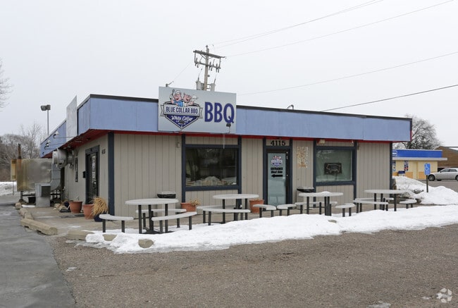
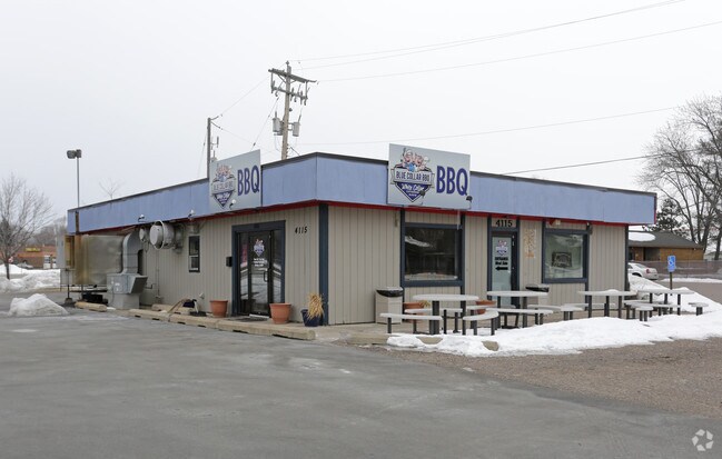
Property Record
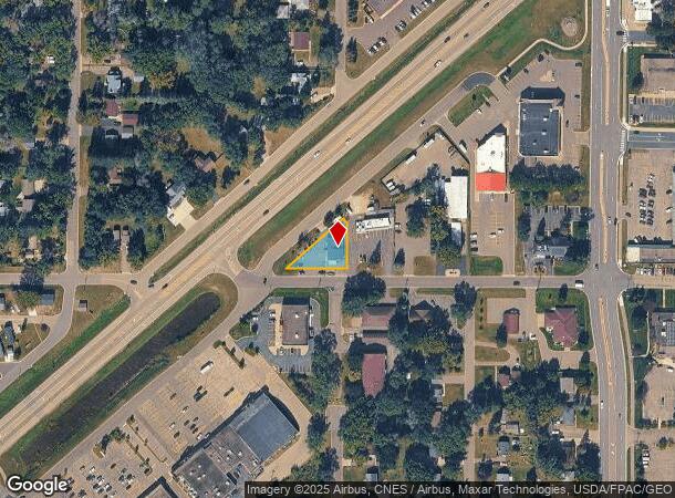
4115 Woodland Rd, Circle Pines, MN 55014
NEARBY LISTINGS FOR SALE OR LEASE
Property Detail
4115 Woodland Rd
Minneapolis-St. Paul-Bloomington, MN-WI
Lexington Park
26-31-23-44-0060
LOT 6 BLOCK 9 LEXINGTON PARK, EX RD SUBJ TO EASE OF REC
Commercialnec
Anoka
X
Minnesota
27003C0343E
6
2025
0.23 AC
2025
Rosedale
050901
Minneapolis/St Paul
1,800 SF
DEMOGRAPHICS near 4115 Woodland Rd
1 Mile
3 Mile
5 Mile
2024 Total Population
9,459
43,389
132,437
2029 Population
9,926
44,178
135,304
Pop Growth 2024-2029
+ 4.94%
+ 1.82%
+ 2.16%
Average Age
39
40
40
2024 Total Households
3,731
16,103
49,093
HH Growth 2024-2029
+ 4.96%
+ 1.68%
+ 1.97%
Median Household Inc
$78,705
$93,070
$93,113
Avg Household Size
2.50
2.60
2.60
2024 Avg HH Vehicles
2.00
2.00
2.00
Median Home Value
$247,218
$308,745
$314,905
Median Year Built
1984
1985
1985
Nearby Places
Map Layers
Map Styles
 Street
 Aerial
- Restaurants
- Banks
- Shops
- Fitness
- Groceries
PUBLIC TRANSPORTATION
AIRPORT
Minneapolis-St Paul International/Wold-Chamberlain
DRIVE
WALK
Distance
Minneapolis-St Paul International/Wold-Chamberlain
37 min
25.4 mi
SALE & LEASE HISTORY
LISTING DATE
SALE/LEASE

Jul 15, 2020
For Sale
Jan 31, 2018
For Sale
Aug 21, 2019
For Sale
Nearby Properties
Address
Land Use
TOTAL SIZE
Lot Size
Zoning
Address
Land Use
TOTAL SIZE
Lot Size
Zoning
2,443,869 SF
31.79 AC
Address
Land Use
TOTAL SIZE
Lot Size
Zoning
467.27 AC
Address
Land Use
TOTAL SIZE
Lot Size
Zoning
226,201 SF
70.59 AC
Address
Land Use
TOTAL SIZE
Lot Size
Zoning
156,499 SF
81.20 AC
Address
Land Use
TOTAL SIZE
Lot Size
Zoning
223.30 AC
Address
Land Use
TOTAL SIZE
Lot Size
Zoning
264,300 SF
4.16 AC
Address
Land Use
TOTAL SIZE
Lot Size
Zoning
239,389 SF
5.73 AC
Address
Land Use
TOTAL SIZE
Lot Size
Zoning
Address
Land Use
TOTAL SIZE
Lot Size
Zoning
260,375 SF
4.24 AC
Address
Land Use
TOTAL SIZE
Lot Size
Zoning
606,798 SF
49.16 AC
Address
Land Use
TOTAL SIZE
Lot Size
Zoning
239,318 SF
Address
Land Use
TOTAL SIZE
Lot Size
Zoning
Address
Land Use
TOTAL SIZE
Lot Size
Zoning
109.41 AC
Address
Land Use
TOTAL SIZE
Lot Size
Zoning
195,000 SF
Address
Land Use
TOTAL SIZE
Lot Size
Zoning
8,400 SF
10.10 AC
Address
Land Use
TOTAL SIZE
Lot Size
Zoning
208 SF
228 AC
Address
Land Use
TOTAL SIZE
Lot Size
Zoning
248,816 SF
14.02 AC
Address
Land Use
TOTAL SIZE
Lot Size
Zoning
190,377 SF
9.61 AC
Address
Land Use
TOTAL SIZE
Lot Size
Zoning
109,136 SF
Address
Land Use
TOTAL SIZE
Lot Size
Zoning
46,557 SF
9.27 AC
Address
Land Use
TOTAL SIZE
Lot Size
Zoning
119,907 SF
36.99 AC
Address
Land Use
TOTAL SIZE
Lot Size
Zoning
61,740 SF
16.10 AC
Address
Land Use
TOTAL SIZE
Lot Size
Zoning
77,940 SF
19.07 AC
Address
Land Use
TOTAL SIZE
Lot Size
Zoning
135,746 SF
8.85 AC
Address
Land Use
TOTAL SIZE
Lot Size
Zoning
121,740 SF
9.40 AC
Address
Land Use
TOTAL SIZE
Lot Size
Zoning
223,763 SF
24.89 AC
Address
Land Use
TOTAL SIZE
Lot Size
Zoning
112,500 SF
7.55 AC
Address
Land Use
TOTAL SIZE
Lot Size
Zoning
130,125 SF
4.17 AC
Address
Land Use
TOTAL SIZE
Lot Size
Zoning
392,607 SF
30.31 AC
Address
Land Use
TOTAL SIZE
Lot Size
Zoning
120,000 SF
39.44 AC
The World's #1 Commercial Real Estate Marketplace
Connect with us
© 2025 CoStar Group
The information above has been obtained from sources believed reliable. While we do not doubt its accuracy we have not verified it and make no guarantee, warranty or representation about it. It is your responsibility to independently confirm its accuracy and completeness. Any projections, opinions, assumptions, or estimates used are for example only and do not represent the current or future performance of the property. The value of this transaction to you depends on tax and other factors which should be evaluated by your tax, financial, and legal advisors. You and your advisors should conduct a careful, independent investigation of the property to determine to your satisfaction the suitability of the property for your needs.