Property Record
413 Hays Ave, Pittsburgh, PA 15210

Save to a Folder
{{folder.Name}}
{{folder.ListingIds.length}} Properties
{{folder.ListingIds.length}} Property
Create a New Folder
Property Detail
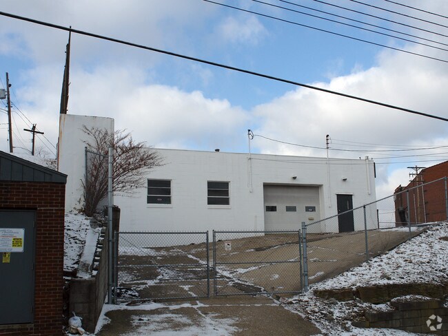
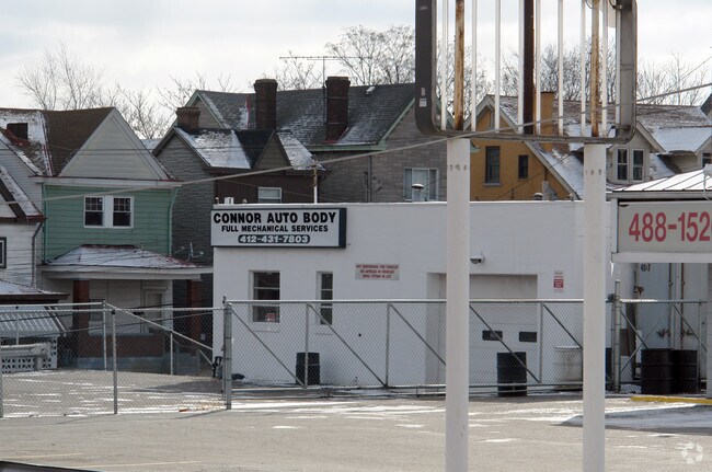
413 Hays Ave
Pittsburgh, PA
MT OL TER PLAN 16-17-18 LOT 90X143.65 1 STY C B GAR BLACK TOP PAVING 4924 SQ FT
0033-C-00255-0000-00
Allegheny
Autorepair
Pennsylvania
B and X Area of moderate flood hazard, usually the area between the limits of the 100-year and 500-year floods.
255
2026
0.30 AC
2026
South Pittsburgh/Rte 51
481000
Pittsburgh
NEARBY LISTINGS FOR SALE OR LEASE
DEMOGRAPHICS near 413 Hays Ave
1 mile
3 mile
5 mile
2025 Total Population
19,984
148,720
389,415
2030 Population
20,169
148,388
386,621
Pop Growth 2025-2030
+ 0.93%
(0.22%)
(0.72%)
Average Age
39
39
40
2025 Total Households
8,631
67,978
177,025
HH Growth 2025-2030
+ 0.89%
(0.30%)
(0.80%)
Median Household Inc
$53,423
$63,090
$69,852
Avg Household Size
2.20
2.00
2.00
2025 Avg HH Vehicles
1.00
1.00
1.00
Median Home Value
$87,598
$175,696
$224,059
Median Year Built
1947
1950
1951
Nearby Places
Map Layers
Map Styles
 Street
 Aerial
Layers
 Traffic
 Biking
Places
Listings with unknown addresses are not visible on the map
- Restaurants
- Banks
- Shops
- Fitness
- Groceries
PUBLIC TRANSPORTATION
COMMUTER RAIL
Drive
Walk
Distance
7 min
3.0 mi
AIRPORT
Pittsburgh International
Drive
Walk
Distance
Pittsburgh International
33 min
18.6 mi
Arnold Palmer Regional
Drive
Walk
Distance
Arnold Palmer Regional
70 min
43.5 mi
Nearby Properties
Address
Land Use
TOTAL SIZE
Lot Size
Zoning
Address
Land Use
TOTAL SIZE
Lot Size
Zoning
10.41 AC
Address
Land Use
TOTAL SIZE
Lot Size
Zoning
Address
Land Use
TOTAL SIZE
Lot Size
Zoning
14.70 AC
Address
Land Use
TOTAL SIZE
Lot Size
Zoning
Address
Land Use
TOTAL SIZE
Lot Size
Zoning
3.86 AC
Address
Land Use
TOTAL SIZE
Lot Size
Zoning
10.14 AC
Address
Land Use
TOTAL SIZE
Lot Size
Zoning
13.53 AC
Address
Land Use
TOTAL SIZE
Lot Size
Zoning
3.35 AC
Address
Land Use
TOTAL SIZE
Lot Size
Zoning
5.11 AC
Address
Land Use
TOTAL SIZE
Lot Size
Zoning
2.68 AC
Address
Land Use
TOTAL SIZE
Lot Size
Zoning
13.85 AC
Address
Land Use
TOTAL SIZE
Lot Size
Zoning
5.77 AC
Address
Land Use
TOTAL SIZE
Lot Size
Zoning
4.05 AC
Address
Land Use
TOTAL SIZE
Lot Size
Zoning
3.91 AC
Address
Land Use
TOTAL SIZE
Lot Size
Zoning
12.80 AC
Address
Land Use
TOTAL SIZE
Lot Size
Zoning
0.92 AC
Address
Land Use
TOTAL SIZE
Lot Size
Zoning
3.78 AC
Address
Land Use
TOTAL SIZE
Lot Size
Zoning
2.46 AC
Address
Land Use
TOTAL SIZE
Lot Size
Zoning
2.52 AC
Address
Land Use
TOTAL SIZE
Lot Size
Zoning
1.20 AC
Address
Land Use
TOTAL SIZE
Lot Size
Zoning
2.31 AC
Address
Land Use
TOTAL SIZE
Lot Size
Zoning
0.85 AC
Address
Land Use
TOTAL SIZE
Lot Size
Zoning
1.43 AC
Address
Land Use
TOTAL SIZE
Lot Size
Zoning
Address
Land Use
TOTAL SIZE
Lot Size
Zoning
1.82 AC
Address
Land Use
TOTAL SIZE
Lot Size
Zoning
Address
Land Use
TOTAL SIZE
Lot Size
Zoning
Address
Land Use
TOTAL SIZE
Lot Size
Zoning
6.55 AC
Address
Land Use
TOTAL SIZE
Lot Size
Zoning
1.10 AC
Address
Land Use
TOTAL SIZE
Lot Size
Zoning
0.77 AC
The World's #1 Commercial Real Estate Marketplace
Connect with us
© 2026 CoStar Group
The information above has been obtained from sources believed reliable. While we do not doubt its accuracy we have not verified it and make no guarantee, warranty or representation about it. It is your responsibility to independently confirm its accuracy and completeness. Any projections, opinions, assumptions, or estimates used are for example only and do not represent the current or future performance of the property. The value of this transaction to you depends on tax and other factors which should be evaluated by your tax, financial, and legal advisors. You and your advisors should conduct a careful, independent investigation of the property to determine to your satisfaction the suitability of the property for your needs.