Property Record
4150 E Cheyenne Ave, Las Vegas, NV 89115


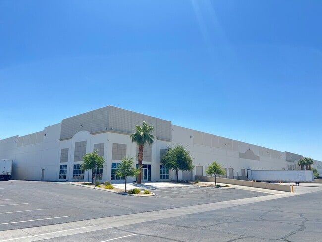
Property Detail
4150 E Cheyenne Ave
Las Vegas-Henderson-North Las Vegas, NV
PARCEL MAP FILE 101 PAGE 55 LOT 2
140-07-802-014
Clark
Shipyard
Nevada
M1
2
2026
21.23 AC
2026
North Las Vegas
004713
Las Vegas
420,000 SF
NEARBY LISTINGS FOR SALE OR LEASE
DEMOGRAPHICS near 4150 E Cheyenne Ave
1 mile
3 mile
5 mile
2025 Total Population
20,044
156,918
414,066
2030 Population
20,967
163,791
434,205
Pop Growth 2025-2030
+ 4.60%
+ 4.38%
+ 4.86%
Average Age
34
34
36
2025 Total Households
6,040
46,209
130,927
HH Growth 2025-2030
+ 4.72%
+ 4.44%
+ 4.96%
Median Household Inc
$51,299
$51,743
$57,428
Avg Household Size
3.20
3.20
3.00
2025 Avg HH Vehicles
2.00
2.00
2.00
Median Home Value
$308,945
$282,844
$338,316
Median Year Built
1987
1986
1991
Nearby Places
Map Layers
Map Styles
 Street
 Aerial
Transit
 Traffic
 Biking
Places
Listings with unknown addresses are not visible on the map
- Restaurants
- Banks
- Shops
- Fitness
- Groceries
PUBLIC TRANSPORTATION
AIRPORT
Harry Reid International
Drive
Walk
Distance
Harry Reid International
24 min
14.1 mi
Boulder City Municipal
Drive
Walk
Distance
Boulder City Municipal
41 min
28.0 mi
SALE & LEASE HISTORY
LISTING DATE
SALE/LEASE

Jul 10, 2025
For Lease
Nearby Properties
Address
Land Use
TOTAL SIZE
Lot Size
Zoning
Address
Land Use
TOTAL SIZE
Lot Size
Zoning
1,767,948 SF
142.04 AC
Address
Land Use
TOTAL SIZE
Lot Size
Zoning
252,005 SF
27.94 AC
C3
Address
Land Use
TOTAL SIZE
Lot Size
Zoning
1,102,891 SF
84.40 AC
Address
Land Use
TOTAL SIZE
Lot Size
Zoning
747,196 SF
40.03 AC
Address
Land Use
TOTAL SIZE
Lot Size
Zoning
681,792 SF
29.65 AC
Address
Land Use
TOTAL SIZE
Lot Size
Zoning
677,768 SF
31.52 AC
Address
Land Use
TOTAL SIZE
Lot Size
Zoning
696,064 SF
29.08 AC
Address
Land Use
TOTAL SIZE
Lot Size
Zoning
602,609 SF
27.33 AC
M2
Address
Land Use
TOTAL SIZE
Lot Size
Zoning
324 SF
8.74 AC
R1
Address
Land Use
TOTAL SIZE
Lot Size
Zoning
15,566 SF
48.39 AC
R4
Address
Land Use
TOTAL SIZE
Lot Size
Zoning
570,810 SF
29.73 AC
Address
Land Use
TOTAL SIZE
Lot Size
Zoning
617,670 SF
27.90 AC
M2
Address
Land Use
TOTAL SIZE
Lot Size
Zoning
3,735 SF
17.69 AC
R3
Address
Land Use
TOTAL SIZE
Lot Size
Zoning
1,608 SF
30.32 AC
RAPSP
Address
Land Use
TOTAL SIZE
Lot Size
Zoning
546,249 SF
28.58 AC
Address
Land Use
TOTAL SIZE
Lot Size
Zoning
191,879 SF
12 AC
RACHE
Address
Land Use
TOTAL SIZE
Lot Size
Zoning
152,520 SF
42.31 AC
M2
Address
Land Use
TOTAL SIZE
Lot Size
Zoning
7.24 AC
PF
Address
Land Use
TOTAL SIZE
Lot Size
Zoning
504,501 SF
23.08 AC
M2
Address
Land Use
TOTAL SIZE
Lot Size
Zoning
513,240 SF
24.86 AC
M2
Address
Land Use
TOTAL SIZE
Lot Size
Zoning
342,160 SF
37.72 AC
RT
Address
Land Use
TOTAL SIZE
Lot Size
Zoning
29.35 AC
CV
Address
Land Use
TOTAL SIZE
Lot Size
Zoning
355,910 SF
18.87 AC
M2
Address
Land Use
TOTAL SIZE
Lot Size
Zoning
612,680 SF
25.48 AC
M2
Address
Land Use
TOTAL SIZE
Lot Size
Zoning
371,648 SF
17.30 AC
Address
Land Use
TOTAL SIZE
Lot Size
Zoning
446,880 SF
23.84 AC
Address
Land Use
TOTAL SIZE
Lot Size
Zoning
34,765 SF
16.85 AC
M2
Address
Land Use
TOTAL SIZE
Lot Size
Zoning
201,218 SF
36.38 AC
Address
Land Use
TOTAL SIZE
Lot Size
Zoning
20.91 AC
PF
The World's #1 Commercial Real Estate Marketplace
Connect with us
© 2026 CoStar Group
The information above has been obtained from sources believed reliable. While we do not doubt its accuracy we have not verified it and make no guarantee, warranty or representation about it. It is your responsibility to independently confirm its accuracy and completeness. Any projections, opinions, assumptions, or estimates used are for example only and do not represent the current or future performance of the property. The value of this transaction to you depends on tax and other factors which should be evaluated by your tax, financial, and legal advisors. You and your advisors should conduct a careful, independent investigation of the property to determine to your satisfaction the suitability of the property for your needs.