Property Record
4181 W 108Th St, Hialeah, FL 33018

Property Detail
4181 W 108Th St
04-2017-004-0013
17 52 40 9.47 AC M/L COUNTYLINE CORPORATE PARK CENTRAL PB 175-17 BEG S/L & E/L OF TR A TH W1154.16FT FOR POB TH S 89 DEG W 350FT N 00 DEG W 1179.21FT N 89 DEG E 350FT S 00 DEG E 1179.14FT TO POB LOT SIZE 412714 SQ FT M/L FAU 04 2017 004 0010
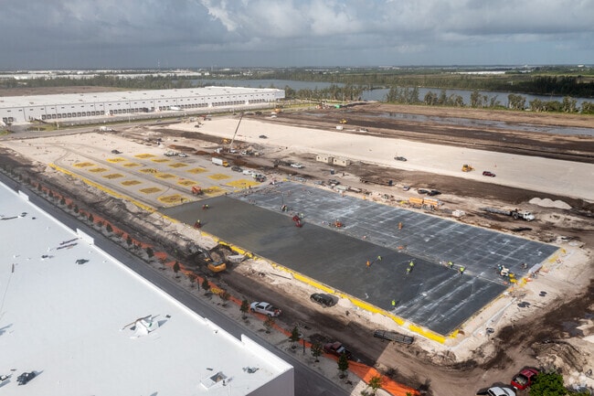
Warehouse
Miami-Dade
7701
Florida
AE The base floodplain where base flood elevations are provided. AE Zones are now used on new format FIRMs instead of A1-A30 Zones.
9.47 AC
2024
Outlying Miami-Dade
2025
South Florida
012701
Miami-Miami Beach-Kendall, FL
201,141 SF
NEARBY LISTINGS FOR SALE OR LEASE
DEMOGRAPHICS near 4181 W 108Th St
1 mile
3 mile
5 mile
2025 Total Population
2,295
74,682
281,271
2030 Population
2,547
79,660
299,151
Pop Growth 2025-2030
+ 10.98%
+ 6.67%
+ 6.36%
Average Age
33
41
41
2025 Total Households
661
22,266
90,378
HH Growth 2025-2030
+ 10.74%
+ 6.52%
+ 6.26%
Median Household Inc
$131,063
$105,823
$82,146
Avg Household Size
3.30
3.20
3.00
2025 Avg HH Vehicles
2.00
2.00
2.00
Median Home Value
$631,356
$535,025
$484,916
Median Year Built
2011
1996
1991
Nearby Places
Map Layers
Map Styles
 Street
 Aerial
Layers
 Traffic
 Biking
Places
Listings with unknown addresses are not visible on the map
- Restaurants
- Banks
- Shops
- Fitness
- Groceries
PUBLIC TRANSPORTATION
COMMUTER RAIL
Palmetto (Metrorail Green Line - Miami-Dade Transit (Metrorail/Metromover))
Drive
Walk
Distance
Palmetto (Metrorail Green Line - Miami-Dade Transit (Metrorail/Metromover))
17 min
7.8 mi
Okeechobee (Metrorail Green Line - Miami-Dade Transit (Metrorail/Metromover))
Drive
Walk
Distance
Okeechobee (Metrorail Green Line - Miami-Dade Transit (Metrorail/Metromover))
19 min
8.7 mi
AIRPORT
Miami International
Drive
Walk
Distance
Miami International
28 min
13.5 mi
Fort Lauderdale/Hollywood International
Drive
Walk
Distance
Fort Lauderdale/Hollywood International
40 min
25.4 mi
Freight Ports
Port of Miami
Drive
Walk
Distance
Port of Miami
39 min
21.6 mi
Nearby Properties
Address
Land Use
TOTAL SIZE
Lot Size
Zoning
Address
Land Use
TOTAL SIZE
Lot Size
Zoning
483,328 SF
63.80 AC
7701
Address
Land Use
TOTAL SIZE
Lot Size
Zoning
507,170 SF
23.13 AC
7100
Address
Land Use
TOTAL SIZE
Lot Size
Zoning
572,062 SF
38.15 AC
9400
Address
Land Use
TOTAL SIZE
Lot Size
Zoning
724,587 SF
48.54 AC
7701
Address
Land Use
TOTAL SIZE
Lot Size
Zoning
595,768 SF
33.42 AC
7600
Address
Land Use
TOTAL SIZE
Lot Size
Zoning
725,624 SF
34.80 AC
7300
Address
Land Use
TOTAL SIZE
Lot Size
Zoning
526,059 SF
18.99 AC
6407
Address
Land Use
TOTAL SIZE
Lot Size
Zoning
469,837 SF
26 AC
7600
Address
Land Use
TOTAL SIZE
Lot Size
Zoning
812,314 SF
44 AC
7600
Address
Land Use
TOTAL SIZE
Lot Size
Zoning
509,271 SF
28.69 AC
7701
Address
Land Use
TOTAL SIZE
Lot Size
Zoning
399,805 SF
14.02 AC
8000
Address
Land Use
TOTAL SIZE
Lot Size
Zoning
374,816 SF
21.41 AC
7701
Address
Land Use
TOTAL SIZE
Lot Size
Zoning
359,483 SF
11.34 AC
8000
Address
Land Use
TOTAL SIZE
Lot Size
Zoning
223,543 SF
39.40 AC
6407
Address
Land Use
TOTAL SIZE
Lot Size
Zoning
307,032 SF
20.08 AC
7701
Address
Land Use
TOTAL SIZE
Lot Size
Zoning
537,862 SF
22.21 AC
7701
Address
Land Use
TOTAL SIZE
Lot Size
Zoning
333,414 SF
24.20 AC
7701
Address
Land Use
TOTAL SIZE
Lot Size
Zoning
345,413 SF
10.48 AC
9000
Address
Land Use
TOTAL SIZE
Lot Size
Zoning
298,578 SF
15.95 AC
7701
Address
Land Use
TOTAL SIZE
Lot Size
Zoning
382,421 SF
19.66 AC
3700
Address
Land Use
TOTAL SIZE
Lot Size
Zoning
672,678 SF
38.88 AC
7100
Address
Land Use
TOTAL SIZE
Lot Size
Zoning
627,014 SF
48.58 AC
7100
Address
Land Use
TOTAL SIZE
Lot Size
Zoning
400,062 SF
33.33 AC
0101
Address
Land Use
TOTAL SIZE
Lot Size
Zoning
267,601 SF
16.81 AC
7100
Address
Land Use
TOTAL SIZE
Lot Size
Zoning
235,248 SF
12.31 AC
7600
Address
Land Use
TOTAL SIZE
Lot Size
Zoning
230,147 SF
15 AC
7701
Address
Land Use
TOTAL SIZE
Lot Size
Zoning
230,169 SF
10.62 AC
7600
Address
Land Use
TOTAL SIZE
Lot Size
Zoning
320,597 SF
14.52 AC
7701
Address
Land Use
TOTAL SIZE
Lot Size
Zoning
308,699 SF
28.97 AC
7100
Address
Land Use
TOTAL SIZE
Lot Size
Zoning
214,526 SF
10.15 AC
7701
The World's #1 Commercial Real Estate Marketplace
Connect with us
© 2026 CoStar Group
The information above has been obtained from sources believed reliable. While we do not doubt its accuracy we have not verified it and make no guarantee, warranty or representation about it. It is your responsibility to independently confirm its accuracy and completeness. Any projections, opinions, assumptions, or estimates used are for example only and do not represent the current or future performance of the property. The value of this transaction to you depends on tax and other factors which should be evaluated by your tax, financial, and legal advisors. You and your advisors should conduct a careful, independent investigation of the property to determine to your satisfaction the suitability of the property for your needs.