Property Record
41W919 Jericho Rd, Aurora, IL 60506

Property Detail
41W919 Jericho Rd
Chicago-Naperville-Elgin, IL-IN
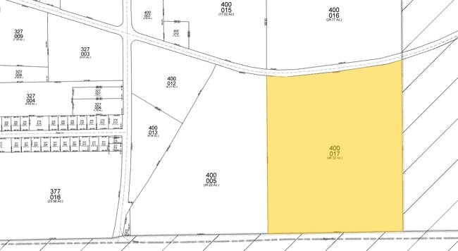
THAT PT OF THE W 1/2 OF THE SW 1/4 OF SEC 34-38-7 THAT IS S OF THE S ROW OF JERICHO RD
14-34-300-005
KANE
Farms
Illinois
B and X Area of moderate flood hazard, usually the area between the limits of the 100-year and 500-year floods.
61.16 AC
2024
Western East/West Corr
2024
Chicago
854509
NEARBY LISTINGS FOR SALE OR LEASE
DEMOGRAPHICS near 41W919 Jericho Rd
1 mile
3 mile
5 mile
2025 Total Population
1,615
25,006
79,366
2030 Population
1,647
26,459
83,263
Pop Growth 2025-2030
+ 1.98%
+ 5.81%
+ 4.91%
Average Age
34
36
39
2025 Total Households
446
7,960
27,438
HH Growth 2025-2030
+ 2.24%
+ 5.83%
+ 4.71%
Median Household Inc
$66,944
$101,613
$103,293
Avg Household Size
3.60
3.10
2.80
2025 Avg HH Vehicles
1.00
2.00
2.00
Median Home Value
$280,494
$315,378
$313,372
Median Year Built
2004
2005
1999
Nearby Places
Map Layers
Map Styles
 Street
 Aerial
Layers
 Traffic
 Biking
Places
Listings with unknown addresses are not visible on the map
- Restaurants
- Banks
- Shops
- Fitness
- Groceries
PUBLIC TRANSPORTATION
COMMUTER RAIL
Aurora Station (Burlington Northern-Santa Fe Railway Line - Northeast Illinois Regional Commuter Railroad (Metra))
Drive
Walk
Distance
Aurora Station (Burlington Northern-Santa Fe Railway Line - Northeast Illinois Regional Commuter Railroad (Metra))
14 min
7.3 mi
Plano Amtrak Station (Carl Sandburg - Amtrak, Illinois Zephyr - Amtrak)
Drive
Walk
Distance
Plano Amtrak Station (Carl Sandburg - Amtrak, Illinois Zephyr - Amtrak)
16 min
9.8 mi
Freight Ports
Port Milwaukee
Drive
Walk
Distance
Port Milwaukee
144 min
117.5 mi
Nearby Properties
Address
Land Use
TOTAL SIZE
Lot Size
Zoning
Address
Land Use
TOTAL SIZE
Lot Size
Zoning
0.13 AC
Address
Land Use
TOTAL SIZE
Lot Size
Zoning
84,884 SF
5.23 AC
Address
Land Use
TOTAL SIZE
Lot Size
Zoning
15,913 SF
31.25 AC
Address
Land Use
TOTAL SIZE
Lot Size
Zoning
108,848 SF
5.79 AC
Address
Land Use
TOTAL SIZE
Lot Size
Zoning
1.80 AC
Address
Land Use
TOTAL SIZE
Lot Size
Zoning
16,100 SF
5.14 AC
Address
Land Use
TOTAL SIZE
Lot Size
Zoning
4,632 SF
3.24 AC
Address
Land Use
TOTAL SIZE
Lot Size
Zoning
Address
Land Use
TOTAL SIZE
Lot Size
Zoning
10,046 SF
1.40 AC
Address
Land Use
TOTAL SIZE
Lot Size
Zoning
16,186 SF
3.08 AC
Address
Land Use
TOTAL SIZE
Lot Size
Zoning
45,817 SF
1.48 AC
Address
Land Use
TOTAL SIZE
Lot Size
Zoning
11,803 SF
1.31 AC
Address
Land Use
TOTAL SIZE
Lot Size
Zoning
34,899 SF
1.11 AC
Address
Land Use
TOTAL SIZE
Lot Size
Zoning
5,000 SF
3.05 AC
Address
Land Use
TOTAL SIZE
Lot Size
Zoning
14,850 SF
1.77 AC
Address
Land Use
TOTAL SIZE
Lot Size
Zoning
0.06 AC
Address
Land Use
TOTAL SIZE
Lot Size
Zoning
3,120 SF
0.27 AC
Address
Land Use
TOTAL SIZE
Lot Size
Zoning
5,371 SF
1.41 AC
Address
Land Use
TOTAL SIZE
Lot Size
Zoning
5,839 SF
1.16 AC
Address
Land Use
TOTAL SIZE
Lot Size
Zoning
32,671 SF
5.23 AC
Address
Land Use
TOTAL SIZE
Lot Size
Zoning
57,769 SF
3.42 AC
Address
Land Use
TOTAL SIZE
Lot Size
Zoning
3,583 SF
2.53 AC
Address
Land Use
TOTAL SIZE
Lot Size
Zoning
4,767 SF
1.02 AC
Address
Land Use
TOTAL SIZE
Lot Size
Zoning
0.44 AC
Address
Land Use
TOTAL SIZE
Lot Size
Zoning
31,632 SF
3.99 AC
Address
Land Use
TOTAL SIZE
Lot Size
Zoning
1,949 SF
1.24 AC
Address
Land Use
TOTAL SIZE
Lot Size
Zoning
2,829 SF
0.99 AC
Address
Land Use
TOTAL SIZE
Lot Size
Zoning
11,756 SF
1.23 AC
Address
Land Use
TOTAL SIZE
Lot Size
Zoning
9,086 SF
0.48 AC
Address
Land Use
TOTAL SIZE
Lot Size
Zoning
18,112 SF
28.69 AC
The World's #1 Commercial Real Estate Marketplace
Connect with us
© 2026 CoStar Group
The information above has been obtained from sources believed reliable. While we do not doubt its accuracy we have not verified it and make no guarantee, warranty or representation about it. It is your responsibility to independently confirm its accuracy and completeness. Any projections, opinions, assumptions, or estimates used are for example only and do not represent the current or future performance of the property. The value of this transaction to you depends on tax and other factors which should be evaluated by your tax, financial, and legal advisors. You and your advisors should conduct a careful, independent investigation of the property to determine to your satisfaction the suitability of the property for your needs.