Property Record
42 Lodi Ct, Warwick, RI 02886
Save to a Folder
{{folder.Name}}
{{folder.ListingIds.length}} Properties
{{folder.ListingIds.length}} Property
Create a New Folder
Current Lease Availabilities
Property Detail
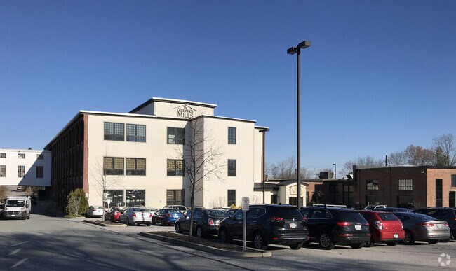
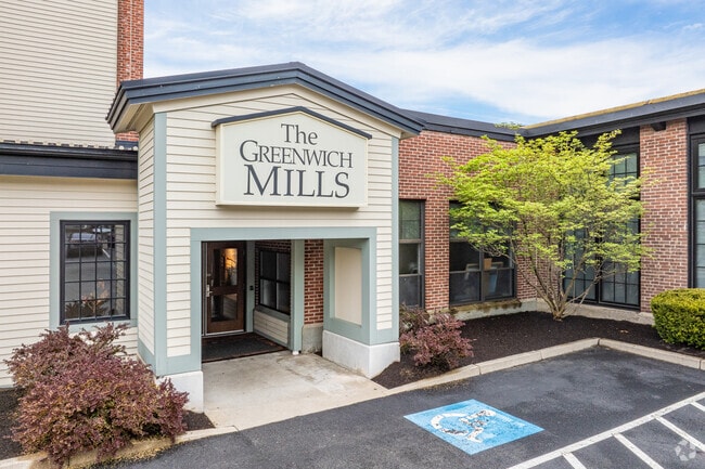
42 Lodi Ct
Industrialgeneral
KENT
LI
Rhode Island
B and X Area of moderate flood hazard, usually the area between the limits of the 100-year and 500-year floods.
0.49 AC
2025
Warwick
2025
Providence
022100
Providence-Warwick, RI-MA
27,470 SF
WARW-000220-000169-000000
NEARBY LISTINGS FOR SALE OR LEASE
DEMOGRAPHICS near 42 Lodi Ct
1 mile
3 mile
5 mile
2025 Total Population
4,360
36,416
109,696
2030 Population
4,389
36,735
110,759
Pop Growth 2025-2030
+ 0.67%
+ 0.88%
+ 0.97%
Average Age
44
45
43
2025 Total Households
2,171
15,987
46,653
HH Growth 2025-2030
+ 0.60%
+ 0.86%
+ 0.94%
Median Household Inc
$127,021
$108,760
$92,981
Avg Household Size
2.00
2.20
2.30
2025 Avg HH Vehicles
2.00
2.00
2.00
Median Home Value
$604,862
$452,172
$376,264
Median Year Built
1949
1966
1967
Nearby Places
Map Layers
Map Styles
 Street
 Aerial
Layers
 Traffic
 Biking
Places
Listings with unknown addresses are not visible on the map
- Restaurants
- Banks
- Shops
- Fitness
- Groceries
PUBLIC TRANSPORTATION
COMMUTER RAIL
Tf Green Airport (Providence/Stoughton Line - MBTA)
Drive
Walk
Distance
Tf Green Airport (Providence/Stoughton Line - MBTA)
10 min
4.9 mi
Wickford Junction (Providence/Stoughton Line - MBTA)
Drive
Walk
Distance
Wickford Junction (Providence/Stoughton Line - MBTA)
17 min
9.5 mi
AIRPORT
Rhode Island Tf Green International
Drive
Walk
Distance
Rhode Island Tf Green International
15 min
7.2 mi
Freight Ports
Port of Davisville, RI
Drive
Walk
Distance
Port of Davisville, RI
16 min
7.3 mi
Nearby Properties
Address
Land Use
TOTAL SIZE
Lot Size
Zoning
Address
Land Use
TOTAL SIZE
Lot Size
Zoning
24,276 SF
0.01 AC
A15
Address
Land Use
TOTAL SIZE
Lot Size
Zoning
6,640 SF
0.01 AC
A10
Address
Land Use
TOTAL SIZE
Lot Size
Zoning
283,536 SF
97.97 AC
O
Address
Land Use
TOTAL SIZE
Lot Size
Zoning
19.60 AC
CH
Address
Land Use
TOTAL SIZE
Lot Size
Zoning
18,720 SF
15 AC
PDR
Address
Land Use
TOTAL SIZE
Lot Size
Zoning
3,743 SF
A15
Address
Land Use
TOTAL SIZE
Lot Size
Zoning
Address
Land Use
TOTAL SIZE
Lot Size
Zoning
20.43 AC
MUPD
Address
Land Use
TOTAL SIZE
Lot Size
Zoning
25,632 SF
A15
Address
Land Use
TOTAL SIZE
Lot Size
Zoning
10,375 SF
75.99 AC
A10
Address
Land Use
TOTAL SIZE
Lot Size
Zoning
19.65 AC
BP
Address
Land Use
TOTAL SIZE
Lot Size
Zoning
161,263 SF
61.75 AC
R30
Address
Land Use
TOTAL SIZE
Lot Size
Zoning
63.69 AC
LI
Address
Land Use
TOTAL SIZE
Lot Size
Zoning
107,212 SF
18.50 AC
R10
Address
Land Use
TOTAL SIZE
Lot Size
Zoning
137,323 SF
22.84 AC
PR
Address
Land Use
TOTAL SIZE
Lot Size
Zoning
5.31 AC
M/LI
Address
Land Use
TOTAL SIZE
Lot Size
Zoning
160,971 SF
175 AC
A15
Address
Land Use
TOTAL SIZE
Lot Size
Zoning
9,216 SF
A7
Address
Land Use
TOTAL SIZE
Lot Size
Zoning
147,866 SF
6.08 AC
A7
Address
Land Use
TOTAL SIZE
Lot Size
Zoning
147,866 SF
A7
Address
Land Use
TOTAL SIZE
Lot Size
Zoning
137,511 SF
14.80 AC
GB
Address
Land Use
TOTAL SIZE
Lot Size
Zoning
4,288 SF
10.23 AC
GB
Address
Land Use
TOTAL SIZE
Lot Size
Zoning
116,034 SF
10.65 AC
B
Address
Land Use
TOTAL SIZE
Lot Size
Zoning
60,324 SF
4.39 AC
BP
Address
Land Use
TOTAL SIZE
Lot Size
Zoning
28.16 AC
B
Address
Land Use
TOTAL SIZE
Lot Size
Zoning
48,468 SF
4.50 AC
M/LI
Address
Land Use
TOTAL SIZE
Lot Size
Zoning
5.09 AC
Address
Land Use
TOTAL SIZE
Lot Size
Zoning
4,622 SF
473.27 AC
OS
Address
Land Use
TOTAL SIZE
Lot Size
Zoning
112,179 SF
13.45 AC
PR
Address
Land Use
TOTAL SIZE
Lot Size
Zoning
3,912 SF
11 AC
WB
The World's #1 Commercial Real Estate Marketplace
Connect with us
© 2026 CoStar Group
The information above has been obtained from sources believed reliable. While we do not doubt its accuracy we have not verified it and make no guarantee, warranty or representation about it. It is your responsibility to independently confirm its accuracy and completeness. Any projections, opinions, assumptions, or estimates used are for example only and do not represent the current or future performance of the property. The value of this transaction to you depends on tax and other factors which should be evaluated by your tax, financial, and legal advisors. You and your advisors should conduct a careful, independent investigation of the property to determine to your satisfaction the suitability of the property for your needs.