Property Record
16 Route 111, Derry, NH 03038
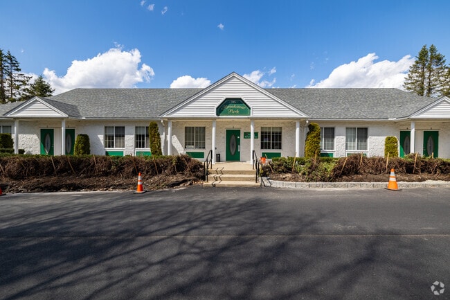
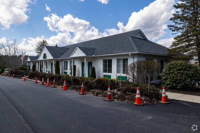
This Property Is For Sale
NEARBY LISTINGS FOR SALE OR LEASE
Property Detail
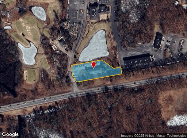
16 Route 111
DERY-000004-000000-000129
Rockingham
Officebuilding
New Hampshire
X
4
25009C0075F
1.40 AC
2024
Rockingham
2024
Boston
003602
Boston-Cambridge-Newton, MA-NH
10,000 SF
DEMOGRAPHICS near 16 Route 111
1 mile
3 mile
5 mile
2024 Total Population
1,813
16,356
51,629
2029 Population
1,882
16,983
53,362
Pop Growth 2024-2029
+ 3.81%
+ 3.83%
+ 3.36%
Average Age
44
44
43
2024 Total Households
669
6,099
19,375
HH Growth 2024-2029
+ 3.89%
+ 3.80%
+ 3.27%
Median Household Inc
$131,435
$124,105
$116,945
Avg Household Size
2.70
2.60
2.60
2024 Avg HH Vehicles
2.00
2.00
2.00
Median Home Value
$458,108
$445,894
$424,726
Median Year Built
1985
1982
1981
Nearby Places
Map Layers
Map Styles
 Street
 Aerial
Transit
 Traffic
 Biking
Places
Listings with unknown addresses are not visible on the map
- Restaurants
- Banks
- Shops
- Fitness
- Groceries
PUBLIC TRANSPORTATION
AIRPORT
Manchester Boston Regional
Drive
Walk
Distance
Manchester Boston Regional
36 min
20.7 mi
Portsmouth International at Pease
Drive
Walk
Distance
Portsmouth International at Pease
57 min
38.9 mi
General Edward Lawrence Logan International
Drive
Walk
Distance
General Edward Lawrence Logan International
58 min
41.0 mi
Freight Ports
Port of Boston
Drive
Walk
Distance
Port of Boston
58 min
40.8 mi
Nearby Properties
Address
Land Use
TOTAL SIZE
Lot Size
Zoning
Address
Land Use
TOTAL SIZE
Lot Size
Zoning
297,592 SF
2.90 AC
CIC
Address
Land Use
TOTAL SIZE
Lot Size
Zoning
82,926 SF
40.38 AC
A-RES
Address
Land Use
TOTAL SIZE
Lot Size
Zoning
55,819 SF
382.76 AC
RR2SCR
Address
Land Use
TOTAL SIZE
Lot Size
Zoning
12,187 SF
18.51 AC
A-RES
Address
Land Use
TOTAL SIZE
Lot Size
Zoning
58,661 SF
9.53 AC
A-RES
Address
Land Use
TOTAL SIZE
Lot Size
Zoning
863 SF
14.79 AC
B-RES
Address
Land Use
TOTAL SIZE
Lot Size
Zoning
56,632 SF
14.20 AC
RUR
Address
Land Use
TOTAL SIZE
Lot Size
Zoning
231.50 AC
B-RES
Address
Land Use
TOTAL SIZE
Lot Size
Zoning
320 SF
13.40 AC
RUR
Address
Land Use
TOTAL SIZE
Lot Size
Zoning
480 SF
A-RES
Address
Land Use
TOTAL SIZE
Lot Size
Zoning
33,757 SF
6.43 AC
C2 C
Address
Land Use
TOTAL SIZE
Lot Size
Zoning
16,368 SF
7.67 AC
C1 C
Address
Land Use
TOTAL SIZE
Lot Size
Zoning
71,420 SF
18.50 AC
C2 C
Address
Land Use
TOTAL SIZE
Lot Size
Zoning
26,262 SF
3.75 AC
CDA
Address
Land Use
TOTAL SIZE
Lot Size
Zoning
30.36 AC
GC
Address
Land Use
TOTAL SIZE
Lot Size
Zoning
23,160 SF
2.82 AC
GC
Address
Land Use
TOTAL SIZE
Lot Size
Zoning
10,559 SF
1.52 AC
C1 C
Address
Land Use
TOTAL SIZE
Lot Size
Zoning
35,870 SF
4.32 AC
LCSD
Address
Land Use
TOTAL SIZE
Lot Size
Zoning
7,463 SF
3.05 AC
A-RES
Address
Land Use
TOTAL SIZE
Lot Size
Zoning
842 SF
13.30 AC
B-RES
Address
Land Use
TOTAL SIZE
Lot Size
Zoning
57,938 SF
23.60 AC
RUR
Address
Land Use
TOTAL SIZE
Lot Size
Zoning
3,336 SF
15 AC
A-RES
Address
Land Use
TOTAL SIZE
Lot Size
Zoning
5,281 SF
71.16 AC
A-RES
Address
Land Use
TOTAL SIZE
Lot Size
Zoning
61 AC
LDR
Address
Land Use
TOTAL SIZE
Lot Size
Zoning
12,608 SF
8.61 AC
C-I C
Address
Land Use
TOTAL SIZE
Lot Size
Zoning
12,669 SF
5 AC
RUR
Address
Land Use
TOTAL SIZE
Lot Size
Zoning
18,586 SF
16.25 AC
A-RES
Address
Land Use
TOTAL SIZE
Lot Size
Zoning
15,089 SF
5.26 AC
C1 C
Address
Land Use
TOTAL SIZE
Lot Size
Zoning
20,717 SF
4.63 AC
C-I C
Address
Land Use
TOTAL SIZE
Lot Size
Zoning
8,080 SF
2.14 AC
A-RES
The World's #1 Commercial Real Estate Marketplace
Connect with us
© 2026 CoStar Group
The information above has been obtained from sources believed reliable. While we do not doubt its accuracy we have not verified it and make no guarantee, warranty or representation about it. It is your responsibility to independently confirm its accuracy and completeness. Any projections, opinions, assumptions, or estimates used are for example only and do not represent the current or future performance of the property. The value of this transaction to you depends on tax and other factors which should be evaluated by your tax, financial, and legal advisors. You and your advisors should conduct a careful, independent investigation of the property to determine to your satisfaction the suitability of the property for your needs.