Property Record
4201 E Fremont St, Stockton, CA 95215


NEARBY LISTINGS FOR SALE OR LEASE
Property Detail
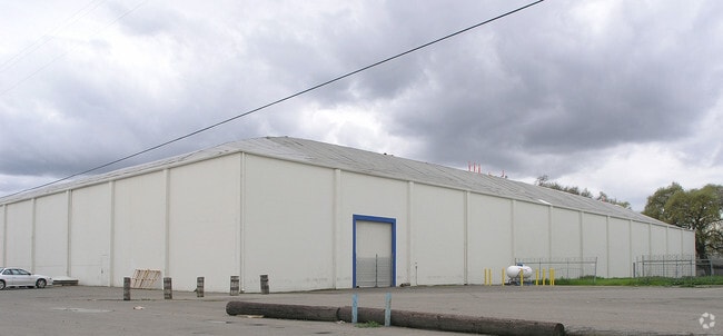
4201 E Fremont St
Stockton-Lodi, CA
Martin-Brower Fresh Start Bake
143-270-45
PARCEL MAPS 6 PG 42 LOT B
Warehouse
San Joaquin
X
California
06077C0480F
b
2025
4.32 AC
2025
NE Stockton
002701
Stockton/Modesto
130,200 SF
DEMOGRAPHICS near 4201 E Fremont St
1 Mile
3 Mile
5 Mile
2024 Total Population
9,011
83,288
236,156
2029 Population
9,468
87,641
248,884
Pop Growth 2024-2029
+ 5.07%
+ 5.23%
+ 5.39%
Average Age
34
35
35
2024 Total Households
2,454
24,126
71,245
HH Growth 2024-2029
+ 5.05%
+ 5.30%
+ 5.51%
Median Household Inc
$57,812
$50,284
$56,105
Avg Household Size
3.60
3.30
3.10
2024 Avg HH Vehicles
2.00
2.00
2.00
Median Home Value
$327,162
$293,365
$332,177
Median Year Built
1961
1964
1971
Nearby Places
Map Layers
Map Styles
 Street
 Aerial
- Restaurants
- Banks
- Shops
- Fitness
- Groceries
PUBLIC TRANSPORTATION
COMMUTER RAIL
Stockton (ACE Train - Altamont Commuter Express (ACE), Altamont Corridor Express - Altamont Commuter Express (ACE))
DRIVE
WALK
Distance
Stockton (ACE Train - Altamont Commuter Express (ACE), Altamont Corridor Express - Altamont Commuter Express (ACE))
5 min
2.7 mi
Stockton (San Joaquins - Amtrak)
DRIVE
WALK
Distance
Stockton (San Joaquins - Amtrak)
7 min
4.1 mi
AIRPORT
Stockton Metro
DRIVE
WALK
Distance
Stockton Metro
12 min
8.2 mi
Freight Ports
Port of Stockton
DRIVE
WALK
Distance
Port of Stockton
11 min
6.7 mi
Nearby Properties
Address
Land Use
TOTAL SIZE
Lot Size
Zoning
Address
Land Use
TOTAL SIZE
Lot Size
Zoning
530,700 SF
8.35 AC
Address
Land Use
TOTAL SIZE
Lot Size
Zoning
152,000 SF
1.31 AC
Address
Land Use
TOTAL SIZE
Lot Size
Zoning
780,371 SF
46.04 AC
IG
Address
Land Use
TOTAL SIZE
Lot Size
Zoning
9,750 SF
136.94 AC
AU20
Address
Land Use
TOTAL SIZE
Lot Size
Zoning
502,000 SF
19.76 AC
Address
Land Use
TOTAL SIZE
Lot Size
Zoning
652,548 SF
35.24 AC
IL
Address
Land Use
TOTAL SIZE
Lot Size
Zoning
47.61 AC
Address
Land Use
TOTAL SIZE
Lot Size
Zoning
265,496 SF
12.37 AC
Address
Land Use
TOTAL SIZE
Lot Size
Zoning
219,572 SF
16.53 AC
IL
Address
Land Use
TOTAL SIZE
Lot Size
Zoning
262,560 SF
14.42 AC
Address
Land Use
TOTAL SIZE
Lot Size
Zoning
197,876 SF
10.21 AC
Address
Land Use
TOTAL SIZE
Lot Size
Zoning
15,203 SF
3.65 AC
Address
Land Use
TOTAL SIZE
Lot Size
Zoning
8,000 SF
0.67 AC
Address
Land Use
TOTAL SIZE
Lot Size
Zoning
158,400 SF
8.69 AC
Address
Land Use
TOTAL SIZE
Lot Size
Zoning
62,588 SF
43.56 AC
IW
Address
Land Use
TOTAL SIZE
Lot Size
Zoning
0.79 AC
Address
Land Use
TOTAL SIZE
Lot Size
Zoning
37,846 SF
2.94 AC
Address
Land Use
TOTAL SIZE
Lot Size
Zoning
14.76 AC
Address
Land Use
TOTAL SIZE
Lot Size
Zoning
5,264 SF
9.82 AC
IL
Address
Land Use
TOTAL SIZE
Lot Size
Zoning
178,260 SF
10.75 AC
Address
Land Use
TOTAL SIZE
Lot Size
Zoning
60,477 SF
8.25 AC
Address
Land Use
TOTAL SIZE
Lot Size
Zoning
96,768 SF
6.23 AC
Address
Land Use
TOTAL SIZE
Lot Size
Zoning
129,750 SF
8.63 AC
Address
Land Use
TOTAL SIZE
Lot Size
Zoning
261,860 SF
7.48 AC
IW
Address
Land Use
TOTAL SIZE
Lot Size
Zoning
8 AC
IL
Address
Land Use
TOTAL SIZE
Lot Size
Zoning
84,895 SF
2.21 AC
Address
Land Use
TOTAL SIZE
Lot Size
Zoning
76,500 SF
7.03 AC
Address
Land Use
TOTAL SIZE
Lot Size
Zoning
65,516 SF
10.56 AC
RM
Address
Land Use
TOTAL SIZE
Lot Size
Zoning
83,337 SF
7.17 AC
RM
Address
Land Use
TOTAL SIZE
Lot Size
Zoning
5,684 SF
17 AC
The World's #1 Commercial Real Estate Marketplace
Connect with us
© 2026 CoStar Group
The information above has been obtained from sources believed reliable. While we do not doubt its accuracy we have not verified it and make no guarantee, warranty or representation about it. It is your responsibility to independently confirm its accuracy and completeness. Any projections, opinions, assumptions, or estimates used are for example only and do not represent the current or future performance of the property. The value of this transaction to you depends on tax and other factors which should be evaluated by your tax, financial, and legal advisors. You and your advisors should conduct a careful, independent investigation of the property to determine to your satisfaction the suitability of the property for your needs.