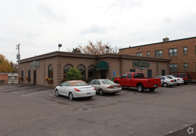
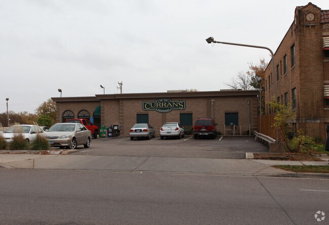
Property Record
4207 Nicollet Ave, Minneapolis, MN 55409

NEARBY LISTINGS FOR SALE OR LEASE
Property Detail
4207 Nicollet Ave
Minneapolis-St. Paul-Bloomington, MN-WI
William Bernsteins 1St Addn To Mpls
10-028-24-42-0178
LOT 028 BLOCK 002 A WILLIAM BERNSTEINS 1ST ADDN TO MPLS LOTS 28 29 30 AND N 10 FT OF LOT 27 BLK 2 124.70 X 127.20
Apartment
Hennepin
X
Minnesota
27053C0367F
28
2024
0.36 AC
2024
Calhoun
109900
Minneapolis/St Paul
59,904 SF
DEMOGRAPHICS near 4207 Nicollet Ave
1 Mile
3 Mile
5 Mile
2024 Total Population
25,494
218,908
478,648
2029 Population
24,817
215,131
471,891
Pop Growth 2024-2029
(2.66%)
(1.73%)
(1.41%)
Average Age
38
38
38
2024 Total Households
10,395
98,361
215,637
HH Growth 2024-2029
(2.82%)
(1.73%)
(1.34%)
Median Household Inc
$90,922
$75,514
$74,911
Avg Household Size
2.30
2.10
2.10
2024 Avg HH Vehicles
2.00
1.00
1.00
Median Home Value
$344,600
$366,955
$365,151
Median Year Built
1946
1948
1958
Nearby Places
Map Layers
Map Styles
 Street
 Aerial
- Restaurants
- Banks
- Shops
- Fitness
- Groceries
PUBLIC TRANSPORTATION
COMMUTER RAIL
Target Field Station (Northstar Corridor - Northstar Commuter Rail)
DRIVE
WALK
Distance
Target Field Station (Northstar Corridor - Northstar Commuter Rail)
12 min
4.7 mi
AIRPORT
Minneapolis-St Paul International/Wold-Chamberlain
DRIVE
WALK
Distance
Minneapolis-St Paul International/Wold-Chamberlain
18 min
9.8 mi
Nearby Properties
Address
Land Use
TOTAL SIZE
Lot Size
Zoning
Address
Land Use
TOTAL SIZE
Lot Size
Zoning
458,470 SF
1.18 AC
OR3
Address
Land Use
TOTAL SIZE
Lot Size
Zoning
275,782 SF
2.40 AC
C3A
Address
Land Use
TOTAL SIZE
Lot Size
Zoning
659,076 SF
1.45 AC
C3A
Address
Land Use
TOTAL SIZE
Lot Size
Zoning
1.50 AC
Address
Land Use
TOTAL SIZE
Lot Size
Zoning
561,603 SF
1 AC
B4N
Address
Land Use
TOTAL SIZE
Lot Size
Zoning
264,176 SF
1.61 AC
OR2
Address
Land Use
TOTAL SIZE
Lot Size
Zoning
386,583 SF
1.79 AC
OR2
Address
Land Use
TOTAL SIZE
Lot Size
Zoning
340,330 SF
2.22 AC
Address
Land Use
TOTAL SIZE
Lot Size
Zoning
233,886 SF
1.63 AC
R5
Address
Land Use
TOTAL SIZE
Lot Size
Zoning
268,404 SF
1.22 AC
C2
Address
Land Use
TOTAL SIZE
Lot Size
Zoning
239,539 SF
1.29 AC
OR2
Address
Land Use
TOTAL SIZE
Lot Size
Zoning
295,036 SF
1.82 AC
R6
Address
Land Use
TOTAL SIZE
Lot Size
Zoning
424,327 SF
2.16 AC
Address
Land Use
TOTAL SIZE
Lot Size
Zoning
346,787 SF
1.94 AC
R3
Address
Land Use
TOTAL SIZE
Lot Size
Zoning
186,691 SF
0.80 AC
C3A
Address
Land Use
TOTAL SIZE
Lot Size
Zoning
263,948 SF
2.73 AC
R6
Address
Land Use
TOTAL SIZE
Lot Size
Zoning
281,154 SF
1.36 AC
C2
Address
Land Use
TOTAL SIZE
Lot Size
Zoning
160,202 SF
0.74 AC
C3A
Address
Land Use
TOTAL SIZE
Lot Size
Zoning
319,792 SF
1.52 AC
OR3
Address
Land Use
TOTAL SIZE
Lot Size
Zoning
179,243 SF
1.05 AC
C2
Address
Land Use
TOTAL SIZE
Lot Size
Zoning
186,761 SF
1.14 AC
C3A
Address
Land Use
TOTAL SIZE
Lot Size
Zoning
4,900 SF
1.59 AC
Address
Land Use
TOTAL SIZE
Lot Size
Zoning
2.01 AC
Address
Land Use
TOTAL SIZE
Lot Size
Zoning
283,912 SF
2.17 AC
R6
Address
Land Use
TOTAL SIZE
Lot Size
Zoning
307,923 SF
1.33 AC
R5
Address
Land Use
TOTAL SIZE
Lot Size
Zoning
357,707 SF
2.37 AC
B4S-1
Address
Land Use
TOTAL SIZE
Lot Size
Zoning
184,111 SF
0.29 AC
C3A
Address
Land Use
TOTAL SIZE
Lot Size
Zoning
170,290 SF
2.28 AC
OR2
Address
Land Use
TOTAL SIZE
Lot Size
Zoning
229,198 SF
1.39 AC
R3
Address
Land Use
TOTAL SIZE
Lot Size
Zoning
164,639 SF
0.96 AC
C3S
The World's #1 Commercial Real Estate Marketplace
Connect with us
© 2025 CoStar Group
The information above has been obtained from sources believed reliable. While we do not doubt its accuracy we have not verified it and make no guarantee, warranty or representation about it. It is your responsibility to independently confirm its accuracy and completeness. Any projections, opinions, assumptions, or estimates used are for example only and do not represent the current or future performance of the property. The value of this transaction to you depends on tax and other factors which should be evaluated by your tax, financial, and legal advisors. You and your advisors should conduct a careful, independent investigation of the property to determine to your satisfaction the suitability of the property for your needs.