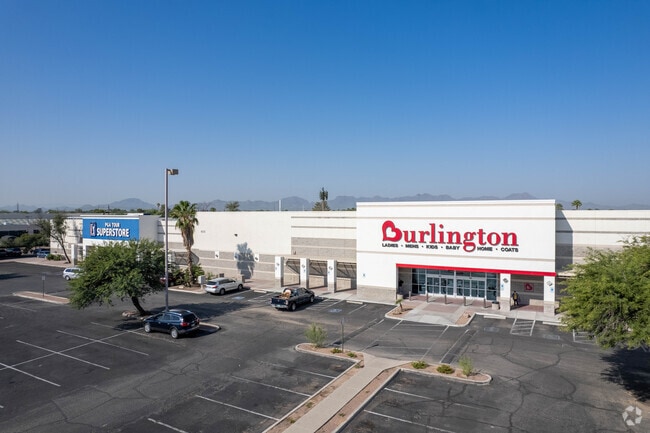
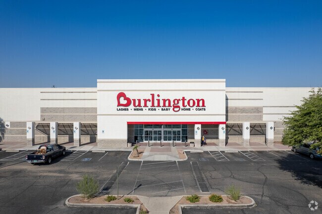
Property Record
4215 N Oracle Rd, Tucson, AZ 85705

NEARBY LISTINGS FOR SALE OR LEASE
Property Detail
4215 N Oracle Rd
Tucson, AZ
Limberlost
104-09-2240
NWC ORACLE ROAD & LIMBERLOST DRIVE LOT 1 SQ20180820634
Stripcommercialcenter
Pima
X
Arizona
04019C1686L
1
2025
7.04 AC
2025
Central West
004508
Tucson
93,449 SF
DEMOGRAPHICS near 4215 N Oracle Rd
1 Mile
3 Mile
5 Mile
2024 Total Population
13,906
100,258
229,999
2029 Population
14,329
103,949
238,440
Pop Growth 2024-2029
+ 3.04%
+ 3.68%
+ 3.67%
Average Age
41
39
39
2024 Total Households
6,552
46,272
104,806
HH Growth 2024-2029
+ 3.01%
+ 3.68%
+ 3.74%
Median Household Inc
$34,925
$40,537
$46,727
Avg Household Size
2.10
2.10
2.10
2024 Avg HH Vehicles
1.00
1.00
2.00
Median Home Value
$101,427
$194,531
$265,382
Median Year Built
1978
1979
1978
Nearby Places
Map Layers
Map Styles
 Street
 Aerial
- Restaurants
- Banks
- Shops
- Fitness
- Groceries
PUBLIC TRANSPORTATION
COMMUTER RAIL
DRIVE
WALK
Distance
11 min
4.8 mi
AIRPORT
Tucson International
DRIVE
WALK
Distance
Tucson International
25 min
13.4 mi
SALE & LEASE HISTORY
LISTING DATE
SALE/LEASE

Sep 25, 2016
For Lease
Oct 19, 2017
For Lease
Jan 23, 2017
For Lease
Nearby Properties
Address
Land Use
TOTAL SIZE
Lot Size
Zoning
Address
Land Use
TOTAL SIZE
Lot Size
Zoning
663,900 SF
14.54 AC
Address
Land Use
TOTAL SIZE
Lot Size
Zoning
134,710 SF
9.59 AC
I1
Address
Land Use
TOTAL SIZE
Lot Size
Zoning
640,899 SF
13.61 AC
Address
Land Use
TOTAL SIZE
Lot Size
Zoning
106,852 SF
19.50 AC
I1
Address
Land Use
TOTAL SIZE
Lot Size
Zoning
451,596 SF
18.92 AC
C3
Address
Land Use
TOTAL SIZE
Lot Size
Zoning
35,300 SF
5.20 AC
SR
Address
Land Use
TOTAL SIZE
Lot Size
Zoning
39,508 SF
7.29 AC
MU
Address
Land Use
TOTAL SIZE
Lot Size
Zoning
27,678 SF
64.08 AC
R2
Address
Land Use
TOTAL SIZE
Lot Size
Zoning
1,216,456 SF
28.73 AC
Address
Land Use
TOTAL SIZE
Lot Size
Zoning
145,357 SF
8.29 AC
C1
Address
Land Use
TOTAL SIZE
Lot Size
Zoning
288,815 SF
14.96 AC
Address
Land Use
TOTAL SIZE
Lot Size
Zoning
139,733 SF
9.80 AC
C3
Address
Land Use
TOTAL SIZE
Lot Size
Zoning
290,039 SF
1.98 AC
C3
Address
Land Use
TOTAL SIZE
Lot Size
Zoning
122,413 SF
21.85 AC
I1
Address
Land Use
TOTAL SIZE
Lot Size
Zoning
177,018 SF
16.78 AC
C2
Address
Land Use
TOTAL SIZE
Lot Size
Zoning
310,562 SF
16.89 AC
R3
Address
Land Use
TOTAL SIZE
Lot Size
Zoning
375,887 SF
28.70 AC
CR4
Address
Land Use
TOTAL SIZE
Lot Size
Zoning
231,357 SF
33 AC
R2
Address
Land Use
TOTAL SIZE
Lot Size
Zoning
388,226 SF
22 AC
CR5
Address
Land Use
TOTAL SIZE
Lot Size
Zoning
12,962 SF
2.80 AC
C3
Address
Land Use
TOTAL SIZE
Lot Size
Zoning
19,892 SF
3.36 AC
CB1
Address
Land Use
TOTAL SIZE
Lot Size
Zoning
250,488 SF
28.62 AC
R2
Address
Land Use
TOTAL SIZE
Lot Size
Zoning
209,967 SF
14.19 AC
Address
Land Use
TOTAL SIZE
Lot Size
Zoning
36,100 SF
2.42 AC
I1
Address
Land Use
TOTAL SIZE
Lot Size
Zoning
24,100 SF
4.96 AC
MU
Address
Land Use
TOTAL SIZE
Lot Size
Zoning
223,640 SF
18.06 AC
CB1
Address
Land Use
TOTAL SIZE
Lot Size
Zoning
21,000 SF
9.34 AC
Address
Land Use
TOTAL SIZE
Lot Size
Zoning
68,107 SF
4.34 AC
Address
Land Use
TOTAL SIZE
Lot Size
Zoning
311,175 SF
13.09 AC
SP
Address
Land Use
TOTAL SIZE
Lot Size
Zoning
279,055 SF
18.03 AC
CR4
The World's #1 Commercial Real Estate Marketplace
Connect with us
© 2025 CoStar Group
The information above has been obtained from sources believed reliable. While we do not doubt its accuracy we have not verified it and make no guarantee, warranty or representation about it. It is your responsibility to independently confirm its accuracy and completeness. Any projections, opinions, assumptions, or estimates used are for example only and do not represent the current or future performance of the property. The value of this transaction to you depends on tax and other factors which should be evaluated by your tax, financial, and legal advisors. You and your advisors should conduct a careful, independent investigation of the property to determine to your satisfaction the suitability of the property for your needs.