Property Record
4235 Saint Stephens Rd, Mobile, AL 36612
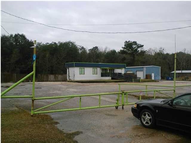

Property Detail
4235 Saint Stephens Rd
23-07-44-0-001-015
COM AT INT EIGHT MILE CRK & S/L HWY 45 & RUN SE ALG S/L HWY 480 FT(S) TO POB TH CONT SE 200 FT(S) TH SW 500 FT TH SE 150 FT
Commercialnec
Mobile
AE The base floodplain where base flood elevations are provided. AE Zones are now used on new format FIRMs instead of A1-A30 Zones.
Alabama
2025
15.82 AC
2025
Prichard/Saraland
004900
Mobile
1,440 SF
Mobile, AL
NEARBY LISTINGS FOR SALE OR LEASE
DEMOGRAPHICS near 4235 Saint Stephens Rd
1 mile
3 mile
5 mile
2024 Total Population
3,869
29,429
81,553
2029 Population
3,884
29,685
81,853
Pop Growth 2024-2029
+ 0.39%
+ 0.87%
+ 0.37%
Average Age
41
40
40
2024 Total Households
1,451
11,467
31,962
HH Growth 2024-2029
+ 0.34%
+ 0.88%
+ 0.47%
Median Household Inc
$40,596
$35,815
$40,043
Avg Household Size
2.50
2.40
2.40
2024 Avg HH Vehicles
2.00
2.00
2.00
Median Home Value
$91,666
$79,344
$111,004
Median Year Built
1975
1970
1971
Nearby Places
Map Layers
Map Styles
 Street
 Aerial
Transit
 Traffic
 Biking
Places
Listings with unknown addresses are not visible on the map
- Restaurants
- Banks
- Shops
- Fitness
- Groceries
PUBLIC TRANSPORTATION
AIRPORT
Mobile Regional
Drive
Walk
Distance
Mobile Regional
28 min
11.8 mi
Mobile International
Drive
Walk
Distance
Mobile International
21 min
13.6 mi
Freight Ports
Port of Mobile
Drive
Walk
Distance
Port of Mobile
13 min
8.4 mi
Nearby Properties
Address
Land Use
TOTAL SIZE
Lot Size
Zoning
Address
Land Use
TOTAL SIZE
Lot Size
Zoning
63,390 SF
107.45 AC
Address
Land Use
TOTAL SIZE
Lot Size
Zoning
35,775 SF
22.48 AC
Address
Land Use
TOTAL SIZE
Lot Size
Zoning
35,828 SF
26.30 AC
Address
Land Use
TOTAL SIZE
Lot Size
Zoning
187,257 SF
33.10 AC
Address
Land Use
TOTAL SIZE
Lot Size
Zoning
15,960 SF
11.06 AC
Address
Land Use
TOTAL SIZE
Lot Size
Zoning
5,553 SF
40.77 AC
Address
Land Use
TOTAL SIZE
Lot Size
Zoning
131,516 SF
15 AC
Address
Land Use
TOTAL SIZE
Lot Size
Zoning
53,850 SF
12 AC
Address
Land Use
TOTAL SIZE
Lot Size
Zoning
54,965 SF
1.97 AC
Address
Land Use
TOTAL SIZE
Lot Size
Zoning
87,532 SF
17 AC
Address
Land Use
TOTAL SIZE
Lot Size
Zoning
94,787 SF
18 AC
Address
Land Use
TOTAL SIZE
Lot Size
Zoning
40,245 SF
1.99 AC
Address
Land Use
TOTAL SIZE
Lot Size
Zoning
48,304 SF
3.28 AC
Address
Land Use
TOTAL SIZE
Lot Size
Zoning
41,928 SF
29.40 AC
Address
Land Use
TOTAL SIZE
Lot Size
Zoning
101,578 SF
32 AC
Address
Land Use
TOTAL SIZE
Lot Size
Zoning
89,556 SF
18 AC
Address
Land Use
TOTAL SIZE
Lot Size
Zoning
58,789 SF
17 AC
Address
Land Use
TOTAL SIZE
Lot Size
Zoning
58,624 SF
8.30 AC
Address
Land Use
TOTAL SIZE
Lot Size
Zoning
74,538 SF
4.48 AC
Address
Land Use
TOTAL SIZE
Lot Size
Zoning
17,300 SF
7.17 AC
Address
Land Use
TOTAL SIZE
Lot Size
Zoning
17,422 SF
2.68 AC
Address
Land Use
TOTAL SIZE
Lot Size
Zoning
60,446 SF
2.67 AC
Address
Land Use
TOTAL SIZE
Lot Size
Zoning
40,755 SF
14 AC
Address
Land Use
TOTAL SIZE
Lot Size
Zoning
7,628 SF
6.80 AC
Address
Land Use
TOTAL SIZE
Lot Size
Zoning
45,468 SF
3.91 AC
Address
Land Use
TOTAL SIZE
Lot Size
Zoning
8,244 SF
8.47 AC
Address
Land Use
TOTAL SIZE
Lot Size
Zoning
46,492 SF
17 AC
Address
Land Use
TOTAL SIZE
Lot Size
Zoning
69,369 SF
6.60 AC
Address
Land Use
TOTAL SIZE
Lot Size
Zoning
40,757 SF
7.14 AC
Address
Land Use
TOTAL SIZE
Lot Size
Zoning
11,538 SF
4.84 AC
The World's #1 Commercial Real Estate Marketplace
Connect with us
© 2026 CoStar Group
The information above has been obtained from sources believed reliable. While we do not doubt its accuracy we have not verified it and make no guarantee, warranty or representation about it. It is your responsibility to independently confirm its accuracy and completeness. Any projections, opinions, assumptions, or estimates used are for example only and do not represent the current or future performance of the property. The value of this transaction to you depends on tax and other factors which should be evaluated by your tax, financial, and legal advisors. You and your advisors should conduct a careful, independent investigation of the property to determine to your satisfaction the suitability of the property for your needs.