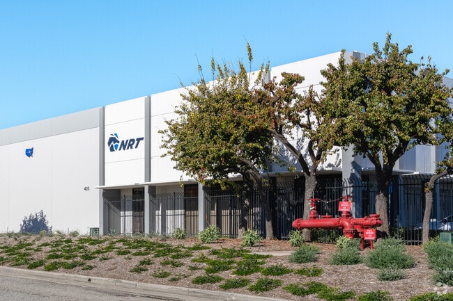
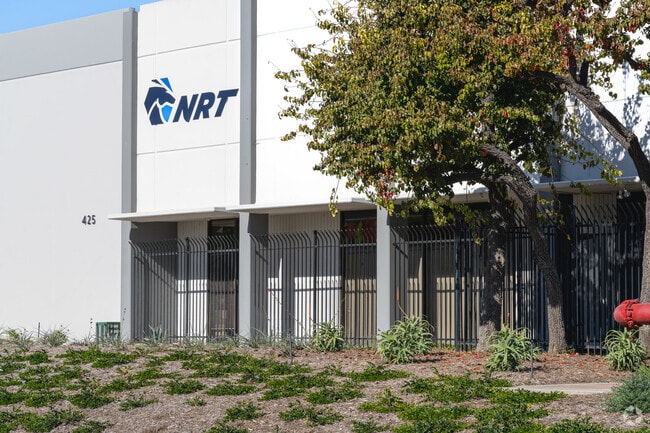
Property Record
425 W Carob St, Compton, CA 90220

Property Detail
425 W Carob St
7318-001-105
*TR=PARCEL MAP AS PER BK 26 PG 53-54 OF P M*(EX LAND SHOWN AS SBE 872-19- 321A PAR 1) LOT 8
Lightindustrial
Los Angeles
COMH*
California
B and X Area of moderate flood hazard, usually the area between the limits of the 100-year and 500-year floods.
8
2025
4.10 AC
2025
Compton
543203
Los Angeles
99,900 SF
Los Angeles-Long Beach-Glendale, CA
NEARBY LISTINGS FOR SALE OR LEASE
DEMOGRAPHICS near 425 W Carob St
1 mile
3 mile
5 mile
2025 Total Population
15,526
210,681
689,734
2030 Population
15,258
206,774
678,606
Pop Growth 2025-2030
(1.73%)
(1.85%)
(1.61%)
Average Age
36
37
38
2025 Total Households
3,983
54,841
189,884
HH Growth 2025-2030
(2.01%)
(2.11%)
(1.83%)
Median Household Inc
$73,481
$77,852
$76,897
Avg Household Size
3.80
3.60
3.40
2025 Avg HH Vehicles
2.00
2.00
2.00
Median Home Value
$617,523
$660,748
$683,001
Median Year Built
1958
1959
1959
Nearby Places
Map Layers
Map Styles
 Street
 Aerial
Layers
 Traffic
 Biking
Places
Listings with unknown addresses are not visible on the map
- Restaurants
- Banks
- Shops
- Fitness
- Groceries
PUBLIC TRANSPORTATION
AIRPORT
Long Beach (Daugherty Field)
Drive
Walk
Distance
Long Beach (Daugherty Field)
17 min
9.2 mi
Los Angeles International
Drive
Walk
Distance
Los Angeles International
23 min
14.8 mi
John Wayne/Orange County
Drive
Walk
Distance
John Wayne/Orange County
40 min
29.6 mi
Nearby Properties
Address
Land Use
TOTAL SIZE
Lot Size
Zoning
Address
Land Use
TOTAL SIZE
Lot Size
Zoning
18,791 SF
54.78 AC
LCM2
Address
Land Use
TOTAL SIZE
Lot Size
Zoning
291,731 SF
16.84 AC
CAML*
Address
Land Use
TOTAL SIZE
Lot Size
Zoning
206,715 SF
19.23 AC
CAMH*
Address
Land Use
TOTAL SIZE
Lot Size
Zoning
373,498 SF
5.20 AC
LBR4R
Address
Land Use
TOTAL SIZE
Lot Size
Zoning
383,109 SF
17 AC
LCM2
Address
Land Use
TOTAL SIZE
Lot Size
Zoning
169,400 SF
8.11 AC
COMH*
Address
Land Use
TOTAL SIZE
Lot Size
Zoning
402,197 SF
27.29 AC
COMH*
Address
Land Use
TOTAL SIZE
Lot Size
Zoning
37,867 SF
8.32 AC
COMH-B*
Address
Land Use
TOTAL SIZE
Lot Size
Zoning
340,121 SF
13 AC
LCM2
Address
Land Use
TOTAL SIZE
Lot Size
Zoning
515,047 SF
4.87 AC
COMH*
Address
Land Use
TOTAL SIZE
Lot Size
Zoning
430,706 SF
18.95 AC
CASP-4*
Address
Land Use
TOTAL SIZE
Lot Size
Zoning
514,397 SF
24.34 AC
COMH-B*
Address
Land Use
TOTAL SIZE
Lot Size
Zoning
472,062 SF
24.39 AC
COMH-B*
Address
Land Use
TOTAL SIZE
Lot Size
Zoning
230,694 SF
9.02 AC
COMH-B*
Address
Land Use
TOTAL SIZE
Lot Size
Zoning
210,742 SF
11.25 AC
CAML*
Address
Land Use
TOTAL SIZE
Lot Size
Zoning
130,977 SF
5.55 AC
LCM2*
Address
Land Use
TOTAL SIZE
Lot Size
Zoning
157,320 SF
7.18 AC
COMH*
Address
Land Use
TOTAL SIZE
Lot Size
Zoning
110,190 SF
5.16 AC
CAMH*
Address
Land Use
TOTAL SIZE
Lot Size
Zoning
146,820 SF
7.83 AC
LCM2*
Address
Land Use
TOTAL SIZE
Lot Size
Zoning
622,175 SF
14.25 AC
LCM11/2*
Address
Land Use
TOTAL SIZE
Lot Size
Zoning
71,479 SF
3.11 AC
CAML*
Address
Land Use
TOTAL SIZE
Lot Size
Zoning
87,211 SF
3.67 AC
CAMH*
Address
Land Use
TOTAL SIZE
Lot Size
Zoning
146,182 SF
CAML*
Address
Land Use
TOTAL SIZE
Lot Size
Zoning
312,272 SF
8.57 AC
CAMH*
Address
Land Use
TOTAL SIZE
Lot Size
Zoning
120,000 SF
LCM1
Address
Land Use
TOTAL SIZE
Lot Size
Zoning
183,722 SF
5.71 AC
CAMH*
Address
Land Use
TOTAL SIZE
Lot Size
Zoning
109,179 SF
4.55 AC
LCM2*
Address
Land Use
TOTAL SIZE
Lot Size
Zoning
150,080 SF
6.59 AC
CAMH*
Address
Land Use
TOTAL SIZE
Lot Size
Zoning
99,090 SF
4.54 AC
CAMH*
Address
Land Use
TOTAL SIZE
Lot Size
Zoning
132,173 SF
11.53 AC
LCM2-B1*
The World's #1 Commercial Real Estate Marketplace
Connect with us
© 2026 CoStar Group
The information above has been obtained from sources believed reliable. While we do not doubt its accuracy we have not verified it and make no guarantee, warranty or representation about it. It is your responsibility to independently confirm its accuracy and completeness. Any projections, opinions, assumptions, or estimates used are for example only and do not represent the current or future performance of the property. The value of this transaction to you depends on tax and other factors which should be evaluated by your tax, financial, and legal advisors. You and your advisors should conduct a careful, independent investigation of the property to determine to your satisfaction the suitability of the property for your needs.