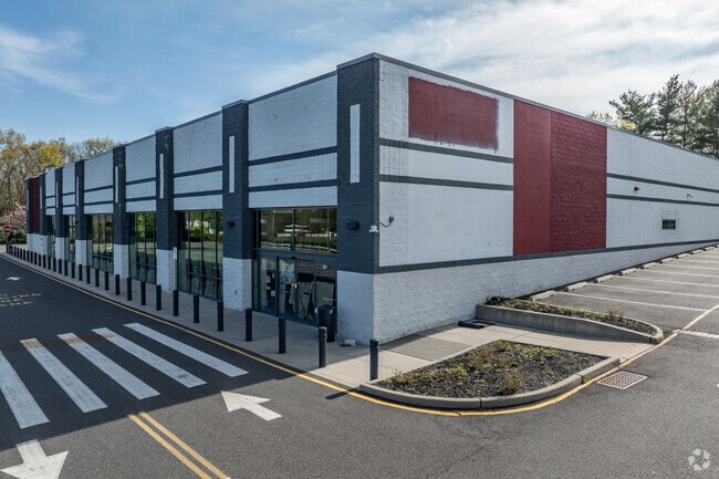
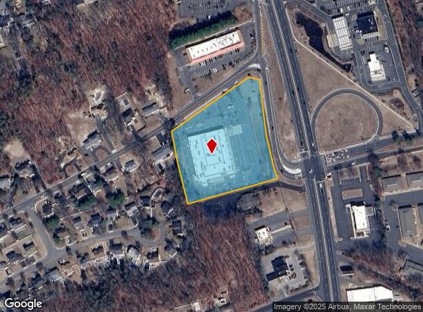
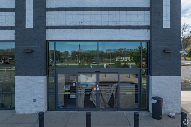
Property Record
4250 Us Highway 9, Howell, NJ 07731
NEARBY LISTINGS FOR SALE OR LEASE
Property Detail
4250 Us Highway 9
New York-Jersey City-White Plains, NY-NJ
Boundary & Development
21-00079-0000-00078
ALSO LOT 79 NIT 1A
Supermarket
Monmouth
X
New Jersey
34025C0313F
78.1
2024
1.41 AC
2025
Western Monmouth
811304
Northern New Jersey
30,529 SF
DEMOGRAPHICS near 4250 Us Highway 9
1 Mile
3 Mile
5 Mile
2024 Total Population
9,903
48,621
151,034
2029 Population
9,733
49,410
154,329
Pop Growth 2024-2029
(1.72%)
+ 1.62%
+ 2.18%
Average Age
40
36
32
2024 Total Households
3,246
14,656
41,296
HH Growth 2024-2029
(2.09%)
+ 0.88%
+ 1.26%
Median Household Inc
$126,460
$104,427
$87,810
Avg Household Size
2.90
3.10
3.30
2024 Avg HH Vehicles
2.00
2.00
2.00
Median Home Value
$375,082
$388,575
$405,654
Median Year Built
1977
1978
1985
Nearby Places
- Restaurants
- Banks
- Shops
- Fitness
- Groceries
Nearby Properties
Address
Land Use
TOTAL SIZE
Lot Size
Zoning
Address
Land Use
TOTAL SIZE
Lot Size
Zoning
24.15 AC
MF
Address
Land Use
TOTAL SIZE
Lot Size
Zoning
36,678 SF
38.75 AC
MFAH
Address
Land Use
TOTAL SIZE
Lot Size
Zoning
161,340 SF
35.35 AC
HD-1
Address
Land Use
TOTAL SIZE
Lot Size
Zoning
25.63 AC
HD-1
Address
Land Use
TOTAL SIZE
Lot Size
Zoning
237,479 SF
21 AC
LC
Address
Land Use
TOTAL SIZE
Lot Size
Zoning
21,876 SF
22.26 AC
B3
Address
Land Use
TOTAL SIZE
Lot Size
Zoning
14.90 AC
PFE
Address
Land Use
TOTAL SIZE
Lot Size
Zoning
1,032 SF
12.50 AC
HC
Address
Land Use
TOTAL SIZE
Lot Size
Zoning
136,800 SF
14.08 AC
ARE1
Address
Land Use
TOTAL SIZE
Lot Size
Zoning
87,347 SF
10.18 AC
HC
Address
Land Use
TOTAL SIZE
Lot Size
Zoning
18.34 AC
HC
Address
Land Use
TOTAL SIZE
Lot Size
Zoning
28.99 AC
HD-1
Address
Land Use
TOTAL SIZE
Lot Size
Zoning
14.73 AC
R-5
Address
Land Use
TOTAL SIZE
Lot Size
Zoning
37,202 SF
14.79 AC
B3
Address
Land Use
TOTAL SIZE
Lot Size
Zoning
8,784 SF
16.16 AC
R-LM
Address
Land Use
TOTAL SIZE
Lot Size
Zoning
1,825 SF
49.38 AC
OSP
Address
Land Use
TOTAL SIZE
Lot Size
Zoning
8.43 AC
MF
Address
Land Use
TOTAL SIZE
Lot Size
Zoning
360,400 SF
35.98 AC
SED
Address
Land Use
TOTAL SIZE
Lot Size
Zoning
112 SF
20.47 AC
HCMF
Address
Land Use
TOTAL SIZE
Lot Size
Zoning
98,731 SF
13.65 AC
HD
Address
Land Use
TOTAL SIZE
Lot Size
Zoning
3.39 AC
HC
Address
Land Use
TOTAL SIZE
Lot Size
Zoning
6,210 SF
5 AC
HC
Address
Land Use
TOTAL SIZE
Lot Size
Zoning
83,396 SF
9.51 AC
R15
Address
Land Use
TOTAL SIZE
Lot Size
Zoning
117,975 SF
21.20 AC
HD-1
Address
Land Use
TOTAL SIZE
Lot Size
Zoning
141,437 SF
13.35 AC
HD-1
Address
Land Use
TOTAL SIZE
Lot Size
Zoning
125,379 SF
22.16 AC
HD
Address
Land Use
TOTAL SIZE
Lot Size
Zoning
51,531 SF
13.30 AC
HD
Address
Land Use
TOTAL SIZE
Lot Size
Zoning
6.80 AC
HC
Address
Land Use
TOTAL SIZE
Lot Size
Zoning
24,630 SF
6.93 AC
HD-1
Address
Land Use
TOTAL SIZE
Lot Size
Zoning
1,124 SF
7.80 AC
B4
The World's #1 Commercial Real Estate Marketplace
Connect with us
© 2025 CoStar Group
The information above has been obtained from sources believed reliable. While we do not doubt its accuracy we have not verified it and make no guarantee, warranty or representation about it. It is your responsibility to independently confirm its accuracy and completeness. Any projections, opinions, assumptions, or estimates used are for example only and do not represent the current or future performance of the property. The value of this transaction to you depends on tax and other factors which should be evaluated by your tax, financial, and legal advisors. You and your advisors should conduct a careful, independent investigation of the property to determine to your satisfaction the suitability of the property for your needs.