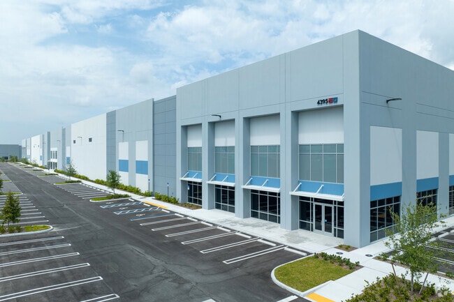
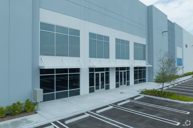
Property Record
4295 W 88Th St, Hialeah, FL 33018

Property Detail
4295 W 88Th St
04-2020-001-0073
20 52 40 25.995 AC M/L SUB OF PB 2-68 PORT OF LOTS 14 THRU 16 & PORT OF TR A & LAKE AREA OF RINKER LAKE PB 82-47 BEG 1429.89FTN & 10FTE OF SW COR OF SEC TH E1141.11FT N 00 DEG W 100FT N 89 DEG E 772.59FT N 02 DEG W 542.34FT S 89 DEG W 1917.36FT S 02
Warehouse
Miami-Dade
7600
Florida
AE The base floodplain where base flood elevations are provided. AE Zones are now used on new format FIRMs instead of A1-A30 Zones.
14-16
2024
26 AC
2025
Outlying Miami-Dade
012701
South Florida
469,837 SF
Miami-Miami Beach-Kendall, FL
NEARBY LISTINGS FOR SALE OR LEASE
DEMOGRAPHICS near 4295 W 88Th St
1 mile
3 mile
5 mile
2025 Total Population
4,374
87,207
295,934
2030 Population
4,763
92,948
316,085
Pop Growth 2025-2030
+ 8.89%
+ 6.58%
+ 6.81%
Average Age
38
41
41
2025 Total Households
1,242
26,681
96,544
HH Growth 2025-2030
+ 8.78%
+ 6.44%
+ 6.73%
Median Household Inc
$124,407
$88,609
$76,241
Avg Household Size
3.40
3.20
3.00
2025 Avg HH Vehicles
2.00
2.00
2.00
Median Home Value
$518,544
$468,336
$472,184
Median Year Built
2010
1994
1990
Nearby Places
Map Layers
Map Styles
 Street
 Aerial
Layers
 Traffic
 Biking
Places
Listings with unknown addresses are not visible on the map
- Restaurants
- Banks
- Shops
- Fitness
- Groceries
PUBLIC TRANSPORTATION
COMMUTER RAIL
Palmetto (Metrorail Green Line - Miami-Dade Transit (Metrorail/Metromover))
Drive
Walk
Distance
Palmetto (Metrorail Green Line - Miami-Dade Transit (Metrorail/Metromover))
12 min
6.4 mi
Okeechobee (Metrorail Green Line - Miami-Dade Transit (Metrorail/Metromover))
Drive
Walk
Distance
Okeechobee (Metrorail Green Line - Miami-Dade Transit (Metrorail/Metromover))
14 min
7.4 mi
AIRPORT
Miami International
Drive
Walk
Distance
Miami International
23 min
11.8 mi
Fort Lauderdale/Hollywood International
Drive
Walk
Distance
Fort Lauderdale/Hollywood International
34 min
24.7 mi
Freight Ports
Port of Miami
Drive
Walk
Distance
Port of Miami
35 min
20.4 mi
SALE & LEASE HISTORY
LISTING DATE
SALE/LEASE

Aug 25, 2022
For Lease
Aug 24, 2022
For Lease
Nearby Properties
Address
Land Use
TOTAL SIZE
Lot Size
Zoning
Address
Land Use
TOTAL SIZE
Lot Size
Zoning
636,721 SF
52.61 AC
2800
Address
Land Use
TOTAL SIZE
Lot Size
Zoning
483,328 SF
63.80 AC
7701
Address
Land Use
TOTAL SIZE
Lot Size
Zoning
572,062 SF
38.15 AC
9400
Address
Land Use
TOTAL SIZE
Lot Size
Zoning
724,587 SF
48.54 AC
7701
Address
Land Use
TOTAL SIZE
Lot Size
Zoning
439,520 SF
20.20 AC
9400
Address
Land Use
TOTAL SIZE
Lot Size
Zoning
595,768 SF
33.42 AC
7600
Address
Land Use
TOTAL SIZE
Lot Size
Zoning
725,624 SF
34.80 AC
7300
Address
Land Use
TOTAL SIZE
Lot Size
Zoning
526,059 SF
18.99 AC
6407
Address
Land Use
TOTAL SIZE
Lot Size
Zoning
812,314 SF
44 AC
7600
Address
Land Use
TOTAL SIZE
Lot Size
Zoning
509,271 SF
28.69 AC
7701
Address
Land Use
TOTAL SIZE
Lot Size
Zoning
399,805 SF
14.02 AC
8000
Address
Land Use
TOTAL SIZE
Lot Size
Zoning
374,816 SF
21.41 AC
7701
Address
Land Use
TOTAL SIZE
Lot Size
Zoning
359,483 SF
11.34 AC
8000
Address
Land Use
TOTAL SIZE
Lot Size
Zoning
223,543 SF
39.40 AC
6407
Address
Land Use
TOTAL SIZE
Lot Size
Zoning
307,032 SF
20.08 AC
7701
Address
Land Use
TOTAL SIZE
Lot Size
Zoning
537,862 SF
22.21 AC
7701
Address
Land Use
TOTAL SIZE
Lot Size
Zoning
333,414 SF
24.20 AC
7701
Address
Land Use
TOTAL SIZE
Lot Size
Zoning
345,413 SF
10.48 AC
9000
Address
Land Use
TOTAL SIZE
Lot Size
Zoning
298,578 SF
15.95 AC
7701
Address
Land Use
TOTAL SIZE
Lot Size
Zoning
382,421 SF
19.66 AC
3700
Address
Land Use
TOTAL SIZE
Lot Size
Zoning
672,678 SF
38.88 AC
7100
Address
Land Use
TOTAL SIZE
Lot Size
Zoning
627,014 SF
48.58 AC
7100
Address
Land Use
TOTAL SIZE
Lot Size
Zoning
400,062 SF
33.33 AC
0101
Address
Land Use
TOTAL SIZE
Lot Size
Zoning
267,601 SF
16.81 AC
7100
Address
Land Use
TOTAL SIZE
Lot Size
Zoning
235,248 SF
12.31 AC
7600
Address
Land Use
TOTAL SIZE
Lot Size
Zoning
230,147 SF
15 AC
7701
Address
Land Use
TOTAL SIZE
Lot Size
Zoning
230,169 SF
10.62 AC
7600
Address
Land Use
TOTAL SIZE
Lot Size
Zoning
320,597 SF
14.52 AC
7701
Address
Land Use
TOTAL SIZE
Lot Size
Zoning
145,352 SF
18.49 AC
7700
The World's #1 Commercial Real Estate Marketplace
Connect with us
© 2026 CoStar Group
The information above has been obtained from sources believed reliable. While we do not doubt its accuracy we have not verified it and make no guarantee, warranty or representation about it. It is your responsibility to independently confirm its accuracy and completeness. Any projections, opinions, assumptions, or estimates used are for example only and do not represent the current or future performance of the property. The value of this transaction to you depends on tax and other factors which should be evaluated by your tax, financial, and legal advisors. You and your advisors should conduct a careful, independent investigation of the property to determine to your satisfaction the suitability of the property for your needs.