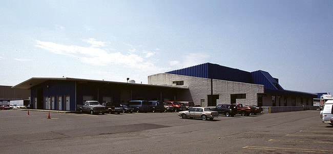
Property Record
43 Kilmer Rd, Edison, NJ 08817

NEARBY LISTINGS FOR SALE OR LEASE
Property Detail
43 Kilmer Rd
Lakewood-New Brunswick, NJ
Plan Of Survey Sheet 1 Of 1 Prepared By
05-00003-04-00010
15.56 AC
Vacantlandnec
Middlesex
X
New Jersey
34023C0043F
10
2024
15.56 AC
2025
South Edison
001702
Northern New Jersey
DEMOGRAPHICS near 43 Kilmer Rd
1 Mile
3 Mile
5 Mile
2024 Total Population
9,798
142,816
294,312
2029 Population
9,899
141,761
292,690
Pop Growth 2024-2029
+ 1.03%
(0.74%)
(0.55%)
Average Age
37
36
38
2024 Total Households
3,397
45,277
99,299
HH Growth 2024-2029
+ 0.68%
(0.58%)
(0.47%)
Median Household Inc
$114,454
$86,301
$100,250
Avg Household Size
2.70
2.80
2.70
2024 Avg HH Vehicles
2.00
2.00
2.00
Median Home Value
$477,148
$380,889
$392,014
Median Year Built
1978
1970
1970
Nearby Places
Map Layers
Map Styles
 Street
 Aerial
- Restaurants
- Banks
- Shops
- Fitness
- Groceries
PUBLIC TRANSPORTATION
COMMUTER RAIL
Edison (Northeast Corridor Line - NJ Transit Commuter Rail (NJ Transit))
DRIVE
WALK
Distance
Edison (Northeast Corridor Line - NJ Transit Commuter Rail (NJ Transit))
4 min
1.3 mi
New Brunswick (Northeast Corridor Line - NJ Transit Commuter Rail (NJ Transit))
DRIVE
WALK
Distance
New Brunswick (Northeast Corridor Line - NJ Transit Commuter Rail (NJ Transit))
7 min
2.6 mi
AIRPORT
Newark Liberty International
DRIVE
WALK
Distance
Newark Liberty International
37 min
26.9 mi
Trenton Mercer
DRIVE
WALK
Distance
Trenton Mercer
47 min
32.6 mi
Freight Ports
New York Container Terminal
DRIVE
WALK
Distance
New York Container Terminal
31 min
19.7 mi
Nearby Properties
Address
Land Use
TOTAL SIZE
Lot Size
Zoning
Address
Land Use
TOTAL SIZE
Lot Size
Zoning
27.46 AC
LI5
Address
Land Use
TOTAL SIZE
Lot Size
Zoning
8.25 AC
D-HI
Address
Land Use
TOTAL SIZE
Lot Size
Zoning
Address
Land Use
TOTAL SIZE
Lot Size
Zoning
38,536 SF
149.61 AC
IN-2
Address
Land Use
TOTAL SIZE
Lot Size
Zoning
145,522 SF
97.30 AC
E
Address
Land Use
TOTAL SIZE
Lot Size
Zoning
11.50 AC
HI
Address
Land Use
TOTAL SIZE
Lot Size
Zoning
37.80 AC
IN-2
Address
Land Use
TOTAL SIZE
Lot Size
Zoning
138,550 SF
104.63 AC
E
Address
Land Use
TOTAL SIZE
Lot Size
Zoning
24.12 AC
LI5
Address
Land Use
TOTAL SIZE
Lot Size
Zoning
78.71 AC
ER
Address
Land Use
TOTAL SIZE
Lot Size
Zoning
17 AC
O-1
Address
Land Use
TOTAL SIZE
Lot Size
Zoning
21.30 AC
IN-1
Address
Land Use
TOTAL SIZE
Lot Size
Zoning
Address
Land Use
TOTAL SIZE
Lot Size
Zoning
52,074 SF
68.14 AC
E
Address
Land Use
TOTAL SIZE
Lot Size
Zoning
1.15 AC
C-4
Address
Land Use
TOTAL SIZE
Lot Size
Zoning
0.25 AC
C-4
Address
Land Use
TOTAL SIZE
Lot Size
Zoning
18.21 AC
E
Address
Land Use
TOTAL SIZE
Lot Size
Zoning
0.92 AC
D-HI
Address
Land Use
TOTAL SIZE
Lot Size
Zoning
23,140 SF
107.63 AC
E
Address
Land Use
TOTAL SIZE
Lot Size
Zoning
6,495 SF
5.74 AC
IN-1
Address
Land Use
TOTAL SIZE
Lot Size
Zoning
1.81 AC
D-HI
Address
Land Use
TOTAL SIZE
Lot Size
Zoning
53,900 SF
4.69 AC
IN-1
Address
Land Use
TOTAL SIZE
Lot Size
Zoning
11.35 AC
R20
Address
Land Use
TOTAL SIZE
Lot Size
Zoning
83,080 SF
12.40 AC
E
Address
Land Use
TOTAL SIZE
Lot Size
Zoning
111,911 SF
126 AC
E
Address
Land Use
TOTAL SIZE
Lot Size
Zoning
5.54 AC
C-5
Address
Land Use
TOTAL SIZE
Lot Size
Zoning
Address
Land Use
TOTAL SIZE
Lot Size
Zoning
Address
Land Use
TOTAL SIZE
Lot Size
Zoning
137.89 AC
RAA
Address
Land Use
TOTAL SIZE
Lot Size
Zoning
The World's #1 Commercial Real Estate Marketplace
Connect with us
© 2026 CoStar Group
The information above has been obtained from sources believed reliable. While we do not doubt its accuracy we have not verified it and make no guarantee, warranty or representation about it. It is your responsibility to independently confirm its accuracy and completeness. Any projections, opinions, assumptions, or estimates used are for example only and do not represent the current or future performance of the property. The value of this transaction to you depends on tax and other factors which should be evaluated by your tax, financial, and legal advisors. You and your advisors should conduct a careful, independent investigation of the property to determine to your satisfaction the suitability of the property for your needs.