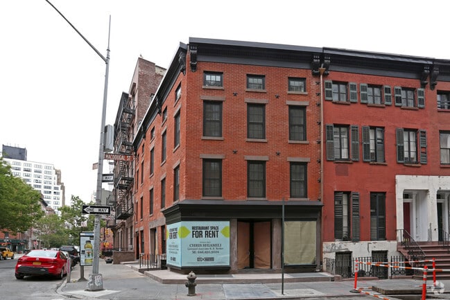
Property Record
43 Macdougal St, New York, NY 10012


Property Detail
43 Macdougal St
0520-0083
New York
Commercialofficeresidentialmixeduse
New York
R7-2
83
B and X Area of moderate flood hazard, usually the area between the limits of the 100-year and 500-year floods.
0.02 AC
2025
SoHo
2026
New York City
003700
New York-Jersey City-White Plains, NY-NJ
4,416 SF
NEARBY LISTINGS FOR SALE OR LEASE
DEMOGRAPHICS near 43 Macdougal St
1 mile
3 mile
5 mile
2025 Total Population
202,833
1,172,255
2,677,615
2030 Population
215,089
1,233,565
2,780,510
Pop Growth 2025-2030
+ 6.04%
+ 5.23%
+ 3.84%
Average Age
40
39
39
2025 Total Households
102,736
570,415
1,220,470
HH Growth 2025-2030
+ 6.31%
+ 5.47%
+ 4.12%
Median Household Inc
$139,976
$131,262
$115,617
Avg Household Size
1.80
1.90
2.10
2025 Avg HH Vehicles
.00
.00
.00
Median Home Value
$1,072,445
$979,400
$985,516
Median Year Built
1947
1962
1957
Nearby Places
Map Layers
Map Styles
 Street
 Aerial
Layers
 Traffic
 Biking
Places
Listings with unknown addresses are not visible on the map
- Restaurants
- Banks
- Shops
- Fitness
- Groceries
PUBLIC TRANSPORTATION
TRANSIT/SUBWAY
Spring Street (A,C,E Line) (A - New York MTA Subway (The Subway), C - New York MTA Subway (The Subway), E - New York MTA Subway (The Subway))
Drive
Walk
Distance
Spring Street (A,C,E Line) (A - New York MTA Subway (The Subway), C - New York MTA Subway (The Subway), E - New York MTA Subway (The Subway))
2 min
3 min
0.2 mi
Houston Street (1 - New York MTA Subway (The Subway), 2 - New York MTA Subway (The Subway))
Drive
Walk
Distance
Houston Street (1 - New York MTA Subway (The Subway), 2 - New York MTA Subway (The Subway))
0 min
3 min
0.2 mi
West 4 Street-Washington Square (A - New York MTA Subway (The Subway), B - New York MTA Subway (The Subway), C - New York MTA Subway (The Subway), D - New York MTA Subway (The Subway), E - New York MTA Subway (The Subway), F - New York MTA Subway (The Subway), M - New York MTA Subway (The Subway))
Drive
Walk
Distance
West 4 Street-Washington Square (A - New York MTA Subway (The Subway), B - New York MTA Subway (The Subway), C - New York MTA Subway (The Subway), D - New York MTA Subway (The Subway), E - New York MTA Subway (The Subway), F - New York MTA Subway (The Subway), M - New York MTA Subway (The Subway))
1 min
7 min
0.4 mi
Prince St (Broadway Express - Q - MTA New York City Transit, Broadway Local - N - MTA New York City Transit, Broadway Local - R - MTA New York City Transit, Broadway Local - W - MTA New York City Transit)
Drive
Walk
Distance
Prince St (Broadway Express - Q - MTA New York City Transit, Broadway Local - N - MTA New York City Transit, Broadway Local - R - MTA New York City Transit, Broadway Local - W - MTA New York City Transit)
1 min
7 min
0.4 mi
Christopher St-Stonewall (7 Avenue Express - MTA New York City Transit, Broadway - 7 Avenue Local - MTA New York City Transit)
Drive
Walk
Distance
Christopher St-Stonewall (7 Avenue Express - MTA New York City Transit, Broadway - 7 Avenue Local - MTA New York City Transit)
2 min
8 min
0.4 mi
COMMUTER RAIL
Christopher St (Hoboken-33rd Street - Port Authority Trans-Hudson (PATH), Journal Square-33rd Street - Port Authority Trans-Hudson (PATH))
Drive
Walk
Distance
Christopher St (Hoboken-33rd Street - Port Authority Trans-Hudson (PATH), Journal Square-33rd Street - Port Authority Trans-Hudson (PATH))
2 min
9 min
0.5 mi
9 St (Path) (Hoboken-33rd Street - Port Authority Trans-Hudson (PATH), Journal Square-33rd Street - Port Authority Trans-Hudson (PATH))
Drive
Walk
Distance
9 St (Path) (Hoboken-33rd Street - Port Authority Trans-Hudson (PATH), Journal Square-33rd Street - Port Authority Trans-Hudson (PATH))
2 min
9 min
0.5 mi
AIRPORT
LaGuardia
Drive
Walk
Distance
LaGuardia
22 min
10.2 mi
Newark Liberty International
Drive
Walk
Distance
Newark Liberty International
18 min
12.1 mi
John F Kennedy International
Drive
Walk
Distance
John F Kennedy International
31 min
18.5 mi
Freight Ports
NY - Red Hook Container Terminal
Drive
Walk
Distance
NY - Red Hook Container Terminal
12 min
4.4 mi
SALE & LEASE HISTORY
LISTING DATE
SALE/LEASE

Sep 25, 2016
For Lease
Jul 12, 2018
For Lease
Jan 19, 2017
For Lease
Nearby Properties
Address
Land Use
TOTAL SIZE
Lot Size
Zoning
Address
Land Use
TOTAL SIZE
Lot Size
Zoning
4,060,596 SF
22.09 AC
M2-3
Address
Land Use
TOTAL SIZE
Lot Size
Zoning
2,245,112 SF
2.02 AC
C6-6
Address
Land Use
TOTAL SIZE
Lot Size
Zoning
1,783,434 SF
1.94 AC
C5-3
Address
Land Use
TOTAL SIZE
Lot Size
Zoning
2,521,850 SF
1.59 AC
C6-4
Address
Land Use
TOTAL SIZE
Lot Size
Zoning
8,462,176 SF
61.41 AC
R7-2
Address
Land Use
TOTAL SIZE
Lot Size
Zoning
2,050,615 SF
1.84 AC
C5-3
Address
Land Use
TOTAL SIZE
Lot Size
Zoning
940,000 SF
1.44 AC
C6-2
Address
Land Use
TOTAL SIZE
Lot Size
Zoning
2,221,336 SF
1.55 AC
C6-4
Address
Land Use
TOTAL SIZE
Lot Size
Zoning
2,636,182 SF
2.35 AC
C65.5
Address
Land Use
TOTAL SIZE
Lot Size
Zoning
2,161,994 SF
3.79 AC
M1-5
Address
Land Use
TOTAL SIZE
Lot Size
Zoning
1,678,135 SF
1.01 AC
C5-3
Address
Land Use
TOTAL SIZE
Lot Size
Zoning
2,354,289 SF
3.96 AC
C6-4
Address
Land Use
TOTAL SIZE
Lot Size
Zoning
2,812,739 SF
2.10 AC
C5-3
Address
Land Use
TOTAL SIZE
Lot Size
Zoning
1,642,675 SF
1.05 AC
C6-7
Address
Land Use
TOTAL SIZE
Lot Size
Zoning
2,734,038 SF
4.24 AC
C52.5
Address
Land Use
TOTAL SIZE
Lot Size
Zoning
1,897,491 SF
2.06 AC
C52.5
Address
Land Use
TOTAL SIZE
Lot Size
Zoning
1,638,259 SF
1.43 AC
C52.5
Address
Land Use
TOTAL SIZE
Lot Size
Zoning
2,360,627 SF
2.08 AC
C6-7
Address
Land Use
TOTAL SIZE
Lot Size
Zoning
1,984,228 SF
1.95 AC
C65.5
Address
Land Use
TOTAL SIZE
Lot Size
Zoning
1,962,900 SF
1.89 AC
C66.5
Address
Land Use
TOTAL SIZE
Lot Size
Zoning
1,048,620 SF
5.67 AC
C6-4
Address
Land Use
TOTAL SIZE
Lot Size
Zoning
1,946,157 SF
1.49 AC
C6-4
Address
Land Use
TOTAL SIZE
Lot Size
Zoning
1,586,876 SF
1.87 AC
C5-3
Address
Land Use
TOTAL SIZE
Lot Size
Zoning
1,842,991 SF
2.08 AC
C66.5
Address
Land Use
TOTAL SIZE
Lot Size
Zoning
1,751,641 SF
1.84 AC
C6-4
Address
Land Use
TOTAL SIZE
Lot Size
Zoning
2,535,958 SF
2.94 AC
C6-4
Address
Land Use
TOTAL SIZE
Lot Size
Zoning
1,178,640 SF
0.92 AC
C6-4
Address
Land Use
TOTAL SIZE
Lot Size
Zoning
1,613,847 SF
1.84 AC
C66.5
Address
Land Use
TOTAL SIZE
Lot Size
Zoning
2.38 AC
Address
Land Use
TOTAL SIZE
Lot Size
Zoning
6,877 SF
27.74 AC
UD
The World's #1 Commercial Real Estate Marketplace
Connect with us
© 2026 CoStar Group
The information above has been obtained from sources believed reliable. While we do not doubt its accuracy we have not verified it and make no guarantee, warranty or representation about it. It is your responsibility to independently confirm its accuracy and completeness. Any projections, opinions, assumptions, or estimates used are for example only and do not represent the current or future performance of the property. The value of this transaction to you depends on tax and other factors which should be evaluated by your tax, financial, and legal advisors. You and your advisors should conduct a careful, independent investigation of the property to determine to your satisfaction the suitability of the property for your needs.