Property Record
4304 E 26Th St, Sioux Falls, SD 57103
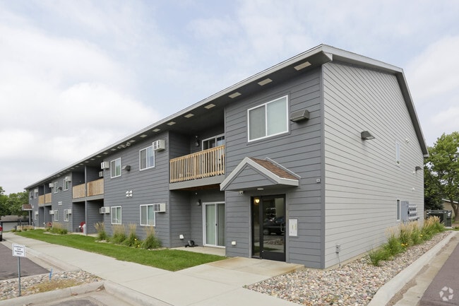


Property Detail
4304 E 26Th St
Sioux Falls, SD-MN
LOTS 10 THRU 19 (EX LOT H1 LOT 19) BLOCK 3 STONEY HOLLOW ADDN & TRACT 1 (EX H1 ) SE14 SE14 23-101-49 SIOUX FALLS CITY UNPLATTED
54066
MINNEHAHA
Apartment
South Dakota
B and X Area of moderate flood hazard, usually the area between the limits of the 100-year and 500-year floods.
10,19
2025
4.51 AC
2025
Sioux Falls
001804
Other Market Areas
33,552 SF
NEARBY LISTINGS FOR SALE OR LEASE
DEMOGRAPHICS near 4304 E 26Th St
1 mile
3 mile
5 mile
2025 Total Population
15,951
85,865
138,550
2030 Population
16,649
91,264
147,508
Pop Growth 2025-2030
+ 4.38%
+ 6.29%
+ 6.47%
Average Age
38
38
39
2025 Total Households
6,316
34,679
57,082
HH Growth 2025-2030
+ 4.84%
+ 6.72%
+ 6.89%
Median Household Inc
$61,749
$74,154
$70,206
Avg Household Size
2.40
2.40
2.30
2025 Avg HH Vehicles
2.00
2.00
2.00
Median Home Value
$280,788
$325,832
$312,032
Median Year Built
1986
1993
1990
Nearby Places
Map Layers
Map Styles
 Street
 Aerial
Layers
 Traffic
 Biking
Places
Listings with unknown addresses are not visible on the map
- Restaurants
- Banks
- Shops
- Fitness
- Groceries
PUBLIC TRANSPORTATION
AIRPORT
Joe Foss Field
Drive
Walk
Distance
Joe Foss Field
26 min
7.9 mi
Freight Ports
Port Milwaukee
Drive
Walk
Distance
Port Milwaukee
547 min
503.1 mi
Nearby Properties
Address
Land Use
TOTAL SIZE
Lot Size
Zoning
Address
Land Use
TOTAL SIZE
Lot Size
Zoning
8.03 AC
MUNICIPALI
Address
Land Use
TOTAL SIZE
Lot Size
Zoning
3,217 SF
10.40 AC
NO;SPECIAL
Address
Land Use
TOTAL SIZE
Lot Size
Zoning
11.33 AC
MUNICIPALI
Address
Land Use
TOTAL SIZE
Lot Size
Zoning
94,624 SF
12.31 AC
Address
Land Use
TOTAL SIZE
Lot Size
Zoning
153,249 SF
15.39 AC
Address
Land Use
TOTAL SIZE
Lot Size
Zoning
4,136 SF
18.95 AC
Address
Land Use
TOTAL SIZE
Lot Size
Zoning
4,358 SF
14.79 AC
Address
Land Use
TOTAL SIZE
Lot Size
Zoning
3,306 SF
17.41 AC
Address
Land Use
TOTAL SIZE
Lot Size
Zoning
284,136 SF
15.02 AC
Address
Land Use
TOTAL SIZE
Lot Size
Zoning
15,704 SF
5.13 AC
Address
Land Use
TOTAL SIZE
Lot Size
Zoning
3.07 AC
FP;FP
Address
Land Use
TOTAL SIZE
Lot Size
Zoning
1.20 AC
FP;FP
Address
Land Use
TOTAL SIZE
Lot Size
Zoning
11,800 SF
11.78 AC
Address
Land Use
TOTAL SIZE
Lot Size
Zoning
15.24 AC
MUNICIPALI
Address
Land Use
TOTAL SIZE
Lot Size
Zoning
2,406 SF
13.76 AC
Address
Land Use
TOTAL SIZE
Lot Size
Zoning
1.57 AC
C2;GENERAL
Address
Land Use
TOTAL SIZE
Lot Size
Zoning
8.02 AC
MUNICIPALI
Address
Land Use
TOTAL SIZE
Lot Size
Zoning
17,117 SF
6.51 AC
PD;PLANNED
Address
Land Use
TOTAL SIZE
Lot Size
Zoning
92,195 SF
8 AC
Address
Land Use
TOTAL SIZE
Lot Size
Zoning
87,328 SF
6.92 AC
Address
Land Use
TOTAL SIZE
Lot Size
Zoning
5.85 AC
Address
Land Use
TOTAL SIZE
Lot Size
Zoning
3,254 SF
2.13 AC
Address
Land Use
TOTAL SIZE
Lot Size
Zoning
10.24 AC
MUNICIPALI
Address
Land Use
TOTAL SIZE
Lot Size
Zoning
86,019 SF
3.60 AC
NO;SPECIAL
Address
Land Use
TOTAL SIZE
Lot Size
Zoning
9.15 AC
MUNICIPALI
Address
Land Use
TOTAL SIZE
Lot Size
Zoning
10.39 AC
MUNICIPALI
Address
Land Use
TOTAL SIZE
Lot Size
Zoning
1.08 AC
Address
Land Use
TOTAL SIZE
Lot Size
Zoning
8.38 AC
MUNICIPALI
Address
Land Use
TOTAL SIZE
Lot Size
Zoning
8.08 AC
MUNICIPALI
The World's #1 Commercial Real Estate Marketplace
Connect with us
© 2026 CoStar Group
The information above has been obtained from sources believed reliable. While we do not doubt its accuracy we have not verified it and make no guarantee, warranty or representation about it. It is your responsibility to independently confirm its accuracy and completeness. Any projections, opinions, assumptions, or estimates used are for example only and do not represent the current or future performance of the property. The value of this transaction to you depends on tax and other factors which should be evaluated by your tax, financial, and legal advisors. You and your advisors should conduct a careful, independent investigation of the property to determine to your satisfaction the suitability of the property for your needs.