Property Record
4318 W Cheyenne Ave, North Las Vegas, NV 89032


NEARBY LISTINGS FOR SALE OR LEASE
Property Detail
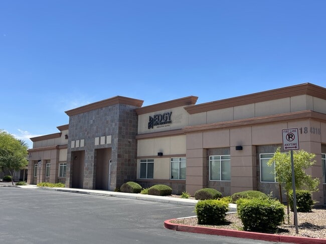
4318 W Cheyenne Ave
Las Vegas-Henderson-North Las Vegas, NV
Cheyenne & Valley 30 Acre Coml
139-07-417-013
CHEYENNE & VALLEY 30 ACRE COML PLAT BOOK 115 PAGE 52 PT LOT 1
Commercialnec
Clark
X
Nevada
32003C2155F
1
2025
0.55 AC
2025
North Las Vegas
003646
Las Vegas
3,600 SF
DEMOGRAPHICS near 4318 W Cheyenne Ave
1 Mile
3 Mile
5 Mile
2024 Total Population
15,766
178,368
478,208
2029 Population
16,717
190,877
512,447
Pop Growth 2024-2029
+ 6.03%
+ 7.01%
+ 7.16%
Average Age
39
38
38
2024 Total Households
5,486
60,989
167,406
HH Growth 2024-2029
+ 5.98%
+ 6.98%
+ 7.18%
Median Household Inc
$57,293
$55,342
$56,703
Avg Household Size
2.80
2.80
2.70
2024 Avg HH Vehicles
2.00
2.00
2.00
Median Home Value
$326,908
$295,818
$320,539
Median Year Built
1996
1992
1992
Nearby Places
Map Layers
Map Styles
 Street
 Aerial
- Restaurants
- Banks
- Shops
- Fitness
- Groceries
PUBLIC TRANSPORTATION
AIRPORT
Harry Reid International
DRIVE
WALK
Distance
Harry Reid International
23 min
12.1 mi
Boulder City Municipal
DRIVE
WALK
Distance
Boulder City Municipal
43 min
32.1 mi
SALE & LEASE HISTORY
LISTING DATE
SALE/LEASE

May 16, 2023
For Lease
Mar 13, 2023
For Lease
Mar 13, 2023
For Lease
Jun 23, 2023
For Lease
Nearby Properties
Address
Land Use
TOTAL SIZE
Lot Size
Zoning
Address
Land Use
TOTAL SIZE
Lot Size
Zoning
34.83 AC
CV
Address
Land Use
TOTAL SIZE
Lot Size
Zoning
724,845 SF
37.33 AC
M2
Address
Land Use
TOTAL SIZE
Lot Size
Zoning
9,738 SF
20.40 AC
Address
Land Use
TOTAL SIZE
Lot Size
Zoning
35.49 AC
R1
Address
Land Use
TOTAL SIZE
Lot Size
Zoning
49,716 SF
59.37 AC
CV
Address
Land Use
TOTAL SIZE
Lot Size
Zoning
390,851 SF
48.43 AC
PUD
Address
Land Use
TOTAL SIZE
Lot Size
Zoning
36.24 AC
M2
Address
Land Use
TOTAL SIZE
Lot Size
Zoning
14,793 SF
9.57 AC
CPB
Address
Land Use
TOTAL SIZE
Lot Size
Zoning
346,277 SF
37.61 AC
PUD
Address
Land Use
TOTAL SIZE
Lot Size
Zoning
378,212 SF
6.38 AC
Address
Land Use
TOTAL SIZE
Lot Size
Zoning
3,518 SF
11.95 AC
Address
Land Use
TOTAL SIZE
Lot Size
Zoning
407,991 SF
26.52 AC
M2
Address
Land Use
TOTAL SIZE
Lot Size
Zoning
445,206 SF
24.81 AC
M2
Address
Land Use
TOTAL SIZE
Lot Size
Zoning
7,704 SF
22.18 AC
N:PUD
Address
Land Use
TOTAL SIZE
Lot Size
Zoning
5,750 SF
19.67 AC
R3
Address
Land Use
TOTAL SIZE
Lot Size
Zoning
4,084 SF
1.84 AC
CPB
Address
Land Use
TOTAL SIZE
Lot Size
Zoning
11.72 AC
R2
Address
Land Use
TOTAL SIZE
Lot Size
Zoning
17.80 AC
M2
Address
Land Use
TOTAL SIZE
Lot Size
Zoning
329,442 SF
32.53 AC
C1
Address
Land Use
TOTAL SIZE
Lot Size
Zoning
7,234 SF
9.21 AC
Address
Land Use
TOTAL SIZE
Lot Size
Zoning
6,280 SF
8.72 AC
RPD18
Address
Land Use
TOTAL SIZE
Lot Size
Zoning
1,883 SF
18.13 AC
C2
Address
Land Use
TOTAL SIZE
Lot Size
Zoning
40,434 SF
25.46 AC
C3
Address
Land Use
TOTAL SIZE
Lot Size
Zoning
2.22 AC
CV
Address
Land Use
TOTAL SIZE
Lot Size
Zoning
86,946 SF
162.05 AC
M2
Address
Land Use
TOTAL SIZE
Lot Size
Zoning
7,103 SF
14.27 AC
L:R-3
The World's #1 Commercial Real Estate Marketplace
Connect with us
© 2026 CoStar Group
The information above has been obtained from sources believed reliable. While we do not doubt its accuracy we have not verified it and make no guarantee, warranty or representation about it. It is your responsibility to independently confirm its accuracy and completeness. Any projections, opinions, assumptions, or estimates used are for example only and do not represent the current or future performance of the property. The value of this transaction to you depends on tax and other factors which should be evaluated by your tax, financial, and legal advisors. You and your advisors should conduct a careful, independent investigation of the property to determine to your satisfaction the suitability of the property for your needs.