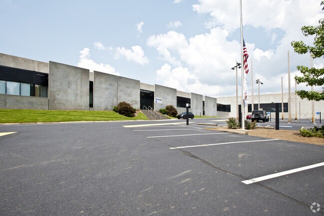
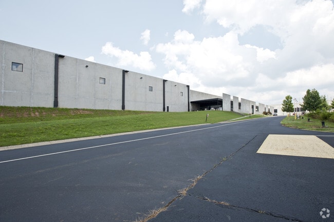
Property Record
4350 Ball Ground Hwy, Ball Ground, GA 30107

NEARBY LISTINGS FOR SALE OR LEASE
Property Detail
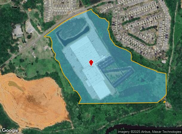
4350 Ball Ground Hwy
Atlanta-Sandy Springs-Roswell, GA
Tower Automotive Products Co
014N27-00000-071-00A-0000
LL 296, 14TH D TRACT II
Lightindustrial
Cherokee
A
Georgia
13057C0170E
0
2025
70.10 AC
2025
Woodstock/Canton
090101
Atlanta
548,520 SF
DEMOGRAPHICS near 4350 Ball Ground Hwy
1 Mile
3 Mile
5 Mile
2024 Total Population
1,404
8,822
36,994
2029 Population
1,621
10,169
42,548
Pop Growth 2024-2029
+ 15.46%
+ 15.27%
+ 15.01%
Average Age
41
41
40
2024 Total Households
544
3,175
13,321
HH Growth 2024-2029
+ 15.63%
+ 15.40%
+ 15.19%
Median Household Inc
$62,093
$81,944
$78,174
Avg Household Size
2.60
2.80
2.70
2024 Avg HH Vehicles
2.00
2.00
2.00
Median Home Value
$239,500
$368,763
$372,013
Median Year Built
2003
2005
2000
Nearby Places
- Restaurants
- Banks
- Shops
- Fitness
- Groceries
Nearby Properties
Address
Land Use
TOTAL SIZE
Lot Size
Zoning
Address
Land Use
TOTAL SIZE
Lot Size
Zoning
80,795 SF
34.86 AC
PD-MIXED U
Address
Land Use
TOTAL SIZE
Lot Size
Zoning
2,752 SF
959.77 AC
AG
Address
Land Use
TOTAL SIZE
Lot Size
Zoning
197.68 AC
PD-MU
Address
Land Use
TOTAL SIZE
Lot Size
Zoning
687,913 SF
24.31 AC
LI
Address
Land Use
TOTAL SIZE
Lot Size
Zoning
78,236 SF
23.64 AC
PD
Address
Land Use
TOTAL SIZE
Lot Size
Zoning
66,710 SF
15.14 AC
PD-MU
Address
Land Use
TOTAL SIZE
Lot Size
Zoning
296,607 SF
46.53 AC
LI
Address
Land Use
TOTAL SIZE
Lot Size
Zoning
196,718 SF
32.59 AC
GC
Address
Land Use
TOTAL SIZE
Lot Size
Zoning
84,304 SF
18.65 AC
HI
Address
Land Use
TOTAL SIZE
Lot Size
Zoning
9,142 SF
89.03 AC
LI
Address
Land Use
TOTAL SIZE
Lot Size
Zoning
30,816 SF
63.71 AC
LI
Address
Land Use
TOTAL SIZE
Lot Size
Zoning
58.19 AC
PD-MIXED U
Address
Land Use
TOTAL SIZE
Lot Size
Zoning
63,061 SF
11.22 AC
GC
Address
Land Use
TOTAL SIZE
Lot Size
Zoning
28,109 SF
1.89 AC
PSC
Address
Land Use
TOTAL SIZE
Lot Size
Zoning
62,108 SF
25 AC
OI
Address
Land Use
TOTAL SIZE
Lot Size
Zoning
108,892 SF
16.53 AC
LI
Address
Land Use
TOTAL SIZE
Lot Size
Zoning
82,621 SF
9.63 AC
PD-MU
Address
Land Use
TOTAL SIZE
Lot Size
Zoning
83.99 AC
LI
Address
Land Use
TOTAL SIZE
Lot Size
Zoning
123.28 AC
LI
Address
Land Use
TOTAL SIZE
Lot Size
Zoning
73,584 SF
10.93 AC
LI
Address
Land Use
TOTAL SIZE
Lot Size
Zoning
50,786 SF
9.09 AC
GC
Address
Land Use
TOTAL SIZE
Lot Size
Zoning
49,389 SF
10.21 AC
GC
Address
Land Use
TOTAL SIZE
Lot Size
Zoning
76,696 SF
5.75 AC
LI
Address
Land Use
TOTAL SIZE
Lot Size
Zoning
31,731 SF
1.37 AC
GC
Address
Land Use
TOTAL SIZE
Lot Size
Zoning
25,720 SF
2.23 AC
GC
Address
Land Use
TOTAL SIZE
Lot Size
Zoning
1,960 SF
81.91 AC
PD-MU
Address
Land Use
TOTAL SIZE
Lot Size
Zoning
246.49 AC
PUD
Address
Land Use
TOTAL SIZE
Lot Size
Zoning
21,896 SF
1.63 AC
LI
Address
Land Use
TOTAL SIZE
Lot Size
Zoning
15,748 SF
35.85 AC
HI
The World's #1 Commercial Real Estate Marketplace
Connect with us
© 2025 CoStar Group
The information above has been obtained from sources believed reliable. While we do not doubt its accuracy we have not verified it and make no guarantee, warranty or representation about it. It is your responsibility to independently confirm its accuracy and completeness. Any projections, opinions, assumptions, or estimates used are for example only and do not represent the current or future performance of the property. The value of this transaction to you depends on tax and other factors which should be evaluated by your tax, financial, and legal advisors. You and your advisors should conduct a careful, independent investigation of the property to determine to your satisfaction the suitability of the property for your needs.