Property Record
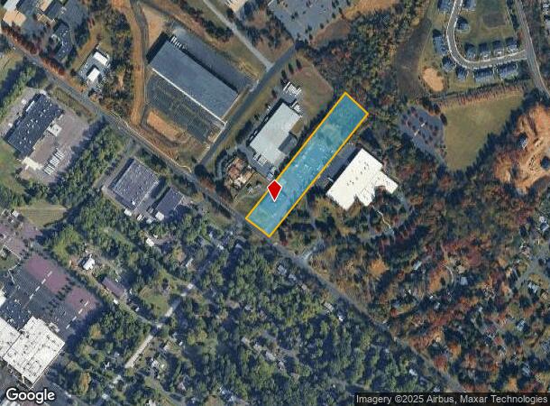
4359 County Line Rd, Chalfont, PA 18914

NEARBY LISTINGS FOR SALE OR LEASE
Property Detail
4359 County Line Rd
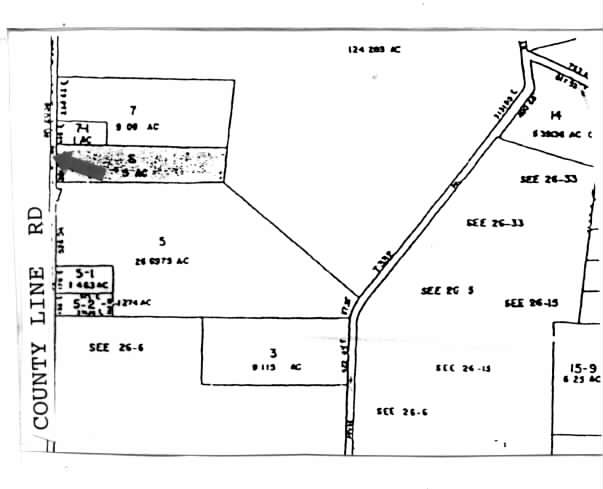
26-005-006
Survey & Plan Thereof W D Ritchie
Warehouse
5A E S LR09033 1483 FT N US202
A
Bucks
42017C0288K
Pennsylvania
2024
5 AC
2025
Bucks
102003
Philadelphia
15,000 SF
Philadelphia-Camden-Wilmington, PA-NJ-DE-MD
DEMOGRAPHICS near 4359 County Line Rd
1 mile
3 mile
5 mile
2024 Total Population
5,828
56,112
140,400
2029 Population
5,846
56,726
142,019
Pop Growth 2024-2029
+ 0.31%
+ 1.09%
+ 1.15%
Average Age
41
42
43
2024 Total Households
2,097
20,671
52,600
HH Growth 2024-2029
+ 0.19%
+ 1.02%
+ 1.11%
Median Household Inc
$120,488
$111,171
$108,796
Avg Household Size
2.70
2.60
2.60
2024 Avg HH Vehicles
2.00
2.00
2.00
Median Home Value
$423,248
$396,588
$400,958
Median Year Built
1983
1982
1981
Nearby Places
Map Layers
Map Styles
 Street
 Aerial
Transit
 Traffic
 Biking
Places
Listings with unknown addresses are not visible on the map
- Restaurants
- Banks
- Shops
- Fitness
- Groceries
PUBLIC TRANSPORTATION
TRANSIT/SUBWAY
Link Belt (R5 - Southeastern Pennsylvania Transportation Authority Regional Rail (SEPTA Regional Rail))
Drive
Walk
Distance
Link Belt (R5 - Southeastern Pennsylvania Transportation Authority Regional Rail (SEPTA Regional Rail))
2 min
13 min
0.6 mi
COMMUTER RAIL
Link Belt (R5 - Southeastern Pennsylvania Transportation Authority Regional Rail (SEPTA Regional Rail))
Drive
Walk
Distance
Link Belt (R5 - Southeastern Pennsylvania Transportation Authority Regional Rail (SEPTA Regional Rail))
2 min
13 min
0.7 mi
Colmar (R5 - Southeastern Pennsylvania Transportation Authority Regional Rail (SEPTA Regional Rail))
Drive
Walk
Distance
Colmar (R5 - Southeastern Pennsylvania Transportation Authority Regional Rail (SEPTA Regional Rail))
4 min
1.2 mi
AIRPORT
Trenton Mercer
Drive
Walk
Distance
Trenton Mercer
52 min
30.2 mi
Lehigh Valley International
Drive
Walk
Distance
Lehigh Valley International
52 min
32.2 mi
Philadelphia International
Drive
Walk
Distance
Philadelphia International
62 min
36.4 mi
Freight Ports
Port of Philadelphia
Drive
Walk
Distance
Port of Philadelphia
41 min
24.9 mi
Nearby Properties
Address
Land Use
TOTAL SIZE
Lot Size
Zoning
Address
Land Use
TOTAL SIZE
Lot Size
Zoning
258,179 SF
65.34 AC
IN
Address
Land Use
TOTAL SIZE
Lot Size
Zoning
977,439 SF
70.93 AC
GA
Address
Land Use
TOTAL SIZE
Lot Size
Zoning
1,127,663 SF
14.16 AC
RS
Address
Land Use
TOTAL SIZE
Lot Size
Zoning
319,136 SF
18.35 AC
HDR
Address
Land Use
TOTAL SIZE
Lot Size
Zoning
301,431 SF
41.90 AC
S
Address
Land Use
TOTAL SIZE
Lot Size
Zoning
517,834 SF
31.33 AC
GA
Address
Land Use
TOTAL SIZE
Lot Size
Zoning
245,104 SF
31.21 AC
C
Address
Land Use
TOTAL SIZE
Lot Size
Zoning
767,474 SF
64.82 AC
RC
Address
Land Use
TOTAL SIZE
Lot Size
Zoning
334,450 SF
18.86 AC
GA
Address
Land Use
TOTAL SIZE
Lot Size
Zoning
142,336 SF
3.17 AC
RS
Address
Land Use
TOTAL SIZE
Lot Size
Zoning
131,631 SF
18.12 AC
SC
Address
Land Use
TOTAL SIZE
Lot Size
Zoning
289,681 SF
4.75 AC
BPO
Address
Land Use
TOTAL SIZE
Lot Size
Zoning
135,540 SF
27.77 AC
A1
Address
Land Use
TOTAL SIZE
Lot Size
Zoning
89,349 SF
18.11 AC
R1
Address
Land Use
TOTAL SIZE
Lot Size
Zoning
87,819 SF
1.82 AC
S
Address
Land Use
TOTAL SIZE
Lot Size
Zoning
19,322 SF
82.24 AC
R1
Address
Land Use
TOTAL SIZE
Lot Size
Zoning
77,875 SF
18.59 AC
RA
Address
Land Use
TOTAL SIZE
Lot Size
Zoning
119,740 SF
9.80 AC
BP
Address
Land Use
TOTAL SIZE
Lot Size
Zoning
136,473 SF
9.44 AC
LI
Address
Land Use
TOTAL SIZE
Lot Size
Zoning
213,542 SF
26.53 AC
LI
Address
Land Use
TOTAL SIZE
Lot Size
Zoning
88,060 SF
20.74 AC
R1
Address
Land Use
TOTAL SIZE
Lot Size
Zoning
76,464 SF
21.67 AC
A1
Address
Land Use
TOTAL SIZE
Lot Size
Zoning
77,805 SF
21.18 AC
R2
Address
Land Use
TOTAL SIZE
Lot Size
Zoning
148,670 SF
4.63 AC
C
Address
Land Use
TOTAL SIZE
Lot Size
Zoning
134,272 SF
3.11 AC
S
Address
Land Use
TOTAL SIZE
Lot Size
Zoning
2,626 SF
72.89 AC
R1
Address
Land Use
TOTAL SIZE
Lot Size
Zoning
301,131 SF
18.98 AC
LI
Address
Land Use
TOTAL SIZE
Lot Size
Zoning
38,713 SF
12.89 AC
LI
Address
Land Use
TOTAL SIZE
Lot Size
Zoning
164,376 SF
12.87 AC
LI
Address
Land Use
TOTAL SIZE
Lot Size
Zoning
57,420 SF
2 AC
IN
The World's #1 Commercial Real Estate Marketplace
Connect with us
© 2026 CoStar Group
The information above has been obtained from sources believed reliable. While we do not doubt its accuracy we have not verified it and make no guarantee, warranty or representation about it. It is your responsibility to independently confirm its accuracy and completeness. Any projections, opinions, assumptions, or estimates used are for example only and do not represent the current or future performance of the property. The value of this transaction to you depends on tax and other factors which should be evaluated by your tax, financial, and legal advisors. You and your advisors should conduct a careful, independent investigation of the property to determine to your satisfaction the suitability of the property for your needs.