Property Record
4366 E 17Th St, Ammon, ID 83406
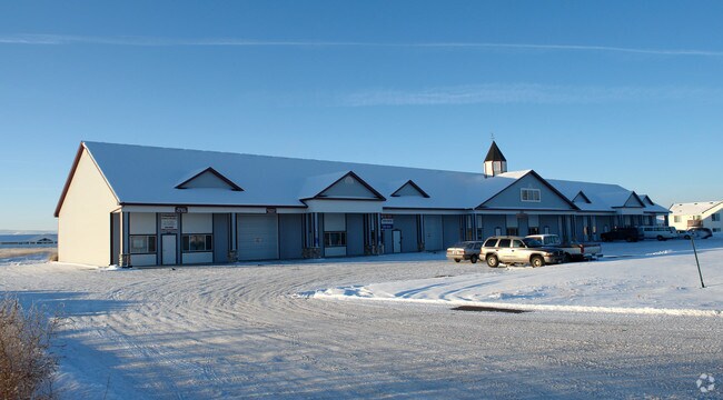

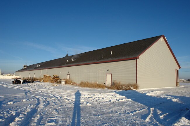
Property Detail
4366 E 17Th St
RPB2936007017A
62,515 SQ FT N PART LOT 17, BLOCK 17, BLOCK 7, EAGLE POINTE # 7 NE1/4, SEC 26, T 2N, R 38
Industrialpark
BONNEVILLE
R2
Idaho
2025
17
2025
1.44 AC
970502
Other Market Areas
14,500 SF
Idaho Falls, ID
NEARBY LISTINGS FOR SALE OR LEASE
DEMOGRAPHICS near 4366 E 17Th St
1 mile
3 mile
5 mile
2025 Total Population
6,956
52,303
98,306
2030 Population
7,324
55,039
103,625
Pop Growth 2025-2030
+ 5.29%
+ 5.23%
+ 5.41%
Average Age
35
35
36
2025 Total Households
2,136
17,317
33,789
HH Growth 2025-2030
+ 5.29%
+ 5.30%
+ 5.46%
Median Household Inc
$95,705
$73,197
$71,335
Avg Household Size
3.30
3.00
2.80
2025 Avg HH Vehicles
3.00
2.00
2.00
Median Home Value
$418,226
$381,670
$372,330
Median Year Built
2002
1999
1991
Nearby Places
Map Layers
Map Styles
 Street
 Aerial
Transit
 Traffic
 Biking
Places
Listings with unknown addresses are not visible on the map
- Restaurants
- Banks
- Shops
- Fitness
- Groceries
PUBLIC TRANSPORTATION
AIRPORT
Idaho Falls Regional
Drive
Walk
Distance
Idaho Falls Regional
19 min
8.7 mi
Freight Ports
Port of Portland
Drive
Walk
Distance
Port of Portland
748 min
714.7 mi
Nearby Properties
Address
Land Use
TOTAL SIZE
Lot Size
Zoning
Address
Land Use
TOTAL SIZE
Lot Size
Zoning
159,026 SF
13.94 AC
R2
Address
Land Use
TOTAL SIZE
Lot Size
Zoning
375,295 SF
26.11 AC
R2
Address
Land Use
TOTAL SIZE
Lot Size
Zoning
267,740 SF
45.91 AC
Address
Land Use
TOTAL SIZE
Lot Size
Zoning
4,363 SF
13.28 AC
Address
Land Use
TOTAL SIZE
Lot Size
Zoning
200,984 SF
10.65 AC
R2
Address
Land Use
TOTAL SIZE
Lot Size
Zoning
106,733 SF
2.99 AC
Address
Land Use
TOTAL SIZE
Lot Size
Zoning
6,300 SF
15.21 AC
Address
Land Use
TOTAL SIZE
Lot Size
Zoning
210,995 SF
24.15 AC
R2
Address
Land Use
TOTAL SIZE
Lot Size
Zoning
800 SF
8.38 AC
Address
Land Use
TOTAL SIZE
Lot Size
Zoning
179,244 SF
16.56 AC
Address
Land Use
TOTAL SIZE
Lot Size
Zoning
129,350 SF
4.87 AC
R2
Address
Land Use
TOTAL SIZE
Lot Size
Zoning
6,300 SF
11.42 AC
Address
Land Use
TOTAL SIZE
Lot Size
Zoning
25,889 SF
2.91 AC
Address
Land Use
TOTAL SIZE
Lot Size
Zoning
4,074 SF
10.06 AC
R2
Address
Land Use
TOTAL SIZE
Lot Size
Zoning
39,458 SF
7.13 AC
Address
Land Use
TOTAL SIZE
Lot Size
Zoning
93,971 SF
9.38 AC
R2
Address
Land Use
TOTAL SIZE
Lot Size
Zoning
5,584 SF
6.74 AC
Address
Land Use
TOTAL SIZE
Lot Size
Zoning
28,978 SF
2.40 AC
Address
Land Use
TOTAL SIZE
Lot Size
Zoning
59,941 SF
11.99 AC
Address
Land Use
TOTAL SIZE
Lot Size
Zoning
122,067 SF
10.51 AC
Address
Land Use
TOTAL SIZE
Lot Size
Zoning
53,973 SF
7.45 AC
Address
Land Use
TOTAL SIZE
Lot Size
Zoning
74,869 SF
8.82 AC
R2
Address
Land Use
TOTAL SIZE
Lot Size
Zoning
70,764 SF
3 AC
R2
Address
Land Use
TOTAL SIZE
Lot Size
Zoning
55,050 SF
4.26 AC
Address
Land Use
TOTAL SIZE
Lot Size
Zoning
96,146 SF
7.53 AC
R2
Address
Land Use
TOTAL SIZE
Lot Size
Zoning
3,219 SF
5.14 AC
R2
Address
Land Use
TOTAL SIZE
Lot Size
Zoning
69,900 SF
7.15 AC
Address
Land Use
TOTAL SIZE
Lot Size
Zoning
80,772 SF
10.41 AC
R2
Address
Land Use
TOTAL SIZE
Lot Size
Zoning
2,992 SF
4.96 AC
R2
Address
Land Use
TOTAL SIZE
Lot Size
Zoning
54,442 SF
2.06 AC
R2
The World's #1 Commercial Real Estate Marketplace
Connect with us
© 2026 CoStar Group
The information above has been obtained from sources believed reliable. While we do not doubt its accuracy we have not verified it and make no guarantee, warranty or representation about it. It is your responsibility to independently confirm its accuracy and completeness. Any projections, opinions, assumptions, or estimates used are for example only and do not represent the current or future performance of the property. The value of this transaction to you depends on tax and other factors which should be evaluated by your tax, financial, and legal advisors. You and your advisors should conduct a careful, independent investigation of the property to determine to your satisfaction the suitability of the property for your needs.