Property Record
4370 Youngfield St, Wheat Ridge, CO 80033
NEARBY LISTINGS FOR SALE OR LEASE
-
-
View all Wheat Ridge listings for sale on LoopNet.com
Property Detail
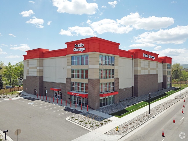
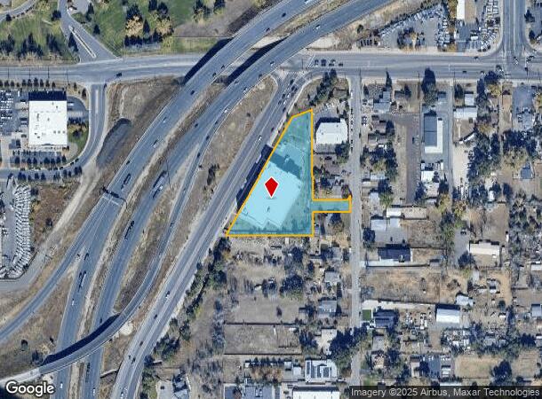
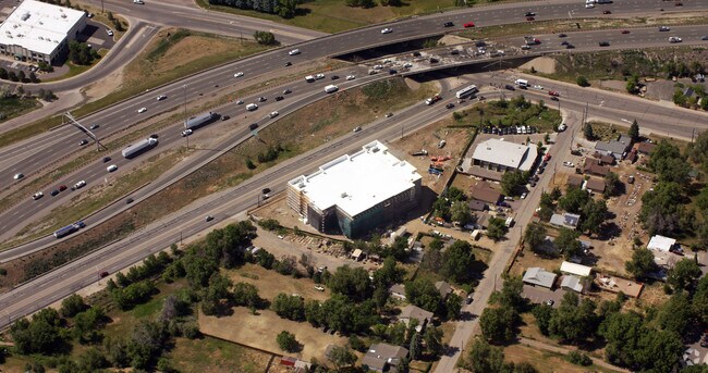
4370 Youngfield St
Denver-Aurora-Lakewood, CO
Stor-All Youngfield
39-202-05-001
SECTION 20 TOWNSHIP 03 RANGE 69 SUBDIVISIONCD 718970 SUBDIVISIONNAME STOR-ALL YOUNGFIELD LOT 0001 SIZE: 78493 VALUE: 1.8019
Industrialgeneral
Jefferson
X
Colorado
08059C0194F
1
2023
1.80 AC
2024
West Denver
010403
Denver
104,583 SF
DEMOGRAPHICS near 4370 Youngfield St
1 Mile
3 Mile
5 Mile
2024 Total Population
4,797
74,854
227,171
2029 Population
4,846
74,562
225,530
Pop Growth 2024-2029
+ 1.02%
(0.39%)
(0.72%)
Average Age
44
42
41
2024 Total Households
2,033
31,938
96,105
HH Growth 2024-2029
+ 1.03%
(0.44%)
(0.77%)
Median Household Inc
$97,840
$90,857
$87,254
Avg Household Size
2.30
2.30
2.30
2024 Avg HH Vehicles
2.00
2.00
2.00
Median Home Value
$697,795
$624,888
$593,717
Median Year Built
1980
1974
1974
Nearby Places
Map Layers
Map Styles
 Street
 Aerial
- Restaurants
- Banks
- Shops
- Fitness
- Groceries
PUBLIC TRANSPORTATION
COMMUTER RAIL
Wheat Ridge - Ward Station Track 1 (Union Station to Wheat Ridge Ward Station - Regional Transportation District)
DRIVE
WALK
Distance
Wheat Ridge - Ward Station Track 1 (Union Station to Wheat Ridge Ward Station - Regional Transportation District)
3 min
1.2 mi
Arvada Ridge Station Track 1 (Union Station to Wheat Ridge Ward Station - Regional Transportation District)
DRIVE
WALK
Distance
Arvada Ridge Station Track 1 (Union Station to Wheat Ridge Ward Station - Regional Transportation District)
5 min
2.4 mi
AIRPORT
Denver International
DRIVE
WALK
Distance
Denver International
38 min
30.7 mi
Freight Ports
Tulsa Port Of Catoosa
DRIVE
WALK
Distance
Tulsa Port Of Catoosa
735 min
716.2 mi
Nearby Properties
Address
Land Use
TOTAL SIZE
Lot Size
Zoning
Address
Land Use
TOTAL SIZE
Lot Size
Zoning
830,160 SF
26.93 AC
Address
Land Use
TOTAL SIZE
Lot Size
Zoning
229,819 SF
29.97 AC
Address
Land Use
TOTAL SIZE
Lot Size
Zoning
269,013 SF
31.89 AC
Address
Land Use
TOTAL SIZE
Lot Size
Zoning
111,673 SF
29.06 AC
Address
Land Use
TOTAL SIZE
Lot Size
Zoning
187,095 SF
23.42 AC
Address
Land Use
TOTAL SIZE
Lot Size
Zoning
187,745 SF
16.25 AC
Address
Land Use
TOTAL SIZE
Lot Size
Zoning
282,190 SF
6.42 AC
PD
Address
Land Use
TOTAL SIZE
Lot Size
Zoning
322,105 SF
136.23 AC
Address
Land Use
TOTAL SIZE
Lot Size
Zoning
353,286 SF
14.49 AC
Address
Land Use
TOTAL SIZE
Lot Size
Zoning
227,132 SF
11.95 AC
Address
Land Use
TOTAL SIZE
Lot Size
Zoning
365,230 SF
12.51 AC
Address
Land Use
TOTAL SIZE
Lot Size
Zoning
167,420 SF
5.84 AC
Address
Land Use
TOTAL SIZE
Lot Size
Zoning
389,561 SF
10.73 AC
Address
Land Use
TOTAL SIZE
Lot Size
Zoning
192,500 SF
10.97 AC
Address
Land Use
TOTAL SIZE
Lot Size
Zoning
260,325 SF
13.70 AC
Address
Land Use
TOTAL SIZE
Lot Size
Zoning
299,678 SF
20.79 AC
PD
Address
Land Use
TOTAL SIZE
Lot Size
Zoning
131,135 SF
2.83 AC
Address
Land Use
TOTAL SIZE
Lot Size
Zoning
391,227 SF
5.77 AC
Address
Land Use
TOTAL SIZE
Lot Size
Zoning
262,699 SF
13.10 AC
A2
Address
Land Use
TOTAL SIZE
Lot Size
Zoning
330,357 SF
15.16 AC
Address
Land Use
TOTAL SIZE
Lot Size
Zoning
288,528 SF
12.78 AC
Address
Land Use
TOTAL SIZE
Lot Size
Zoning
126,539 SF
23.81 AC
Address
Land Use
TOTAL SIZE
Lot Size
Zoning
363,989 SF
30.10 AC
Address
Land Use
TOTAL SIZE
Lot Size
Zoning
241,243 SF
9.08 AC
Address
Land Use
TOTAL SIZE
Lot Size
Zoning
101,761 SF
4.34 AC
Address
Land Use
TOTAL SIZE
Lot Size
Zoning
142,200 SF
9.82 AC
Address
Land Use
TOTAL SIZE
Lot Size
Zoning
520,896 SF
24.42 AC
I1
Address
Land Use
TOTAL SIZE
Lot Size
Zoning
2,997 SF
5.28 AC
Address
Land Use
TOTAL SIZE
Lot Size
Zoning
300,930 SF
6.76 AC
C1
Address
Land Use
TOTAL SIZE
Lot Size
Zoning
125,884 SF
8.88 AC
The World's #1 Commercial Real Estate Marketplace
Connect with us
© 2025 CoStar Group
The information above has been obtained from sources believed reliable. While we do not doubt its accuracy we have not verified it and make no guarantee, warranty or representation about it. It is your responsibility to independently confirm its accuracy and completeness. Any projections, opinions, assumptions, or estimates used are for example only and do not represent the current or future performance of the property. The value of this transaction to you depends on tax and other factors which should be evaluated by your tax, financial, and legal advisors. You and your advisors should conduct a careful, independent investigation of the property to determine to your satisfaction the suitability of the property for your needs.