Property Record
4405 Pheasant Ridge Dr Ne, Minneapolis, MN 55449

NEARBY LISTINGS FOR SALE OR LEASE
Property Detail
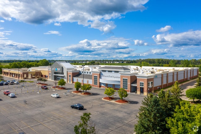
4405 Pheasant Ridge Dr Ne
Minneapolis-St. Paul-Bloomington, MN-WI
Pheasant Ridge Village
24-31-23-22-0008
LOT 3 BLK 1 PHEASANT RIDGE VILLAGE, EX THAT PRT OF SD LOT LYG WITHIN THAT PRT OF NW1/4 OF NW1/4 OF SEC 24 TWP 31 RGE 23 DESC
Commercialnec
Anoka
X
Minnesota
27003C0345E
3
2024
3.65 AC
2025
Northtown
050816
Minneapolis/St Paul
140,684 SF
DEMOGRAPHICS near 4405 Pheasant Ridge Dr Ne
1 Mile
3 Mile
5 Mile
2024 Total Population
3,935
44,620
112,825
2029 Population
4,113
46,722
116,344
Pop Growth 2024-2029
+ 4.52%
+ 4.71%
+ 3.12%
Average Age
38
39
39
2024 Total Households
1,293
15,590
40,754
HH Growth 2024-2029
+ 4.49%
+ 4.68%
+ 2.97%
Median Household Inc
$111,050
$99,089
$98,249
Avg Household Size
2.90
2.80
2.70
2024 Avg HH Vehicles
2.00
2.00
2.00
Median Home Value
$310,262
$345,144
$322,685
Median Year Built
1988
1998
1990
Nearby Places
Map Layers
Map Styles
 Street
 Aerial
- Restaurants
- Banks
- Shops
- Fitness
- Groceries
PUBLIC TRANSPORTATION
AIRPORT
Minneapolis-St Paul International/Wold-Chamberlain
DRIVE
WALK
Distance
Minneapolis-St Paul International/Wold-Chamberlain
38 min
25.0 mi
Freight Ports
Port Milwaukee
DRIVE
WALK
Distance
Port Milwaukee
383 min
347.2 mi
SALE & LEASE HISTORY
LISTING DATE
SALE/LEASE

Mar 29, 2024
For Sale
Jul 24, 2018
For Lease
Apr 25, 2019
For Lease
Nearby Properties
Address
Land Use
TOTAL SIZE
Lot Size
Zoning
Address
Land Use
TOTAL SIZE
Lot Size
Zoning
226,201 SF
70.59 AC
Address
Land Use
TOTAL SIZE
Lot Size
Zoning
156,499 SF
81.20 AC
Address
Land Use
TOTAL SIZE
Lot Size
Zoning
239,389 SF
5.73 AC
Address
Land Use
TOTAL SIZE
Lot Size
Zoning
239,318 SF
Address
Land Use
TOTAL SIZE
Lot Size
Zoning
Address
Land Use
TOTAL SIZE
Lot Size
Zoning
152,721 SF
Address
Land Use
TOTAL SIZE
Lot Size
Zoning
195,000 SF
Address
Land Use
TOTAL SIZE
Lot Size
Zoning
248,816 SF
14.02 AC
Address
Land Use
TOTAL SIZE
Lot Size
Zoning
265,400 SF
13.53 AC
Address
Land Use
TOTAL SIZE
Lot Size
Zoning
74,366 SF
10 AC
Address
Land Use
TOTAL SIZE
Lot Size
Zoning
190,377 SF
9.61 AC
Address
Land Use
TOTAL SIZE
Lot Size
Zoning
109,136 SF
Address
Land Use
TOTAL SIZE
Lot Size
Zoning
46,557 SF
9.27 AC
Address
Land Use
TOTAL SIZE
Lot Size
Zoning
119,907 SF
36.99 AC
Address
Land Use
TOTAL SIZE
Lot Size
Zoning
61,740 SF
16.10 AC
Address
Land Use
TOTAL SIZE
Lot Size
Zoning
77,940 SF
19.07 AC
Address
Land Use
TOTAL SIZE
Lot Size
Zoning
135,746 SF
8.85 AC
Address
Land Use
TOTAL SIZE
Lot Size
Zoning
223,763 SF
24.89 AC
Address
Land Use
TOTAL SIZE
Lot Size
Zoning
48,260 SF
10.38 AC
Address
Land Use
TOTAL SIZE
Lot Size
Zoning
43,132 SF
37.89 AC
Address
Land Use
TOTAL SIZE
Lot Size
Zoning
120,000 SF
39.44 AC
Address
Land Use
TOTAL SIZE
Lot Size
Zoning
180,712 SF
15.95 AC
Address
Land Use
TOTAL SIZE
Lot Size
Zoning
235,504 SF
30.54 AC
Address
Land Use
TOTAL SIZE
Lot Size
Zoning
185,498 SF
25.01 AC
Address
Land Use
TOTAL SIZE
Lot Size
Zoning
243,028 SF
24.35 AC
Address
Land Use
TOTAL SIZE
Lot Size
Zoning
52,981 SF
5.27 AC
Address
Land Use
TOTAL SIZE
Lot Size
Zoning
61,617 SF
Address
Land Use
TOTAL SIZE
Lot Size
Zoning
32,314 SF
4.37 AC
Address
Land Use
TOTAL SIZE
Lot Size
Zoning
145,312 SF
1.84 AC
Address
Land Use
TOTAL SIZE
Lot Size
Zoning
87,740 SF
5.98 AC
The World's #1 Commercial Real Estate Marketplace
Connect with us
© 2026 CoStar Group
The information above has been obtained from sources believed reliable. While we do not doubt its accuracy we have not verified it and make no guarantee, warranty or representation about it. It is your responsibility to independently confirm its accuracy and completeness. Any projections, opinions, assumptions, or estimates used are for example only and do not represent the current or future performance of the property. The value of this transaction to you depends on tax and other factors which should be evaluated by your tax, financial, and legal advisors. You and your advisors should conduct a careful, independent investigation of the property to determine to your satisfaction the suitability of the property for your needs.