Property Record
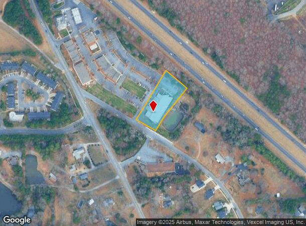
4420 Howt Galvin Way, Charlotte, NC 28214

NEARBY LISTINGS FOR SALE OR LEASE
-
-
View all Charlotte listings for sale on LoopNet.com
Property Detail
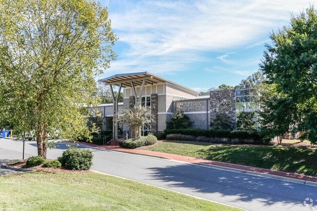
4420 Howt Galvin Way
Charlotte-Concord-Gastonia, NC-SC
Final Plat For Lot 6 Mountain Island Vil
023-122-30
L6 M38-83
Commercialnec
Mecklenburg
X
North Carolina
3710451800L
6
2022
1.27 AC
2025
Northwest Charlotte
006103
Charlotte
15,494 SF
DEMOGRAPHICS near 4420 Howt Galvin Way
1 Mile
3 Mile
5 Mile
2024 Total Population
5,577
27,322
77,324
2029 Population
5,924
29,227
82,386
Pop Growth 2024-2029
+ 6.22%
+ 6.97%
+ 6.55%
Average Age
38
38
37
2024 Total Households
2,083
10,228
28,279
HH Growth 2024-2029
+ 6.34%
+ 7.10%
+ 6.69%
Median Household Inc
$114,214
$85,811
$72,863
Avg Household Size
2.70
2.60
2.70
2024 Avg HH Vehicles
2.00
2.00
2.00
Median Home Value
$393,811
$284,698
$254,012
Median Year Built
2005
2001
2000
Nearby Places
Map Layers
Map Styles
 Street
 Aerial
- Restaurants
- Banks
- Shops
- Fitness
- Groceries
PUBLIC TRANSPORTATION
AIRPORT
Charlotte/Douglas International
DRIVE
WALK
Distance
Charlotte/Douglas International
25 min
11.9 mi
Concord-Padgett Regional
DRIVE
WALK
Distance
Concord-Padgett Regional
24 min
17.2 mi
Nearby Properties
Address
Land Use
TOTAL SIZE
Lot Size
Zoning
Address
Land Use
TOTAL SIZE
Lot Size
Zoning
282,374 SF
11.58 AC
Address
Land Use
TOTAL SIZE
Lot Size
Zoning
197,874 SF
11.71 AC
Address
Land Use
TOTAL SIZE
Lot Size
Zoning
226,973 SF
16.97 AC
R17MFCD
Address
Land Use
TOTAL SIZE
Lot Size
Zoning
214,824 SF
18.78 AC
R12MFCD
Address
Land Use
TOTAL SIZE
Lot Size
Zoning
3,428 SF
13.21 AC
R-17MF
Address
Land Use
TOTAL SIZE
Lot Size
Zoning
437,434 SF
150.02 AC
MANU1
Address
Land Use
TOTAL SIZE
Lot Size
Zoning
89,113 SF
14.56 AC
R-3
Address
Land Use
TOTAL SIZE
Lot Size
Zoning
5,478 SF
44.91 AC
R1
Address
Land Use
TOTAL SIZE
Lot Size
Zoning
13,090 SF
93.97 AC
INDS2
Address
Land Use
TOTAL SIZE
Lot Size
Zoning
186,364 SF
18.43 AC
R-3
Address
Land Use
TOTAL SIZE
Lot Size
Zoning
960 SF
24.24 AC
CC
Address
Land Use
TOTAL SIZE
Lot Size
Zoning
136,318 SF
4.13 AC
I1
Address
Land Use
TOTAL SIZE
Lot Size
Zoning
80,799 SF
7.10 AC
NS
Address
Land Use
TOTAL SIZE
Lot Size
Zoning
Address
Land Use
TOTAL SIZE
Lot Size
Zoning
29,320 SF
340.71 AC
R1
Address
Land Use
TOTAL SIZE
Lot Size
Zoning
75,208 SF
15.55 AC
R-3
Address
Land Use
TOTAL SIZE
Lot Size
Zoning
58,553 SF
7.78 AC
B1CD
Address
Land Use
TOTAL SIZE
Lot Size
Zoning
63,651 SF
7.81 AC
B1CD
Address
Land Use
TOTAL SIZE
Lot Size
Zoning
40,822 SF
7.13 AC
B1
Address
Land Use
TOTAL SIZE
Lot Size
Zoning
41,414 SF
4.85 AC
CC
Address
Land Use
TOTAL SIZE
Lot Size
Zoning
33,307 SF
81.36 AC
R5
Address
Land Use
TOTAL SIZE
Lot Size
Zoning
20.02 AC
R-12MF(CD)
Address
Land Use
TOTAL SIZE
Lot Size
Zoning
11,490 SF
17.14 AC
R-4
Address
Land Use
TOTAL SIZE
Lot Size
Zoning
128,976 SF
5.84 AC
R12MFCD
Address
Land Use
TOTAL SIZE
Lot Size
Zoning
59,730 SF
2.36 AC
BP
Address
Land Use
TOTAL SIZE
Lot Size
Zoning
109,527 SF
30.45 AC
R3
Address
Land Use
TOTAL SIZE
Lot Size
Zoning
12,635 SF
1.95 AC
Address
Land Use
TOTAL SIZE
Lot Size
Zoning
48,889 SF
6.35 AC
B1SCD
Address
Land Use
TOTAL SIZE
Lot Size
Zoning
79,560 SF
3.63 AC
R12MFCD
Address
Land Use
TOTAL SIZE
Lot Size
Zoning
8,143 SF
5.42 AC
CC
The World's #1 Commercial Real Estate Marketplace
Connect with us
© 2026 CoStar Group
The information above has been obtained from sources believed reliable. While we do not doubt its accuracy we have not verified it and make no guarantee, warranty or representation about it. It is your responsibility to independently confirm its accuracy and completeness. Any projections, opinions, assumptions, or estimates used are for example only and do not represent the current or future performance of the property. The value of this transaction to you depends on tax and other factors which should be evaluated by your tax, financial, and legal advisors. You and your advisors should conduct a careful, independent investigation of the property to determine to your satisfaction the suitability of the property for your needs.