Property Record
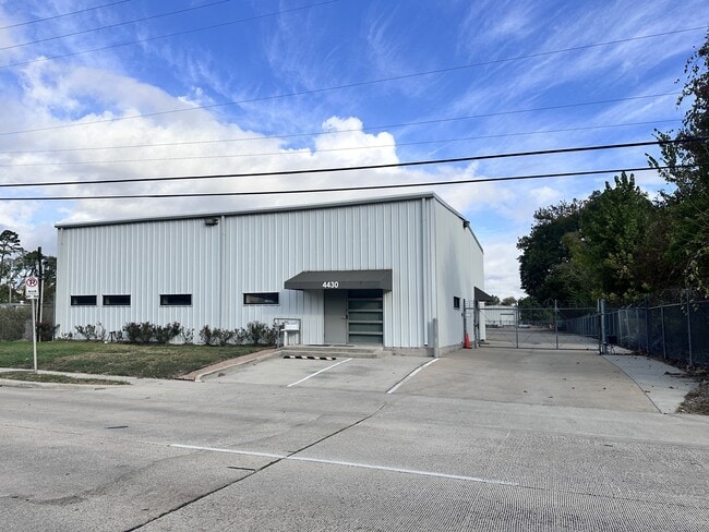
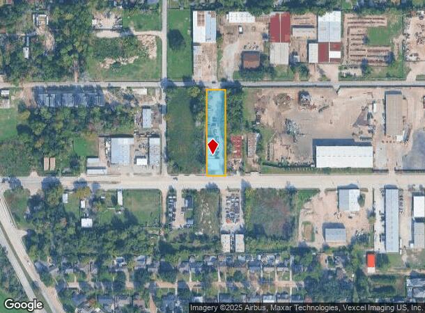
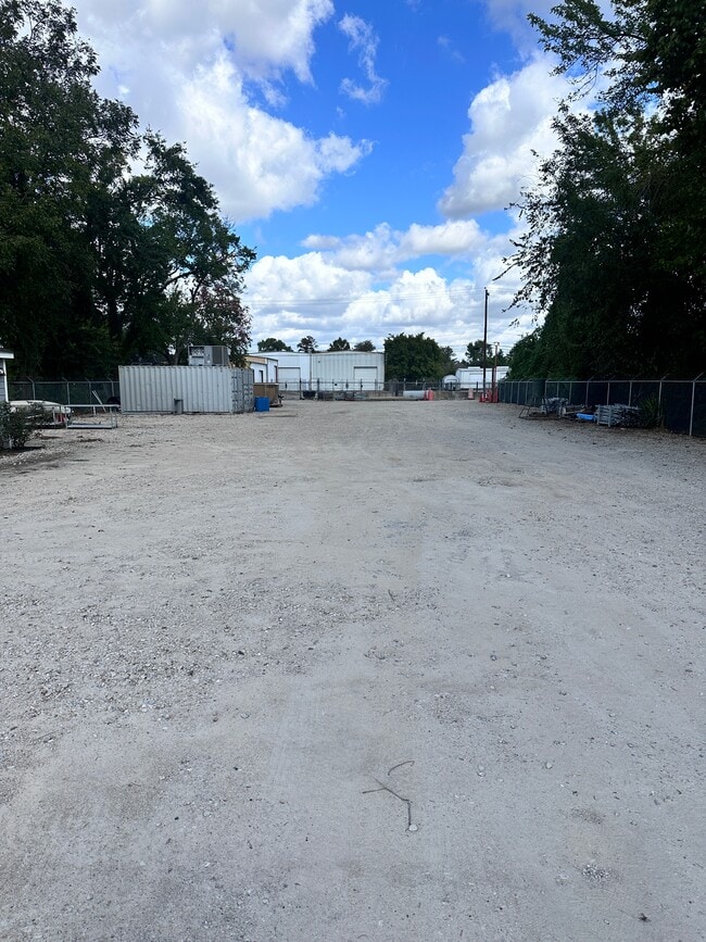
4430 Pinemont Dr, Houston, TX 77018
This Property Is For Sale
Current Lease Availabilities
NEARBY LISTINGS FOR SALE OR LEASE
Property Detail
4430 Pinemont Dr
0392150020047
Rosslyn Heights Ac Home Sec 1
Warehouse
TRS 3A & 3B BLK 2 ROSSLYN HEIGHTS AC HOME SEC 1
AE
Harris
48201C0655M
Texas
2024
0.88 AC
2025
Northwest Near
531600
Houston
7,082 SF
Houston-The Woodlands-Sugar Land, TX
DEMOGRAPHICS near 4430 Pinemont Dr
1 Mile
3 Mile
5 Mile
2024 Total Population
11,618
122,361
370,953
2029 Population
11,920
126,075
381,437
Pop Growth 2024-2029
+ 2.60%
+ 3.04%
+ 2.83%
Average Age
38
37
36
2024 Total Households
4,446
46,762
138,002
HH Growth 2024-2029
+ 2.50%
+ 3.06%
+ 2.98%
Median Household Inc
$67,370
$49,189
$58,898
Avg Household Size
2.50
2.50
2.60
2024 Avg HH Vehicles
2.00
2.00
2.00
Median Home Value
$332,093
$289,516
$310,074
Median Year Built
1971
1975
1978
Nearby Places
Map Layers
Map Styles
 Street
 Aerial
- Restaurants
- Banks
- Shops
- Fitness
- Groceries
PUBLIC TRANSPORTATION
AIRPORT
George Bush Intcntl/Houston
DRIVE
WALK
Distance
George Bush Intcntl/Houston
27 min
17.0 mi
William P Hobby
DRIVE
WALK
Distance
William P Hobby
38 min
23.2 mi
Freight Ports
Port of Houston
DRIVE
WALK
Distance
Port of Houston
30 min
18.8 mi
Nearby Properties
Address
Land Use
TOTAL SIZE
Lot Size
Zoning
Address
Land Use
TOTAL SIZE
Lot Size
Zoning
563,626 SF
4.71 AC
Address
Land Use
TOTAL SIZE
Lot Size
Zoning
432,691 SF
3.26 AC
Address
Land Use
TOTAL SIZE
Lot Size
Zoning
350,655 SF
16.76 AC
Address
Land Use
TOTAL SIZE
Lot Size
Zoning
443,228 SF
3.15 AC
Address
Land Use
TOTAL SIZE
Lot Size
Zoning
402,433 SF
2.77 AC
Address
Land Use
TOTAL SIZE
Lot Size
Zoning
418,456 SF
5.72 AC
Address
Land Use
TOTAL SIZE
Lot Size
Zoning
279,452 SF
5.69 AC
Address
Land Use
TOTAL SIZE
Lot Size
Zoning
308,168 SF
21.34 AC
Address
Land Use
TOTAL SIZE
Lot Size
Zoning
198,259 SF
19.57 AC
Address
Land Use
TOTAL SIZE
Lot Size
Zoning
228,804 SF
3.28 AC
Address
Land Use
TOTAL SIZE
Lot Size
Zoning
259,716 SF
6.31 AC
Address
Land Use
TOTAL SIZE
Lot Size
Zoning
444,798 SF
17.17 AC
Address
Land Use
TOTAL SIZE
Lot Size
Zoning
336,050 SF
14.41 AC
Address
Land Use
TOTAL SIZE
Lot Size
Zoning
330,161 SF
20.90 AC
Address
Land Use
TOTAL SIZE
Lot Size
Zoning
178,094 SF
6.08 AC
Address
Land Use
TOTAL SIZE
Lot Size
Zoning
989,762 SF
6.10 AC
Address
Land Use
TOTAL SIZE
Lot Size
Zoning
145,132 SF
3.69 AC
Address
Land Use
TOTAL SIZE
Lot Size
Zoning
313,158 SF
12.54 AC
Address
Land Use
TOTAL SIZE
Lot Size
Zoning
565,890 SF
33.61 AC
Address
Land Use
TOTAL SIZE
Lot Size
Zoning
244,727 SF
10.49 AC
Address
Land Use
TOTAL SIZE
Lot Size
Zoning
217,700 SF
16.16 AC
Address
Land Use
TOTAL SIZE
Lot Size
Zoning
437,052 SF
15.90 AC
Address
Land Use
TOTAL SIZE
Lot Size
Zoning
197,696 SF
3.06 AC
Address
Land Use
TOTAL SIZE
Lot Size
Zoning
333,616 SF
12.81 AC
Address
Land Use
TOTAL SIZE
Lot Size
Zoning
282,024 SF
13.13 AC
Address
Land Use
TOTAL SIZE
Lot Size
Zoning
200,233 SF
Address
Land Use
TOTAL SIZE
Lot Size
Zoning
194,196 SF
62.19 AC
Address
Land Use
TOTAL SIZE
Lot Size
Zoning
629,340 SF
3.66 AC
Address
Land Use
TOTAL SIZE
Lot Size
Zoning
176,505 SF
2.72 AC
Address
Land Use
TOTAL SIZE
Lot Size
Zoning
614,007 SF
3.25 AC
The World's #1 Commercial Real Estate Marketplace
Connect with us
© 2025 CoStar Group
The information above has been obtained from sources believed reliable. While we do not doubt its accuracy we have not verified it and make no guarantee, warranty or representation about it. It is your responsibility to independently confirm its accuracy and completeness. Any projections, opinions, assumptions, or estimates used are for example only and do not represent the current or future performance of the property. The value of this transaction to you depends on tax and other factors which should be evaluated by your tax, financial, and legal advisors. You and your advisors should conduct a careful, independent investigation of the property to determine to your satisfaction the suitability of the property for your needs.