Property Record
444 Charles Ct, West Chicago, IL 60185
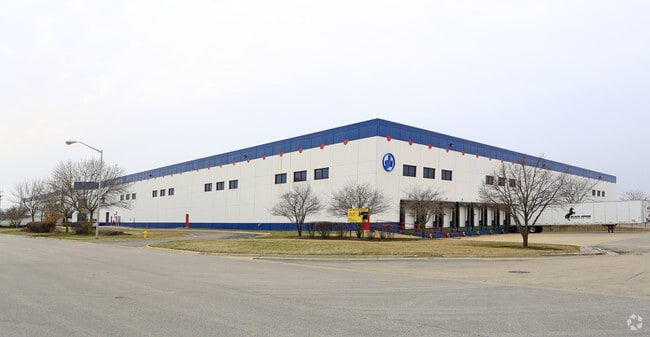


Property Detail
444 Charles Ct
04-08-400-033
JEL SERT II RESUB /EX HWY DESC 2014ED26/
Industrialgeneral
DuPage
I
Illinois
A Areas with a 1% annual chance of flooding and a 26% chance of flooding over the life of a 30-year mortgage.
12.36 AC
2024
Central Kane / DuPage
2024
Chicago
841501
Chicago-Naperville-Elgin, IL-IN
277,018 SF
NEARBY LISTINGS FOR SALE OR LEASE
DEMOGRAPHICS near 444 Charles Ct
1 mile
3 mile
5 mile
2025 Total Population
2,654
29,518
117,187
2030 Population
2,651
29,580
117,990
Pop Growth 2025-2030
(0.11%)
+ 0.21%
+ 0.69%
Average Age
35
38
41
2025 Total Households
716
9,169
42,376
HH Growth 2025-2030
(0.14%)
+ 0.13%
+ 0.73%
Median Household Inc
$61,622
$97,321
$113,726
Avg Household Size
3.40
3.10
2.70
2025 Avg HH Vehicles
2.00
2.00
2.00
Median Home Value
$250,530
$295,675
$357,522
Median Year Built
1967
1977
1981
Nearby Places
Map Layers
Map Styles
 Street
 Aerial
Layers
 Traffic
 Biking
Places
Listings with unknown addresses are not visible on the map
- Restaurants
- Banks
- Shops
- Fitness
- Groceries
PUBLIC TRANSPORTATION
COMMUTER RAIL
West Chicago Station (Union Pacific West Line - Northeast Illinois Regional Commuter Railroad (Metra))
Drive
Walk
Distance
West Chicago Station (Union Pacific West Line - Northeast Illinois Regional Commuter Railroad (Metra))
6 min
2.3 mi
Winfield Station (Union Pacific West Line - Northeast Illinois Regional Commuter Railroad (Metra))
Drive
Walk
Distance
Winfield Station (Union Pacific West Line - Northeast Illinois Regional Commuter Railroad (Metra))
9 min
5.1 mi
AIRPORT
Chicago O'Hare International
Drive
Walk
Distance
Chicago O'Hare International
45 min
27.6 mi
Chicago Midway International
Drive
Walk
Distance
Chicago Midway International
51 min
29.4 mi
Freight Ports
Port Milwaukee
Drive
Walk
Distance
Port Milwaukee
127 min
99.6 mi
Nearby Properties
Address
Land Use
TOTAL SIZE
Lot Size
Zoning
Address
Land Use
TOTAL SIZE
Lot Size
Zoning
38.68 AC
Address
Land Use
TOTAL SIZE
Lot Size
Zoning
42.27 AC
Address
Land Use
TOTAL SIZE
Lot Size
Zoning
715,000 SF
41.83 AC
Address
Land Use
TOTAL SIZE
Lot Size
Zoning
Address
Land Use
TOTAL SIZE
Lot Size
Zoning
26.41 AC
Address
Land Use
TOTAL SIZE
Lot Size
Zoning
Address
Land Use
TOTAL SIZE
Lot Size
Zoning
Address
Land Use
TOTAL SIZE
Lot Size
Zoning
75.23 AC
Address
Land Use
TOTAL SIZE
Lot Size
Zoning
28.84 AC
Address
Land Use
TOTAL SIZE
Lot Size
Zoning
426,028 SF
26.32 AC
Address
Land Use
TOTAL SIZE
Lot Size
Zoning
667,636 SF
38 AC
Address
Land Use
TOTAL SIZE
Lot Size
Zoning
Address
Land Use
TOTAL SIZE
Lot Size
Zoning
291,360 SF
14.55 AC
Address
Land Use
TOTAL SIZE
Lot Size
Zoning
Address
Land Use
TOTAL SIZE
Lot Size
Zoning
242,748 SF
11.65 AC
R
Address
Land Use
TOTAL SIZE
Lot Size
Zoning
33.78 AC
Address
Land Use
TOTAL SIZE
Lot Size
Zoning
18.30 AC
Address
Land Use
TOTAL SIZE
Lot Size
Zoning
21.14 AC
Address
Land Use
TOTAL SIZE
Lot Size
Zoning
13.15 AC
R
Address
Land Use
TOTAL SIZE
Lot Size
Zoning
258,240 SF
10.51 AC
Address
Land Use
TOTAL SIZE
Lot Size
Zoning
17.54 AC
Address
Land Use
TOTAL SIZE
Lot Size
Zoning
18.39 AC
Address
Land Use
TOTAL SIZE
Lot Size
Zoning
39.42 AC
Address
Land Use
TOTAL SIZE
Lot Size
Zoning
11.25 AC
Address
Land Use
TOTAL SIZE
Lot Size
Zoning
240,824 SF
21.26 AC
Address
Land Use
TOTAL SIZE
Lot Size
Zoning
22.10 AC
Address
Land Use
TOTAL SIZE
Lot Size
Zoning
16.68 AC
I
Address
Land Use
TOTAL SIZE
Lot Size
Zoning
168,302 SF
13.78 AC
I
Address
Land Use
TOTAL SIZE
Lot Size
Zoning
474,191 SF
29.95 AC
I
The World's #1 Commercial Real Estate Marketplace
Connect with us
© 2026 CoStar Group
The information above has been obtained from sources believed reliable. While we do not doubt its accuracy we have not verified it and make no guarantee, warranty or representation about it. It is your responsibility to independently confirm its accuracy and completeness. Any projections, opinions, assumptions, or estimates used are for example only and do not represent the current or future performance of the property. The value of this transaction to you depends on tax and other factors which should be evaluated by your tax, financial, and legal advisors. You and your advisors should conduct a careful, independent investigation of the property to determine to your satisfaction the suitability of the property for your needs.