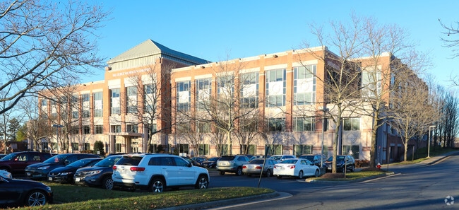
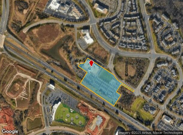
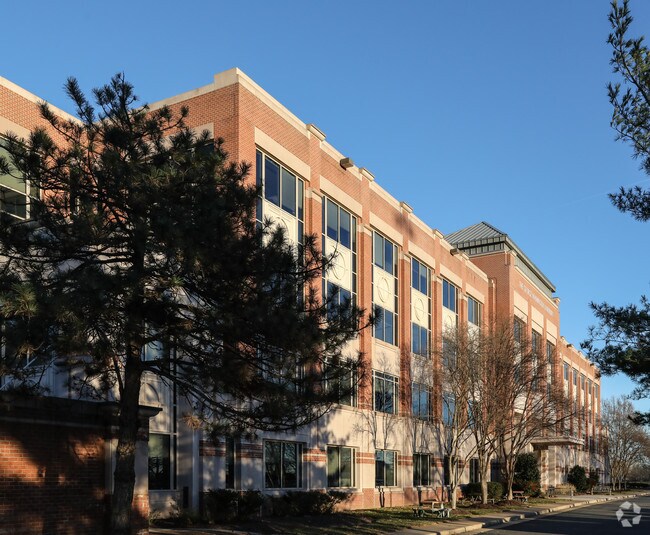
Property Record
44983 Knoll Sq, Ashburn, VA 20147

NEARBY LISTINGS FOR SALE OR LEASE
Property Detail
44983 Knoll Sq
Washington-Arlington-Alexandria, DC-VA-MD-WV
University Ctr Ph.1
039-16-8997
UNIVERSITY CTR PH.1 L.I1A 2111--2270 (4) 1817--1875 VAC ESMT
Publichealthcarefacility
Loudoun
X
Virginia
51107C0265E
i1a
0
10.34 AC
2025
Route 7 Corridor
611002
Washington, DC
204,320 SF
DEMOGRAPHICS near 44983 Knoll Sq
1 Mile
3 Mile
5 Mile
2024 Total Population
10,204
67,279
188,746
2029 Population
11,429
72,816
203,421
Pop Growth 2024-2029
+ 12.01%
+ 8.23%
+ 7.77%
Average Age
38
41
39
2024 Total Households
4,195
26,142
65,487
HH Growth 2024-2029
+ 12.13%
+ 8.55%
+ 8.08%
Median Household Inc
$121,126
$127,972
$141,335
Avg Household Size
2.40
2.50
2.80
2024 Avg HH Vehicles
2.00
2.00
2.00
Median Home Value
$655,399
$654,462
$637,076
Median Year Built
2010
1999
1997
Nearby Places
Map Layers
Map Styles
 Street
 Aerial
- Restaurants
- Banks
- Shops
- Fitness
- Groceries
PUBLIC TRANSPORTATION
AIRPORT
Washington Dulles International
DRIVE
WALK
Distance
Washington Dulles International
21 min
10.5 mi
Ronald Reagan Washington Ntl
DRIVE
WALK
Distance
Ronald Reagan Washington Ntl
51 min
32.1 mi
Freight Ports
Port of Baltimore
DRIVE
WALK
Distance
Port of Baltimore
91 min
64.2 mi
Nearby Properties
Address
Land Use
TOTAL SIZE
Lot Size
Zoning
Address
Land Use
TOTAL SIZE
Lot Size
Zoning
518,449 SF
32.11 AC
IP
Address
Land Use
TOTAL SIZE
Lot Size
Zoning
650,346 SF
PDMUB
Address
Land Use
TOTAL SIZE
Lot Size
Zoning
1,434,706 SF
30.91 AC
PDRDP
Address
Land Use
TOTAL SIZE
Lot Size
Zoning
446,512 SF
25.41 AC
IP
Address
Land Use
TOTAL SIZE
Lot Size
Zoning
672,272 SF
44.53 AC
PDIP
Address
Land Use
TOTAL SIZE
Lot Size
Zoning
679,455 SF
31.97 AC
PDIP
Address
Land Use
TOTAL SIZE
Lot Size
Zoning
2,735,138 SF
123.03 AC
PDAAAR
Address
Land Use
TOTAL SIZE
Lot Size
Zoning
286,865 SF
18.56 AC
IP
Address
Land Use
TOTAL SIZE
Lot Size
Zoning
684,976 SF
85.31 AC
PDOP
Address
Land Use
TOTAL SIZE
Lot Size
Zoning
455,793 SF
22.60 AC
IP
Address
Land Use
TOTAL SIZE
Lot Size
Zoning
362,108 SF
18.82 AC
PDOP
Address
Land Use
TOTAL SIZE
Lot Size
Zoning
154,125 SF
9.68 AC
PDIP
Address
Land Use
TOTAL SIZE
Lot Size
Zoning
169,092 SF
PDMUB
Address
Land Use
TOTAL SIZE
Lot Size
Zoning
109,320 SF
7.20 AC
PDIP
Address
Land Use
TOTAL SIZE
Lot Size
Zoning
1,070,060 SF
197.44 AC
PDRDP
Address
Land Use
TOTAL SIZE
Lot Size
Zoning
685,682 SF
53.96 AC
PDIP
Address
Land Use
TOTAL SIZE
Lot Size
Zoning
123,200 SF
4.74 AC
PDIP
Address
Land Use
TOTAL SIZE
Lot Size
Zoning
405,058 SF
19.88 AC
IP
Address
Land Use
TOTAL SIZE
Lot Size
Zoning
481,791 SF
41.28 AC
PDIP
Address
Land Use
TOTAL SIZE
Lot Size
Zoning
414,268 SF
43.68 AC
R16
Address
Land Use
TOTAL SIZE
Lot Size
Zoning
259,194 SF
10.18 AC
PDIP
Address
Land Use
TOTAL SIZE
Lot Size
Zoning
148,717 SF
PDIP
Address
Land Use
TOTAL SIZE
Lot Size
Zoning
219,514 SF
14.34 AC
PDIP
Address
Land Use
TOTAL SIZE
Lot Size
Zoning
341,831 SF
31.21 AC
PDH6
Address
Land Use
TOTAL SIZE
Lot Size
Zoning
87,560 SF
PDIP
Address
Land Use
TOTAL SIZE
Lot Size
Zoning
446,732 SF
37.94 AC
PDIP
Address
Land Use
TOTAL SIZE
Lot Size
Zoning
119,087 SF
339.95 AC
PDIP
Address
Land Use
TOTAL SIZE
Lot Size
Zoning
429,711 SF
34.74 AC
PDH4
Address
Land Use
TOTAL SIZE
Lot Size
Zoning
426,710 SF
19.50 AC
PDIP
Address
Land Use
TOTAL SIZE
Lot Size
Zoning
274,751 SF
18.87 AC
PDH3
The World's #1 Commercial Real Estate Marketplace
Connect with us
© 2026 CoStar Group
The information above has been obtained from sources believed reliable. While we do not doubt its accuracy we have not verified it and make no guarantee, warranty or representation about it. It is your responsibility to independently confirm its accuracy and completeness. Any projections, opinions, assumptions, or estimates used are for example only and do not represent the current or future performance of the property. The value of this transaction to you depends on tax and other factors which should be evaluated by your tax, financial, and legal advisors. You and your advisors should conduct a careful, independent investigation of the property to determine to your satisfaction the suitability of the property for your needs.