Property Record
450 E Butler Ave, Doylestown, PA 18901
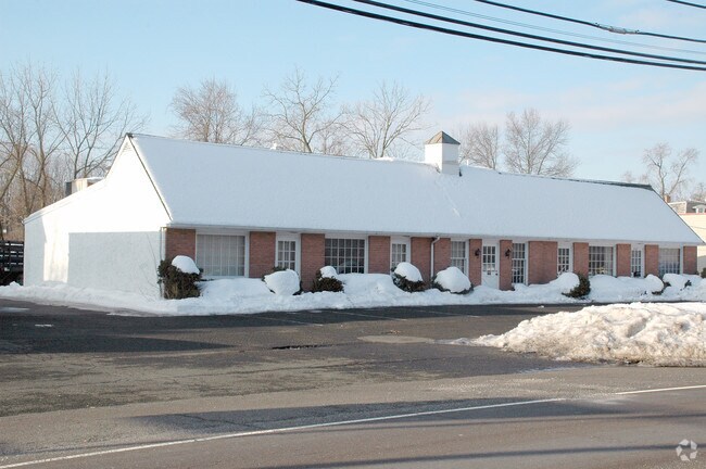


Property Detail
450 E Butler Ave
25-006-018-004
0.895AC.C. SS US202 200 E OF T397 201 ON US202
Storebuilding
BUCKS
C2
Pennsylvania
B and X Area of moderate flood hazard, usually the area between the limits of the 100-year and 500-year floods.
0.90 AC
2025
Upper Bucks County
2026
Philadelphia
104800
Philadelphia-Camden-Wilmington, PA-NJ-DE-MD
8,190 SF
NEARBY LISTINGS FOR SALE OR LEASE
DEMOGRAPHICS near 450 E Butler Ave
1 mile
3 mile
5 mile
2025 Total Population
3,847
42,790
104,569
2030 Population
3,889
43,775
105,813
Pop Growth 2025-2030
+ 1.09%
+ 2.30%
+ 1.19%
Average Age
40
44
43
2025 Total Households
1,283
16,475
38,126
HH Growth 2025-2030
+ 1.09%
+ 2.77%
+ 1.40%
Median Household Inc
$101,993
$117,366
$131,406
Avg Household Size
2.40
2.40
2.60
2025 Avg HH Vehicles
2.00
2.00
2.00
Median Home Value
$439,557
$559,149
$596,829
Median Year Built
1976
1979
1986
Nearby Places
Map Layers
Map Styles
 Street
 Aerial
Layers
 Traffic
 Biking
Places
Listings with unknown addresses are not visible on the map
- Restaurants
- Banks
- Shops
- Fitness
- Groceries
PUBLIC TRANSPORTATION
TRANSIT/SUBWAY
Delaware Valley College (R5 - Southeastern Pennsylvania Transportation Authority Regional Rail (SEPTA Regional Rail))
Drive
Walk
Distance
Delaware Valley College (R5 - Southeastern Pennsylvania Transportation Authority Regional Rail (SEPTA Regional Rail))
2 min
14 min
0.6 mi
New Britain (R5 - Southeastern Pennsylvania Transportation Authority Regional Rail (SEPTA Regional Rail))
Drive
Walk
Distance
New Britain (R5 - Southeastern Pennsylvania Transportation Authority Regional Rail (SEPTA Regional Rail))
2 min
18 min
0.9 mi
COMMUTER RAIL
Delaware Valley College (R5 - Southeastern Pennsylvania Transportation Authority Regional Rail (SEPTA Regional Rail))
Drive
Walk
Distance
Delaware Valley College (R5 - Southeastern Pennsylvania Transportation Authority Regional Rail (SEPTA Regional Rail))
2 min
13 min
0.6 mi
New Britain (R5 - Southeastern Pennsylvania Transportation Authority Regional Rail (SEPTA Regional Rail))
Drive
Walk
Distance
New Britain (R5 - Southeastern Pennsylvania Transportation Authority Regional Rail (SEPTA Regional Rail))
2 min
18 min
0.9 mi
AIRPORT
Trenton Mercer
Drive
Walk
Distance
Trenton Mercer
43 min
24.7 mi
Lehigh Valley International
Drive
Walk
Distance
Lehigh Valley International
62 min
35.3 mi
Philadelphia International
Drive
Walk
Distance
Philadelphia International
69 min
39.6 mi
Freight Ports
Port of Philadelphia
Drive
Walk
Distance
Port of Philadelphia
50 min
28.4 mi
Nearby Properties
Address
Land Use
TOTAL SIZE
Lot Size
Zoning
Address
Land Use
TOTAL SIZE
Lot Size
Zoning
72,937 SF
42.19 AC
CR
Address
Land Use
TOTAL SIZE
Lot Size
Zoning
254,611 SF
22.06 AC
RC
Address
Land Use
TOTAL SIZE
Lot Size
Zoning
261,949 SF
25.38 AC
C2
Address
Land Use
TOTAL SIZE
Lot Size
Zoning
200,220 SF
30.81 AC
C2
Address
Land Use
TOTAL SIZE
Lot Size
Zoning
8,120 SF
56.80 AC
C3
Address
Land Use
TOTAL SIZE
Lot Size
Zoning
30,939 SF
28.69 AC
I
Address
Land Use
TOTAL SIZE
Lot Size
Zoning
30,904 SF
3.32 AC
PI
Address
Land Use
TOTAL SIZE
Lot Size
Zoning
344,604 SF
6.95 AC
LI
Address
Land Use
TOTAL SIZE
Lot Size
Zoning
146,924 SF
17.47 AC
C2
Address
Land Use
TOTAL SIZE
Lot Size
Zoning
90,000 SF
7.25 AC
R2
Address
Land Use
TOTAL SIZE
Lot Size
Zoning
77,630 SF
28.53 AC
R2B
Address
Land Use
TOTAL SIZE
Lot Size
Zoning
91,222 SF
13.75 AC
R2
Address
Land Use
TOTAL SIZE
Lot Size
Zoning
97,496 SF
12.67 AC
R3
Address
Land Use
TOTAL SIZE
Lot Size
Zoning
60,500 SF
5.90 AC
C2
Address
Land Use
TOTAL SIZE
Lot Size
Zoning
230,150 SF
12.10 AC
CR-H
Address
Land Use
TOTAL SIZE
Lot Size
Zoning
77,964 SF
9.79 AC
R3
Address
Land Use
TOTAL SIZE
Lot Size
Zoning
54,090 SF
7.25 AC
R4
Address
Land Use
TOTAL SIZE
Lot Size
Zoning
32,319 SF
7.30 AC
C1
Address
Land Use
TOTAL SIZE
Lot Size
Zoning
114,588 SF
0.82 AC
FC
Address
Land Use
TOTAL SIZE
Lot Size
Zoning
50,049 SF
5.45 AC
PC1
Address
Land Use
TOTAL SIZE
Lot Size
Zoning
16,828 SF
3.28 AC
R2
Address
Land Use
TOTAL SIZE
Lot Size
Zoning
11,159 SF
304.23 AC
Q
Address
Land Use
TOTAL SIZE
Lot Size
Zoning
63,612 SF
0.50 AC
CI
Address
Land Use
TOTAL SIZE
Lot Size
Zoning
24,195 SF
1.50 AC
R2
Address
Land Use
TOTAL SIZE
Lot Size
Zoning
42,587 SF
12.09 AC
R1
Address
Land Use
TOTAL SIZE
Lot Size
Zoning
21,285 SF
118.88 AC
R1
Address
Land Use
TOTAL SIZE
Lot Size
Zoning
63,612 SF
0.52 AC
CI
Address
Land Use
TOTAL SIZE
Lot Size
Zoning
32,298 SF
3.97 AC
R3
Address
Land Use
TOTAL SIZE
Lot Size
Zoning
24,300 SF
3.36 AC
C1
Address
Land Use
TOTAL SIZE
Lot Size
Zoning
25,479 SF
15.35 AC
I
The World's #1 Commercial Real Estate Marketplace
Connect with us
© 2026 CoStar Group
The information above has been obtained from sources believed reliable. While we do not doubt its accuracy we have not verified it and make no guarantee, warranty or representation about it. It is your responsibility to independently confirm its accuracy and completeness. Any projections, opinions, assumptions, or estimates used are for example only and do not represent the current or future performance of the property. The value of this transaction to you depends on tax and other factors which should be evaluated by your tax, financial, and legal advisors. You and your advisors should conduct a careful, independent investigation of the property to determine to your satisfaction the suitability of the property for your needs.