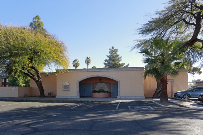
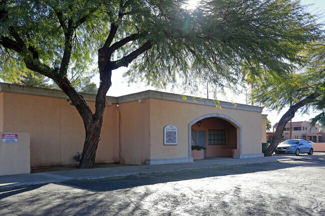
Property Record
4415 E Grant Rd, Tucson, AZ 85712
Current Lease Availabilities
Property Detail
4415 E Grant Rd
Tucson, AZ
NLY PTN N303.58 S363.58 W1290.47 E1947.31 SE4 8.57 AC SEC 34-13-14
110-08-304E
Pima
Apartment
Arizona
2025
8.54 AC
2026
Central Tucson
002901
Tucson
195,945 SF
NEARBY LISTINGS FOR SALE OR LEASE
DEMOGRAPHICS near 4415 E Grant Rd
1 mile
3 mile
5 mile
2025 Total Population
18,206
102,354
282,433
2030 Population
18,737
104,699
289,991
Pop Growth 2025-2030
+ 2.92%
+ 2.29%
+ 2.68%
Average Age
42
42
40
2025 Total Households
8,766
50,928
130,572
HH Growth 2025-2030
+ 3.01%
+ 2.41%
+ 2.81%
Median Household Inc
$43,512
$54,444
$53,295
Avg Household Size
1.90
1.90
2.00
2025 Avg HH Vehicles
1.00
1.00
1.00
Median Home Value
$268,979
$350,712
$336,740
Median Year Built
1970
1970
1974
Nearby Places
Map Layers
Map Styles
 Street
 Aerial
Transit
 Traffic
 Biking
Places
Listings with unknown addresses are not visible on the map
- Restaurants
- Banks
- Shops
- Fitness
- Groceries
PUBLIC TRANSPORTATION
COMMUTER RAIL
Drive
Walk
Distance
14 min
6.0 mi
AIRPORT
Tucson International
Drive
Walk
Distance
Tucson International
21 min
11.8 mi
Nearby Properties
Address
Land Use
TOTAL SIZE
Lot Size
Zoning
Address
Land Use
TOTAL SIZE
Lot Size
Zoning
1,316,364 SF
12.21 AC
Address
Land Use
TOTAL SIZE
Lot Size
Zoning
1,089,840 SF
45.56 AC
Address
Land Use
TOTAL SIZE
Lot Size
Zoning
594,802 SF
62.57 AC
Address
Land Use
TOTAL SIZE
Lot Size
Zoning
226,240 SF
0.33 AC
R2
Address
Land Use
TOTAL SIZE
Lot Size
Zoning
473,573 SF
22.65 AC
C3
Address
Land Use
TOTAL SIZE
Lot Size
Zoning
419,317 SF
7.23 AC
Address
Land Use
TOTAL SIZE
Lot Size
Zoning
141,450 SF
0.14 AC
R1
Address
Land Use
TOTAL SIZE
Lot Size
Zoning
259,645 SF
37.28 AC
R1
Address
Land Use
TOTAL SIZE
Lot Size
Zoning
421,674 SF
8.10 AC
OCR2
Address
Land Use
TOTAL SIZE
Lot Size
Zoning
427,088 SF
19.78 AC
R3
Address
Land Use
TOTAL SIZE
Lot Size
Zoning
137,890 SF
8.28 AC
PAD1
Address
Land Use
TOTAL SIZE
Lot Size
Zoning
435,634 SF
4.29 AC
PAD1
Address
Land Use
TOTAL SIZE
Lot Size
Zoning
174,364 SF
7.36 AC
Address
Land Use
TOTAL SIZE
Lot Size
Zoning
116,558 SF
3.29 AC
R1
Address
Land Use
TOTAL SIZE
Lot Size
Zoning
139,963 SF
19.86 AC
R2
Address
Land Use
TOTAL SIZE
Lot Size
Zoning
295,133 SF
36.29 AC
R1
Address
Land Use
TOTAL SIZE
Lot Size
Zoning
256,775 SF
6.69 AC
C1
Address
Land Use
TOTAL SIZE
Lot Size
Zoning
364,128 SF
11.55 AC
O3
Address
Land Use
TOTAL SIZE
Lot Size
Zoning
230,640 SF
11.99 AC
Address
Land Use
TOTAL SIZE
Lot Size
Zoning
326,189 SF
4.31 AC
O3
Address
Land Use
TOTAL SIZE
Lot Size
Zoning
162,473 SF
6.08 AC
C3
Address
Land Use
TOTAL SIZE
Lot Size
Zoning
74,815 SF
5.05 AC
Address
Land Use
TOTAL SIZE
Lot Size
Zoning
217,152 SF
5.37 AC
PAD1
Address
Land Use
TOTAL SIZE
Lot Size
Zoning
20,802 SF
1.86 AC
MU
Address
Land Use
TOTAL SIZE
Lot Size
Zoning
288,749 SF
21.55 AC
CR2
Address
Land Use
TOTAL SIZE
Lot Size
Zoning
286,164 SF
5.80 AC
C3
Address
Land Use
TOTAL SIZE
Lot Size
Zoning
195,798 SF
12.04 AC
OCR2
Address
Land Use
TOTAL SIZE
Lot Size
Zoning
240,309 SF
14.71 AC
CB1
Address
Land Use
TOTAL SIZE
Lot Size
Zoning
224,883 SF
27.62 AC
Address
Land Use
TOTAL SIZE
Lot Size
Zoning
127,872 SF
2.59 AC
C1
The World's #1 Commercial Real Estate Marketplace
Connect with us
© 2026 CoStar Group
The information above has been obtained from sources believed reliable. While we do not doubt its accuracy we have not verified it and make no guarantee, warranty or representation about it. It is your responsibility to independently confirm its accuracy and completeness. Any projections, opinions, assumptions, or estimates used are for example only and do not represent the current or future performance of the property. The value of this transaction to you depends on tax and other factors which should be evaluated by your tax, financial, and legal advisors. You and your advisors should conduct a careful, independent investigation of the property to determine to your satisfaction the suitability of the property for your needs.