Property Record
4501 N Charles St, Baltimore, MD 21210

NEARBY LISTINGS FOR SALE OR LEASE
Property Detail
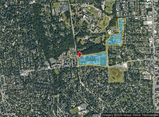
4501 N Charles St
5027-001
30.143 ACRES
Publicschool
Baltimore City
X
Maryland
2400100405G
1
2023
30.14 AC
2025
Radnor-Winston
271101
Baltimore
599,187 SF
Baltimore-Columbia-Towson, MD
DEMOGRAPHICS near 4501 N Charles St
1 Mile
3 Mile
5 Mile
2024 Total Population
21,994
184,473
558,629
2029 Population
20,954
177,441
543,075
Pop Growth 2024-2029
(4.73%)
(3.81%)
(2.78%)
Average Age
38
40
39
2024 Total Households
7,660
77,363
237,198
HH Growth 2024-2029
(5.64%)
(4.12%)
(3.01%)
Median Household Inc
$71,612
$63,687
$58,318
Avg Household Size
2.30
2.20
2.20
2024 Avg HH Vehicles
1.00
1.00
1.00
Median Home Value
$257,780
$241,849
$228,896
Median Year Built
1948
1949
1951
Nearby Places
Map Layers
Map Styles
 Street
 Aerial
- Restaurants
- Banks
- Shops
- Fitness
- Groceries
PUBLIC TRANSPORTATION
COMMUTER RAIL
Penn Station (PENN - WASHINGTON - Maryland Area Regional Commuter Trains (The MARC), Penn Line - Maryland Area Regional Commuter Trains (The MARC), Penn Station & Camden Yards - Maryland Area Regional Commuter Trains (The MARC))
DRIVE
WALK
Distance
Penn Station (PENN - WASHINGTON - Maryland Area Regional Commuter Trains (The MARC), Penn Line - Maryland Area Regional Commuter Trains (The MARC), Penn Station & Camden Yards - Maryland Area Regional Commuter Trains (The MARC))
8 min
3.0 mi
West Baltimore (PENN - WASHINGTON - Maryland Area Regional Commuter Trains (The MARC), Penn Line - Maryland Area Regional Commuter Trains (The MARC))
DRIVE
WALK
Distance
West Baltimore (PENN - WASHINGTON - Maryland Area Regional Commuter Trains (The MARC), Penn Line - Maryland Area Regional Commuter Trains (The MARC))
15 min
5.9 mi
AIRPORT
Baltimore/Washington International Thurgood Marshall
DRIVE
WALK
Distance
Baltimore/Washington International Thurgood Marshall
29 min
14.5 mi
Freight Ports
Port of Baltimore
DRIVE
WALK
Distance
Port of Baltimore
20 min
6.8 mi
Nearby Properties
Address
Land Use
TOTAL SIZE
Lot Size
Zoning
Address
Land Use
TOTAL SIZE
Lot Size
Zoning
1,632,000 SF
106.32 AC
EC-2
Address
Land Use
TOTAL SIZE
Lot Size
Zoning
21,312 SF
54.36 AC
EC-2
Address
Land Use
TOTAL SIZE
Lot Size
Zoning
810,716 SF
28.88 AC
H
Address
Land Use
TOTAL SIZE
Lot Size
Zoning
1,228,117 SF
9.43 AC
C-2
Address
Land Use
TOTAL SIZE
Lot Size
Zoning
24,993 SF
66.85 AC
EC-2
Address
Land Use
TOTAL SIZE
Lot Size
Zoning
189,700 SF
0.71 AC
TOD-4
Address
Land Use
TOTAL SIZE
Lot Size
Zoning
316,273 SF
25.90 AC
H
Address
Land Use
TOTAL SIZE
Lot Size
Zoning
743.89 AC
OS
Address
Land Use
TOTAL SIZE
Lot Size
Zoning
23.09 AC
DR16
Address
Land Use
TOTAL SIZE
Lot Size
Zoning
372,287 SF
0.98 AC
R-10
Address
Land Use
TOTAL SIZE
Lot Size
Zoning
140,000 SF
9.11 AC
EC-2
Address
Land Use
TOTAL SIZE
Lot Size
Zoning
567,521 SF
8.12 AC
R-9
Address
Land Use
TOTAL SIZE
Lot Size
Zoning
5.03 AC
R-10
Address
Land Use
TOTAL SIZE
Lot Size
Zoning
320,000 SF
4.56 AC
TOD-4
Address
Land Use
TOTAL SIZE
Lot Size
Zoning
230,316 SF
9.93 AC
DR2
Address
Land Use
TOTAL SIZE
Lot Size
Zoning
543,281 SF
7.28 AC
C-2
Address
Land Use
TOTAL SIZE
Lot Size
Zoning
366,234 SF
1.12 AC
R-10
Address
Land Use
TOTAL SIZE
Lot Size
Zoning
117,000 SF
71.11 AC
EC-2
Address
Land Use
TOTAL SIZE
Lot Size
Zoning
430,271 SF
56.35 AC
EC-2
Address
Land Use
TOTAL SIZE
Lot Size
Zoning
3.01 AC
EC-2
Address
Land Use
TOTAL SIZE
Lot Size
Zoning
507,813 SF
4.94 AC
TOD-2
Address
Land Use
TOTAL SIZE
Lot Size
Zoning
457,289 SF
29.52 AC
TOD-2
Address
Land Use
TOTAL SIZE
Lot Size
Zoning
211,229 SF
7.46 AC
R-9
Address
Land Use
TOTAL SIZE
Lot Size
Zoning
33.46 AC
DR16
Address
Land Use
TOTAL SIZE
Lot Size
Zoning
158,600 SF
1.50 AC
TOD-4
Address
Land Use
TOTAL SIZE
Lot Size
Zoning
578,808 SF
30.10 AC
Address
Land Use
TOTAL SIZE
Lot Size
Zoning
367,920 SF
2.87 AC
R-9
Address
Land Use
TOTAL SIZE
Lot Size
Zoning
0.01 AC
R-3
Address
Land Use
TOTAL SIZE
Lot Size
Zoning
54.25 AC
EC-1
The World's #1 Commercial Real Estate Marketplace
Connect with us
© 2025 CoStar Group
The information above has been obtained from sources believed reliable. While we do not doubt its accuracy we have not verified it and make no guarantee, warranty or representation about it. It is your responsibility to independently confirm its accuracy and completeness. Any projections, opinions, assumptions, or estimates used are for example only and do not represent the current or future performance of the property. The value of this transaction to you depends on tax and other factors which should be evaluated by your tax, financial, and legal advisors. You and your advisors should conduct a careful, independent investigation of the property to determine to your satisfaction the suitability of the property for your needs.