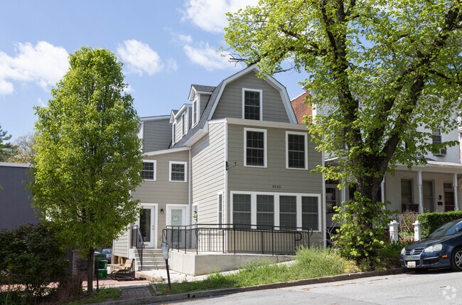
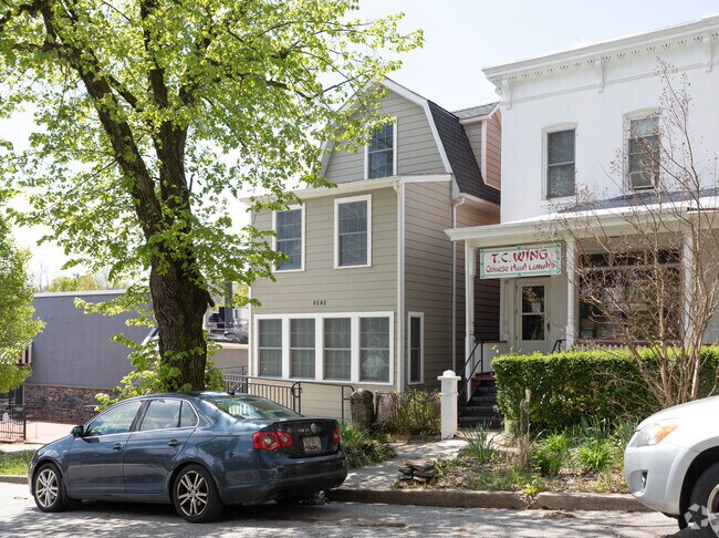
Property Record
4502 Schenley Rd, Baltimore, MD 21210

Property Detail
4502 Schenley Rd
4946-002
25X148-5
Officebuilding
Baltimore City
C-1VC
Maryland
B and X Area of moderate flood hazard, usually the area between the limits of the 100-year and 500-year floods.
2
2024
0.09 AC
2025
Baltimore Northwest
271400
Baltimore
2,520 SF
Baltimore-Columbia-Towson, MD
NEARBY LISTINGS FOR SALE OR LEASE
DEMOGRAPHICS near 4502 Schenley Rd
1 mile
3 mile
5 mile
2025 Total Population
21,142
209,086
563,297
2030 Population
20,529
206,664
559,525
Pop Growth 2025-2030
(2.90%)
(1.16%)
(0.67%)
Average Age
39
40
40
2025 Total Households
9,124
88,765
240,188
HH Growth 2025-2030
(3.15%)
(1.38%)
(0.80%)
Median Household Inc
$96,088
$63,965
$63,242
Avg Household Size
1.90
2.20
2.20
2025 Avg HH Vehicles
1.00
1.00
1.00
Median Home Value
$364,814
$272,815
$265,338
Median Year Built
1949
1948
1951
Nearby Places
Map Layers
Map Styles
 Street
 Aerial
Layers
 Traffic
 Biking
Places
Listings with unknown addresses are not visible on the map
- Restaurants
- Banks
- Shops
- Fitness
- Groceries
PUBLIC TRANSPORTATION
COMMUTER RAIL
Penn Station (Penn Line - Maryland Area Regional Commuter Trains (The MARC))
Drive
Walk
Distance
Penn Station (Penn Line - Maryland Area Regional Commuter Trains (The MARC))
9 min
3.1 mi
Drive
Walk
Distance
14 min
6.2 mi
AIRPORT
Baltimore/Washington International Thurgood Marshall
Drive
Walk
Distance
Baltimore/Washington International Thurgood Marshall
29 min
16.5 mi
Ronald Reagan Washington Ntl
Drive
Walk
Distance
Ronald Reagan Washington Ntl
76 min
48.8 mi
Freight Ports
Port of Baltimore
Drive
Walk
Distance
Port of Baltimore
13 min
6.4 mi
SALE & LEASE HISTORY
LISTING DATE
SALE/LEASE

May 01, 2024
For Lease
Jan 28, 2024
For Lease
Nearby Properties
Address
Land Use
TOTAL SIZE
Lot Size
Zoning
Address
Land Use
TOTAL SIZE
Lot Size
Zoning
1,632,000 SF
106.32 AC
EC-2
Address
Land Use
TOTAL SIZE
Lot Size
Zoning
21,312 SF
54.36 AC
EC-2
Address
Land Use
TOTAL SIZE
Lot Size
Zoning
810,716 SF
28.88 AC
H
Address
Land Use
TOTAL SIZE
Lot Size
Zoning
1,228,117 SF
9.43 AC
C-2
Address
Land Use
TOTAL SIZE
Lot Size
Zoning
256,816 SF
1.27 AC
EC-2
Address
Land Use
TOTAL SIZE
Lot Size
Zoning
24,993 SF
66.85 AC
EC-2
Address
Land Use
TOTAL SIZE
Lot Size
Zoning
599,187 SF
30.14 AC
EC-2
Address
Land Use
TOTAL SIZE
Lot Size
Zoning
189,700 SF
0.71 AC
TOD-4
Address
Land Use
TOTAL SIZE
Lot Size
Zoning
316,273 SF
25.90 AC
H
Address
Land Use
TOTAL SIZE
Lot Size
Zoning
743.89 AC
OS
Address
Land Use
TOTAL SIZE
Lot Size
Zoning
23.09 AC
DR16
Address
Land Use
TOTAL SIZE
Lot Size
Zoning
372,287 SF
0.98 AC
R-10
Address
Land Use
TOTAL SIZE
Lot Size
Zoning
140,000 SF
9.11 AC
EC-2
Address
Land Use
TOTAL SIZE
Lot Size
Zoning
567,521 SF
8.12 AC
R-9
Address
Land Use
TOTAL SIZE
Lot Size
Zoning
5.03 AC
R-10
Address
Land Use
TOTAL SIZE
Lot Size
Zoning
320,000 SF
4.56 AC
TOD-4
Address
Land Use
TOTAL SIZE
Lot Size
Zoning
543,281 SF
7.28 AC
C-2
Address
Land Use
TOTAL SIZE
Lot Size
Zoning
366,234 SF
1.12 AC
R-10
Address
Land Use
TOTAL SIZE
Lot Size
Zoning
117,000 SF
71.11 AC
EC-2
Address
Land Use
TOTAL SIZE
Lot Size
Zoning
430,271 SF
56.35 AC
EC-2
Address
Land Use
TOTAL SIZE
Lot Size
Zoning
3.01 AC
EC-2
Address
Land Use
TOTAL SIZE
Lot Size
Zoning
507,813 SF
4.94 AC
TOD-2
Address
Land Use
TOTAL SIZE
Lot Size
Zoning
457,289 SF
29.52 AC
TOD-2
Address
Land Use
TOTAL SIZE
Lot Size
Zoning
211,229 SF
7.46 AC
R-9
Address
Land Use
TOTAL SIZE
Lot Size
Zoning
33.46 AC
DR16
Address
Land Use
TOTAL SIZE
Lot Size
Zoning
158,600 SF
1.50 AC
TOD-4
Address
Land Use
TOTAL SIZE
Lot Size
Zoning
27.30 AC
DR16
Address
Land Use
TOTAL SIZE
Lot Size
Zoning
367,920 SF
2.87 AC
R-9
Address
Land Use
TOTAL SIZE
Lot Size
Zoning
0.01 AC
R-3
Address
Land Use
TOTAL SIZE
Lot Size
Zoning
54.25 AC
EC-1
The World's #1 Commercial Real Estate Marketplace
Connect with us
© 2026 CoStar Group
The information above has been obtained from sources believed reliable. While we do not doubt its accuracy we have not verified it and make no guarantee, warranty or representation about it. It is your responsibility to independently confirm its accuracy and completeness. Any projections, opinions, assumptions, or estimates used are for example only and do not represent the current or future performance of the property. The value of this transaction to you depends on tax and other factors which should be evaluated by your tax, financial, and legal advisors. You and your advisors should conduct a careful, independent investigation of the property to determine to your satisfaction the suitability of the property for your needs.