Property Record
451 High St, Burlington, NJ 08016


Save to a Folder
{{folder.Name}}
{{folder.ListingIds.length}} Properties
{{folder.ListingIds.length}} Property
Create a New Folder
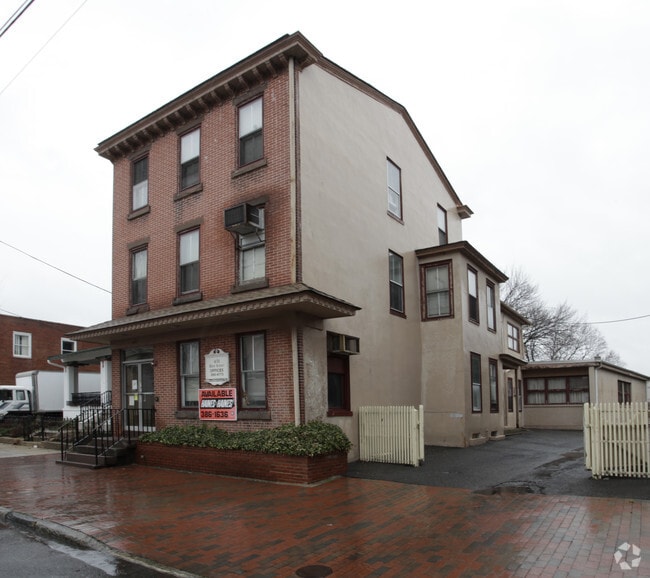
Property Detail
451 High St
Philadelphia-Camden-Wilmington, PA-NJ-DE-MD
FACILITY NAME: HISTORIC SITE
05-00137-0000-00056
Burlington
Governmentalpublicusegeneral
New Jersey
TC-1
56
AE The base floodplain where base flood elevations are provided. AE Zones are now used on new format FIRMs instead of A1-A30 Zones.
0.17 AC
0
North Burlington County
2026
Philadelphia
701204
NEARBY LISTINGS FOR SALE OR LEASE
DEMOGRAPHICS near 451 High St
1 mile
3 mile
5 mile
2025 Total Population
10,185
72,591
171,852
2030 Population
10,574
73,962
174,661
Pop Growth 2025-2030
+ 3.82%
+ 1.89%
+ 1.63%
Average Age
41
41
42
2025 Total Households
4,136
27,167
64,698
HH Growth 2025-2030
+ 3.84%
+ 1.90%
+ 1.66%
Median Household Inc
$76,782
$82,691
$88,000
Avg Household Size
2.40
2.60
2.60
2025 Avg HH Vehicles
2.00
2.00
2.00
Median Home Value
$259,958
$293,242
$306,461
Median Year Built
1950
1961
1965
Nearby Places
Map Layers
Map Styles
 Street
 Aerial
Layers
 Traffic
 Biking
Places
Listings with unknown addresses are not visible on the map
- Restaurants
- Banks
- Shops
- Fitness
- Groceries
PUBLIC TRANSPORTATION
TRANSIT/SUBWAY
Burlington Towne Center (River LINE - River LINE (River LINE))
Drive
Walk
Distance
Burlington Towne Center (River LINE - River LINE (River LINE))
0 min
3 min
0.2 mi
COMMUTER RAIL
Bristol (R7 - Southeastern Pennsylvania Transportation Authority Regional Rail (SEPTA Regional Rail))
Drive
Walk
Distance
Bristol (R7 - Southeastern Pennsylvania Transportation Authority Regional Rail (SEPTA Regional Rail))
9 min
3.7 mi
Croydon (R7 - Southeastern Pennsylvania Transportation Authority Regional Rail (SEPTA Regional Rail))
Drive
Walk
Distance
Croydon (R7 - Southeastern Pennsylvania Transportation Authority Regional Rail (SEPTA Regional Rail))
9 min
4.2 mi
AIRPORT
Trenton Mercer
Drive
Walk
Distance
Trenton Mercer
31 min
18.4 mi
Philadelphia International
Drive
Walk
Distance
Philadelphia International
47 min
32.2 mi
Freight Ports
Port of Philadelphia
Drive
Walk
Distance
Port of Philadelphia
28 min
16.7 mi
Nearby Properties
Address
Land Use
TOTAL SIZE
Lot Size
Zoning
Address
Land Use
TOTAL SIZE
Lot Size
Zoning
2,614 SF
55.41 AC
R40
Address
Land Use
TOTAL SIZE
Lot Size
Zoning
23,591 SF
72.69 AC
I-1
Address
Land Use
TOTAL SIZE
Lot Size
Zoning
Address
Land Use
TOTAL SIZE
Lot Size
Zoning
22,300 SF
59.13 AC
Address
Land Use
TOTAL SIZE
Lot Size
Zoning
Address
Land Use
TOTAL SIZE
Lot Size
Zoning
14.48 AC
Address
Land Use
TOTAL SIZE
Lot Size
Zoning
21,642 SF
55.15 AC
I-2
Address
Land Use
TOTAL SIZE
Lot Size
Zoning
26.12 AC
B-2
Address
Land Use
TOTAL SIZE
Lot Size
Zoning
77.35 AC
I-2
Address
Land Use
TOTAL SIZE
Lot Size
Zoning
2,019 SF
28.85 AC
I-2
Address
Land Use
TOTAL SIZE
Lot Size
Zoning
58.39 AC
B-2
Address
Land Use
TOTAL SIZE
Lot Size
Zoning
22,688 SF
32.55 AC
BLI1
Address
Land Use
TOTAL SIZE
Lot Size
Zoning
46.66 AC
I-1
Address
Land Use
TOTAL SIZE
Lot Size
Zoning
35.90 AC
R-40
Address
Land Use
TOTAL SIZE
Lot Size
Zoning
Address
Land Use
TOTAL SIZE
Lot Size
Zoning
29.76 AC
R-40
Address
Land Use
TOTAL SIZE
Lot Size
Zoning
18.15 AC
I-2
Address
Land Use
TOTAL SIZE
Lot Size
Zoning
Address
Land Use
TOTAL SIZE
Lot Size
Zoning
18.77 AC
Address
Land Use
TOTAL SIZE
Lot Size
Zoning
376 SF
32.32 AC
B-3
Address
Land Use
TOTAL SIZE
Lot Size
Zoning
19,188 SF
29.52 AC
Address
Land Use
TOTAL SIZE
Lot Size
Zoning
23.38 AC
Address
Land Use
TOTAL SIZE
Lot Size
Zoning
37.98 AC
I-2
Address
Land Use
TOTAL SIZE
Lot Size
Zoning
16.23 AC
R-3
Address
Land Use
TOTAL SIZE
Lot Size
Zoning
308 SF
24.29 AC
BLI1
Address
Land Use
TOTAL SIZE
Lot Size
Zoning
253,500 SF
24.28 AC
BLI1
Address
Land Use
TOTAL SIZE
Lot Size
Zoning
23.14 AC
I-2
Address
Land Use
TOTAL SIZE
Lot Size
Zoning
1,325 SF
18.73 AC
Address
Land Use
TOTAL SIZE
Lot Size
Zoning
217,986 SF
39.89 AC
I-1
Address
Land Use
TOTAL SIZE
Lot Size
Zoning
9.65 AC
The World's #1 Commercial Real Estate Marketplace
Connect with us
© 2026 CoStar Group
The information above has been obtained from sources believed reliable. While we do not doubt its accuracy we have not verified it and make no guarantee, warranty or representation about it. It is your responsibility to independently confirm its accuracy and completeness. Any projections, opinions, assumptions, or estimates used are for example only and do not represent the current or future performance of the property. The value of this transaction to you depends on tax and other factors which should be evaluated by your tax, financial, and legal advisors. You and your advisors should conduct a careful, independent investigation of the property to determine to your satisfaction the suitability of the property for your needs.