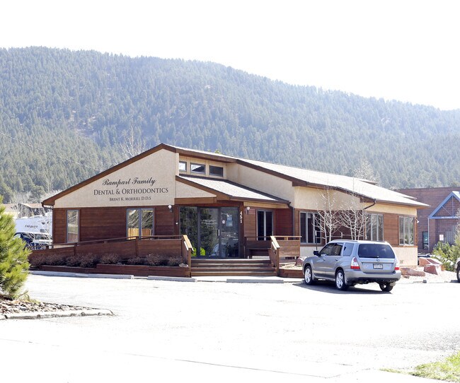
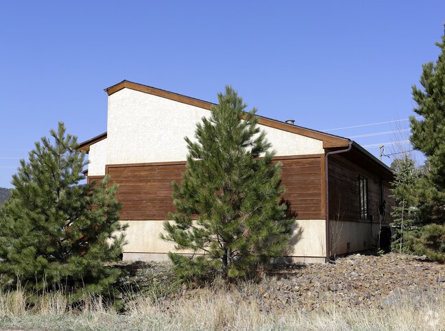
Property Record
451 Rampart Range Rd, Woodland Park, CO 80863
NEARBY LISTINGS FOR SALE OR LEASE
Property Detail
451 Rampart Range Rd
R0000812
Forest Edge Pk
Miscellaneous
L4 B2 ASPENWOOD SUBDIVISION
X
Teller
08041C0475G
Colorado
2024
0.16 AC
2024
Teller County
010107
Colorado Springs
2,192 SF
Colorado Springs, CO
DEMOGRAPHICS near 451 Rampart Range Rd
1 Mile
3 Mile
5 Mile
2024 Total Population
4,616
10,869
12,986
2029 Population
4,701
11,058
13,245
Pop Growth 2024-2029
+ 1.84%
+ 1.74%
+ 1.99%
Average Age
45
45
46
2024 Total Households
1,956
4,523
5,416
HH Growth 2024-2029
+ 1.89%
+ 1.77%
+ 2.01%
Median Household Inc
$73,695
$83,384
$82,268
Avg Household Size
2.30
2.40
2.30
2024 Avg HH Vehicles
2.00
2.00
2.00
Median Home Value
$376,977
$435,350
$429,490
Median Year Built
1984
1987
1985
Nearby Places
Map Layers
Map Styles
 Street
 Aerial
- Restaurants
- Banks
- Shops
- Fitness
- Groceries
PUBLIC TRANSPORTATION
AIRPORT
City of Colorado Springs Municipal
DRIVE
WALK
Distance
City of Colorado Springs Municipal
49 min
29.0 mi
Freight Ports
Tulsa Port Of Catoosa
DRIVE
WALK
Distance
Tulsa Port Of Catoosa
772 min
713.1 mi
Nearby Properties
Address
Land Use
TOTAL SIZE
Lot Size
Zoning
Address
Land Use
TOTAL SIZE
Lot Size
Zoning
41,542 SF
145.43 AC
Address
Land Use
TOTAL SIZE
Lot Size
Zoning
161,632 SF
19.24 AC
A1
Address
Land Use
TOTAL SIZE
Lot Size
Zoning
54,600 SF
6.70 AC
WP
Address
Land Use
TOTAL SIZE
Lot Size
Zoning
15,414 SF
1.76 AC
WP
Address
Land Use
TOTAL SIZE
Lot Size
Zoning
26,664 SF
9.24 AC
MHP
Address
Land Use
TOTAL SIZE
Lot Size
Zoning
29,161 SF
2.04 AC
Address
Land Use
TOTAL SIZE
Lot Size
Zoning
32,146 SF
2.06 AC
Address
Land Use
TOTAL SIZE
Lot Size
Zoning
8,645 SF
3.09 AC
WP
Address
Land Use
TOTAL SIZE
Lot Size
Zoning
13,221 SF
1.53 AC
Address
Land Use
TOTAL SIZE
Lot Size
Zoning
26,268 SF
1.73 AC
Address
Land Use
TOTAL SIZE
Lot Size
Zoning
16,458 SF
16.04 AC
A1
Address
Land Use
TOTAL SIZE
Lot Size
Zoning
35,209 SF
6.04 AC
WP
Address
Land Use
TOTAL SIZE
Lot Size
Zoning
23,892 SF
5.41 AC
R1SR
Address
Land Use
TOTAL SIZE
Lot Size
Zoning
21,970 SF
5.24 AC
Address
Land Use
TOTAL SIZE
Lot Size
Zoning
33,680 SF
1.30 AC
WP
Address
Land Use
TOTAL SIZE
Lot Size
Zoning
16,200 SF
2.10 AC
WP
Address
Land Use
TOTAL SIZE
Lot Size
Zoning
8,520 SF
1.36 AC
WPCC
Address
Land Use
TOTAL SIZE
Lot Size
Zoning
5,041 SF
2.49 AC
WP
Address
Land Use
TOTAL SIZE
Lot Size
Zoning
32,400 SF
7 AC
A1HSCLI
Address
Land Use
TOTAL SIZE
Lot Size
Zoning
18,112 SF
6.33 AC
WP
Address
Land Use
TOTAL SIZE
Lot Size
Zoning
23,056 SF
2.46 AC
Address
Land Use
TOTAL SIZE
Lot Size
Zoning
12,839 SF
5.94 AC
WP
Address
Land Use
TOTAL SIZE
Lot Size
Zoning
1,192 SF
1.60 AC
C1
Address
Land Use
TOTAL SIZE
Lot Size
Zoning
9,982 SF
1.12 AC
WP
Address
Land Use
TOTAL SIZE
Lot Size
Zoning
1,480 SF
40 AC
A-5
Address
Land Use
TOTAL SIZE
Lot Size
Zoning
8,798 SF
4.88 AC
WPPUD
Address
Land Use
TOTAL SIZE
Lot Size
Zoning
76.58 AC
Address
Land Use
TOTAL SIZE
Lot Size
Zoning
14,171 SF
1.37 AC
WP
Address
Land Use
TOTAL SIZE
Lot Size
Zoning
1,032 SF
40 AC
A-5
Address
Land Use
TOTAL SIZE
Lot Size
Zoning
5,227 SF
0.92 AC
A1
The World's #1 Commercial Real Estate Marketplace
Connect with us
© 2026 CoStar Group
The information above has been obtained from sources believed reliable. While we do not doubt its accuracy we have not verified it and make no guarantee, warranty or representation about it. It is your responsibility to independently confirm its accuracy and completeness. Any projections, opinions, assumptions, or estimates used are for example only and do not represent the current or future performance of the property. The value of this transaction to you depends on tax and other factors which should be evaluated by your tax, financial, and legal advisors. You and your advisors should conduct a careful, independent investigation of the property to determine to your satisfaction the suitability of the property for your needs.