Property Record
4511 S Columbia St, Chapel Hill, NC 27517

NEARBY LISTINGS FOR SALE OR LEASE
-
-
View all Chapel Hill listings for sale on LoopNet.com
Property Detail
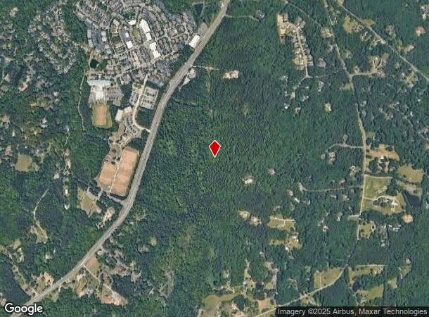
4511 S Columbia St
Durham-Chapel Hill, NC
Obey Creek
9787130667
1 OBEY CREEK P114/7
Vacantlandnec
Orange
AE
North Carolina
3710978700K
30.05 AC
0
Orange County
2025
Raleigh/Durham
012201
DEMOGRAPHICS near 4511 S Columbia St
1 Mile
3 Mile
5 Mile
2024 Total Population
3,671
45,108
89,126
2029 Population
3,367
43,813
87,422
Pop Growth 2024-2029
(8.28%)
(2.87%)
(1.91%)
Average Age
40
35
38
2024 Total Households
1,444
16,032
34,572
HH Growth 2024-2029
(8.59%)
(3.19%)
(2.03%)
Median Household Inc
$158,333
$78,224
$87,199
Avg Household Size
2.50
2.20
2.20
2024 Avg HH Vehicles
2.00
2.00
2.00
Median Home Value
$561,900
$493,726
$476,178
Median Year Built
1994
1990
1989
Nearby Places
Map Layers
Map Styles
 Street
 Aerial
- Restaurants
- Banks
- Shops
- Fitness
- Groceries
PUBLIC TRANSPORTATION
AIRPORT
Raleigh-Durham International
DRIVE
WALK
Distance
Raleigh-Durham International
32 min
19.9 mi
Freight Ports
Port of Wilmington
DRIVE
WALK
Distance
Port of Wilmington
192 min
164.0 mi
Nearby Properties
Address
Land Use
TOTAL SIZE
Lot Size
Zoning
Address
Land Use
TOTAL SIZE
Lot Size
Zoning
264,710 SF
32.50 AC
R1
Address
Land Use
TOTAL SIZE
Lot Size
Zoning
81,191 SF
12.33 AC
OI4
Address
Land Use
TOTAL SIZE
Lot Size
Zoning
5,540 SF
90.09 AC
R-1
Address
Land Use
TOTAL SIZE
Lot Size
Zoning
54,220 SF
41.04 AC
R-1
Address
Land Use
TOTAL SIZE
Lot Size
Zoning
119,585 SF
62.30 AC
Address
Land Use
TOTAL SIZE
Lot Size
Zoning
26,328 SF
13.86 AC
OR3
Address
Land Use
TOTAL SIZE
Lot Size
Zoning
361,420 SF
1.68 AC
Address
Land Use
TOTAL SIZE
Lot Size
Zoning
24,820 SF
1 AC
Address
Land Use
TOTAL SIZE
Lot Size
Zoning
143,750 SF
1.32 AC
OI3OI4
Address
Land Use
TOTAL SIZE
Lot Size
Zoning
174,922 SF
4.59 AC
OI4
Address
Land Use
TOTAL SIZE
Lot Size
Zoning
9,057 SF
19.69 AC
R-1
Address
Land Use
TOTAL SIZE
Lot Size
Zoning
15,916 SF
46.02 AC
R10RSIR
Address
Land Use
TOTAL SIZE
Lot Size
Zoning
38,514 SF
25.11 AC
R-1
Address
Land Use
TOTAL SIZE
Lot Size
Zoning
22,328 SF
19.48 AC
Address
Land Use
TOTAL SIZE
Lot Size
Zoning
27,537 SF
7.33 AC
R-1
Address
Land Use
TOTAL SIZE
Lot Size
Zoning
82,064 SF
1.41 AC
Address
Land Use
TOTAL SIZE
Lot Size
Zoning
45,320 SF
0.66 AC
TC1TC2
Address
Land Use
TOTAL SIZE
Lot Size
Zoning
71,856 SF
20.37 AC
R10R3
Address
Land Use
TOTAL SIZE
Lot Size
Zoning
12,014 SF
10.38 AC
R75
Address
Land Use
TOTAL SIZE
Lot Size
Zoning
48,690 SF
15.69 AC
OR3R75
Address
Land Use
TOTAL SIZE
Lot Size
Zoning
35,988 SF
14.52 AC
R75
Address
Land Use
TOTAL SIZE
Lot Size
Zoning
86,478 SF
8.60 AC
B1CCT
Address
Land Use
TOTAL SIZE
Lot Size
Zoning
18,410 SF
9.81 AC
Address
Land Use
TOTAL SIZE
Lot Size
Zoning
10,764 SF
8.64 AC
M1R75
Address
Land Use
TOTAL SIZE
Lot Size
Zoning
32,268 SF
1.55 AC
OI3OI4
Address
Land Use
TOTAL SIZE
Lot Size
Zoning
57,600 SF
8 AC
R10RSIR
Address
Land Use
TOTAL SIZE
Lot Size
Zoning
54,661 SF
7.89 AC
R3
Address
Land Use
TOTAL SIZE
Lot Size
Zoning
70,518 SF
13.24 AC
OARSIR
Address
Land Use
TOTAL SIZE
Lot Size
Zoning
55,915 SF
20.81 AC
R10R75
Address
Land Use
TOTAL SIZE
Lot Size
Zoning
60,136 SF
11.05 AC
OI4
The World's #1 Commercial Real Estate Marketplace
Connect with us
© 2025 CoStar Group
The information above has been obtained from sources believed reliable. While we do not doubt its accuracy we have not verified it and make no guarantee, warranty or representation about it. It is your responsibility to independently confirm its accuracy and completeness. Any projections, opinions, assumptions, or estimates used are for example only and do not represent the current or future performance of the property. The value of this transaction to you depends on tax and other factors which should be evaluated by your tax, financial, and legal advisors. You and your advisors should conduct a careful, independent investigation of the property to determine to your satisfaction the suitability of the property for your needs.