Property Record
4515 Ross Rd, Sebastopol, CA 95472


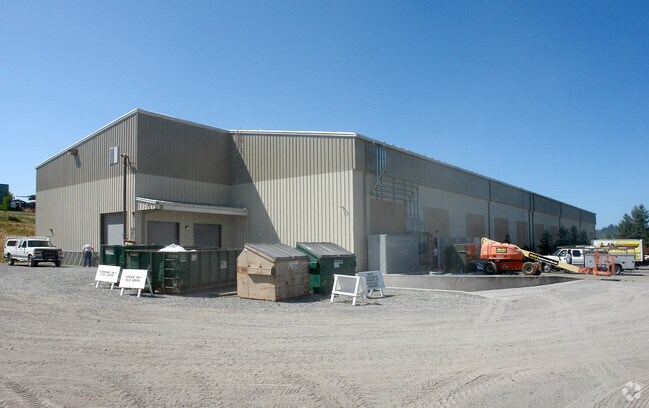
Property Detail
4515 Ross Rd
130-080-066
75 FORM 130-080-60 C/W 61 62 & 63 PER M/D
Lightindustrial
Sonoma
LCF2
California
A Areas with a 1% annual chance of flooding and a 26% chance of flooding over the life of a 30-year mortgage.
6
2025
8.55 AC
2025
Sebastopol/Bodega
153712
North Bay/Santa Rosa
20,296 SF
Santa Rosa-Petaluma, CA
NEARBY LISTINGS FOR SALE OR LEASE
DEMOGRAPHICS near 4515 Ross Rd
1 mile
3 mile
5 mile
2025 Total Population
984
6,764
22,479
2030 Population
916
6,380
21,583
Pop Growth 2025-2030
(6.91%)
(5.68%)
(3.99%)
Average Age
51
49
48
2025 Total Households
416
2,746
9,431
HH Growth 2025-2030
(6.97%)
(5.75%)
(3.92%)
Median Household Inc
$83,967
$122,050
$111,131
Avg Household Size
2.30
2.40
2.30
2025 Avg HH Vehicles
2.00
2.00
2.00
Median Home Value
$916,015
$925,955
$891,469
Median Year Built
1965
1968
1970
Nearby Places
Map Layers
Map Styles
 Street
 Aerial
Layers
 Traffic
 Biking
Places
Listings with unknown addresses are not visible on the map
- Restaurants
- Banks
- Shops
- Fitness
- Groceries
PUBLIC TRANSPORTATION
COMMUTER RAIL
Drive
Walk
Distance
17 min
8.4 mi
AIRPORT
Charles M Schulz - Sonoma County
Drive
Walk
Distance
Charles M Schulz - Sonoma County
24 min
10.1 mi
Freight Ports
Port of Richmond
Drive
Walk
Distance
Port of Richmond
75 min
53.9 mi
Nearby Properties
Address
Land Use
TOTAL SIZE
Lot Size
Zoning
Address
Land Use
TOTAL SIZE
Lot Size
Zoning
30.04 AC
Address
Land Use
TOTAL SIZE
Lot Size
Zoning
22,517 SF
12.51 AC
DA20
Address
Land Use
TOTAL SIZE
Lot Size
Zoning
4,464 SF
19.16 AC
DA20
Address
Land Use
TOTAL SIZE
Lot Size
Zoning
14,962 SF
20.02 AC
Address
Land Use
TOTAL SIZE
Lot Size
Zoning
26,734 SF
9.55 AC
Address
Land Use
TOTAL SIZE
Lot Size
Zoning
360 SF
14 AC
RRD160
Address
Land Use
TOTAL SIZE
Lot Size
Zoning
9.97 AC
Address
Land Use
TOTAL SIZE
Lot Size
Zoning
3,672 SF
16.30 AC
LIA40
Address
Land Use
TOTAL SIZE
Lot Size
Zoning
2,800 SF
262.94 AC
LEAB7FRZN
Address
Land Use
TOTAL SIZE
Lot Size
Zoning
93,969 SF
76.04 AC
Address
Land Use
TOTAL SIZE
Lot Size
Zoning
13,883 SF
4 AC
Address
Land Use
TOTAL SIZE
Lot Size
Zoning
43.67 AC
Address
Land Use
TOTAL SIZE
Lot Size
Zoning
18.05 AC
DA40
Address
Land Use
TOTAL SIZE
Lot Size
Zoning
2,238 SF
3.50 AC
Address
Land Use
TOTAL SIZE
Lot Size
Zoning
5,400 SF
56.30 AC
DA20
Address
Land Use
TOTAL SIZE
Lot Size
Zoning
43,968 SF
9.67 AC
Address
Land Use
TOTAL SIZE
Lot Size
Zoning
1,040 SF
55.57 AC
DA20
Address
Land Use
TOTAL SIZE
Lot Size
Zoning
2,883 SF
17.42 AC
DA10
Address
Land Use
TOTAL SIZE
Lot Size
Zoning
3,050 SF
6.69 AC
Address
Land Use
TOTAL SIZE
Lot Size
Zoning
4,603 SF
10.61 AC
Address
Land Use
TOTAL SIZE
Lot Size
Zoning
1,032 SF
20.47 AC
DA10
Address
Land Use
TOTAL SIZE
Lot Size
Zoning
2,784 SF
20.31 AC
DA10
Address
Land Use
TOTAL SIZE
Lot Size
Zoning
45.26 AC
Address
Land Use
TOTAL SIZE
Lot Size
Zoning
4,555 SF
11.70 AC
Address
Land Use
TOTAL SIZE
Lot Size
Zoning
4,314 SF
167.10 AC
DA20
Address
Land Use
TOTAL SIZE
Lot Size
Zoning
39,288 SF
1.14 AC
M1
Address
Land Use
TOTAL SIZE
Lot Size
Zoning
8,572 SF
20.02 AC
Address
Land Use
TOTAL SIZE
Lot Size
Zoning
80.14 AC
LEA60
Address
Land Use
TOTAL SIZE
Lot Size
Zoning
251.91 AC
The World's #1 Commercial Real Estate Marketplace
Connect with us
© 2026 CoStar Group
The information above has been obtained from sources believed reliable. While we do not doubt its accuracy we have not verified it and make no guarantee, warranty or representation about it. It is your responsibility to independently confirm its accuracy and completeness. Any projections, opinions, assumptions, or estimates used are for example only and do not represent the current or future performance of the property. The value of this transaction to you depends on tax and other factors which should be evaluated by your tax, financial, and legal advisors. You and your advisors should conduct a careful, independent investigation of the property to determine to your satisfaction the suitability of the property for your needs.