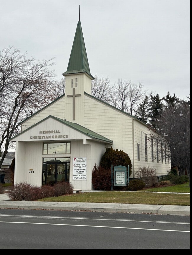
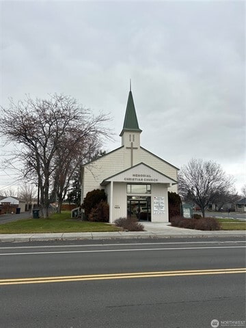
Property Record
453 E Division Ave, Ephrata, WA 98823

Property Detail
453 E Division Ave
Moses Lake, WA
LOTS 13 TO 15 BLOCK 5 EPHRATA HTS 1ST ADD
131047000
Grant
Storebuilding
Washington
B and X Area of moderate flood hazard, usually the area between the limits of the 100-year and 500-year floods.
13-15
2025
0.42 AC
2025
Washington State Area
010402
Other Market Areas
9,868 SF
NEARBY LISTINGS FOR SALE OR LEASE
-
-
View all Ephrata listings for sale on LoopNet.com
DEMOGRAPHICS near 453 E Division Ave
1 mile
3 mile
5 mile
2025 Total Population
7,385
10,353
12,804
2030 Population
7,795
10,942
13,498
Pop Growth 2025-2030
+ 5.55%
+ 5.69%
+ 5.42%
Average Age
37
38
38
2025 Total Households
2,735
3,800
4,663
HH Growth 2025-2030
+ 5.56%
+ 5.71%
+ 5.43%
Median Household Inc
$70,545
$72,255
$74,036
Avg Household Size
2.70
2.70
2.70
2025 Avg HH Vehicles
2.00
2.00
2.00
Median Home Value
$268,202
$268,131
$270,337
Median Year Built
1973
1974
1977
Nearby Places
Map Layers
Map Styles
 Street
 Aerial
Layers
 Traffic
 Biking
Places
Listings with unknown addresses are not visible on the map
- Restaurants
- Banks
- Shops
- Fitness
- Groceries
PUBLIC TRANSPORTATION
COMMUTER RAIL
Drive
Walk
Distance
1 min
8 min
0.4 mi
AIRPORT
Pangborn Memorial
Drive
Walk
Distance
Pangborn Memorial
65 min
45.2 mi
SALE & LEASE HISTORY
LISTING DATE
SALE/LEASE

Jan 16, 2024
For Sale
Nearby Properties
Address
Land Use
TOTAL SIZE
Lot Size
Zoning
Address
Land Use
TOTAL SIZE
Lot Size
Zoning
85,225 SF
5 AC
Address
Land Use
TOTAL SIZE
Lot Size
Zoning
153,927 SF
17.86 AC
Address
Land Use
TOTAL SIZE
Lot Size
Zoning
52,650 SF
2.40 AC
Address
Land Use
TOTAL SIZE
Lot Size
Zoning
42,197 SF
7.92 AC
Address
Land Use
TOTAL SIZE
Lot Size
Zoning
24,966 SF
2.72 AC
Address
Land Use
TOTAL SIZE
Lot Size
Zoning
47,747 SF
15.04 AC
Address
Land Use
TOTAL SIZE
Lot Size
Zoning
102,897 SF
0.78 AC
Address
Land Use
TOTAL SIZE
Lot Size
Zoning
49,824 SF
0.88 AC
Address
Land Use
TOTAL SIZE
Lot Size
Zoning
43,112 SF
4.60 AC
Address
Land Use
TOTAL SIZE
Lot Size
Zoning
239.65 AC
Address
Land Use
TOTAL SIZE
Lot Size
Zoning
23,160 SF
35.35 AC
Address
Land Use
TOTAL SIZE
Lot Size
Zoning
16,158 SF
3.94 AC
Address
Land Use
TOTAL SIZE
Lot Size
Zoning
23,536 SF
1.12 AC
Address
Land Use
TOTAL SIZE
Lot Size
Zoning
34,993 SF
7.07 AC
Address
Land Use
TOTAL SIZE
Lot Size
Zoning
28,872 SF
8.51 AC
Address
Land Use
TOTAL SIZE
Lot Size
Zoning
40,121 SF
7.55 AC
Address
Land Use
TOTAL SIZE
Lot Size
Zoning
24,874 SF
3 AC
Address
Land Use
TOTAL SIZE
Lot Size
Zoning
31,537 SF
5.07 AC
Address
Land Use
TOTAL SIZE
Lot Size
Zoning
60,000 SF
0.60 AC
Address
Land Use
TOTAL SIZE
Lot Size
Zoning
17,568 SF
2 AC
Address
Land Use
TOTAL SIZE
Lot Size
Zoning
30,651 SF
2 AC
Address
Land Use
TOTAL SIZE
Lot Size
Zoning
14,276 SF
4.70 AC
Address
Land Use
TOTAL SIZE
Lot Size
Zoning
18,682 SF
7.67 AC
Address
Land Use
TOTAL SIZE
Lot Size
Zoning
27,849 SF
2 AC
Address
Land Use
TOTAL SIZE
Lot Size
Zoning
23,344 SF
6 AC
Address
Land Use
TOTAL SIZE
Lot Size
Zoning
47,770 SF
10.91 AC
Address
Land Use
TOTAL SIZE
Lot Size
Zoning
30,250 SF
3.65 AC
Address
Land Use
TOTAL SIZE
Lot Size
Zoning
33,040 SF
0.57 AC
Address
Land Use
TOTAL SIZE
Lot Size
Zoning
9,602 SF
0.33 AC
The World's #1 Commercial Real Estate Marketplace
Connect with us
© 2026 CoStar Group
The information above has been obtained from sources believed reliable. While we do not doubt its accuracy we have not verified it and make no guarantee, warranty or representation about it. It is your responsibility to independently confirm its accuracy and completeness. Any projections, opinions, assumptions, or estimates used are for example only and do not represent the current or future performance of the property. The value of this transaction to you depends on tax and other factors which should be evaluated by your tax, financial, and legal advisors. You and your advisors should conduct a careful, independent investigation of the property to determine to your satisfaction the suitability of the property for your needs.