Property Record
4530 S Reservoir Rd, Aurora, CO 80015
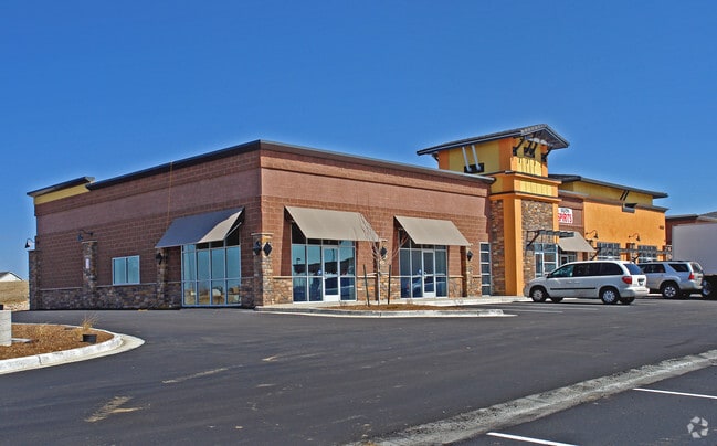


Property Detail
4530 S Reservoir Rd
Denver-Aurora-Centennial, CO
SOME INFO KEYED FROM LEGAL DESCRIPTION, BUT COMPLETE LEGAL NOT CAPTURED
2073-10-1-28-004
ARAPAHOE
Storebuilding
Colorado
B and X Area of moderate flood hazard, usually the area between the limits of the 100-year and 500-year floods.
004,4
2024
2.38 AC
2025
Southeast
085900
Denver
15,486 SF
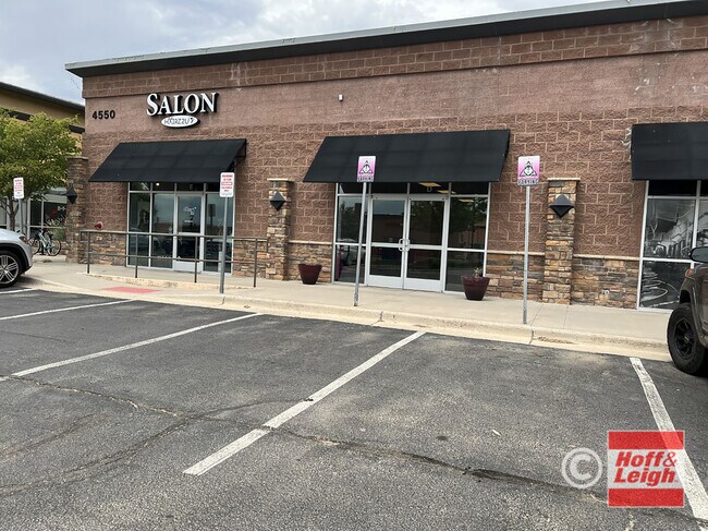
NEARBY LISTINGS FOR SALE OR LEASE
DEMOGRAPHICS near 4530 S Reservoir Rd
1 mile
3 mile
5 mile
2025 Total Population
18,833
138,366
264,610
2030 Population
18,984
139,259
267,987
Pop Growth 2025-2030
+ 0.80%
+ 0.65%
+ 1.28%
Average Age
38
38
39
2025 Total Households
6,080
45,496
94,289
HH Growth 2025-2030
+ 0.74%
+ 0.66%
+ 1.33%
Median Household Inc
$122,601
$122,378
$109,327
Avg Household Size
3.00
3.00
2.70
2025 Avg HH Vehicles
2.00
2.00
2.00
Median Home Value
$591,710
$597,498
$563,465
Median Year Built
1991
1991
1991
Nearby Places
Map Layers
Map Styles
 Street
 Aerial
Layers
 Traffic
 Biking
Places
Listings with unknown addresses are not visible on the map
- Restaurants
- Banks
- Shops
- Fitness
- Groceries
PUBLIC TRANSPORTATION
AIRPORT
Denver International
Drive
Walk
Distance
Denver International
29 min
22.9 mi
SALE & LEASE HISTORY
LISTING DATE
SALE/LEASE

Oct 26, 2021
For Lease
Nearby Properties
Address
Land Use
TOTAL SIZE
Lot Size
Zoning
Address
Land Use
TOTAL SIZE
Lot Size
Zoning
525,600 SF
57.90 AC
Address
Land Use
TOTAL SIZE
Lot Size
Zoning
328,000 SF
33.52 AC
PUD
Address
Land Use
TOTAL SIZE
Lot Size
Zoning
142,378 SF
14.64 AC
Address
Land Use
TOTAL SIZE
Lot Size
Zoning
168,500 SF
24.03 AC
Address
Land Use
TOTAL SIZE
Lot Size
Zoning
368,462 SF
11.68 AC
RZMF
Address
Land Use
TOTAL SIZE
Lot Size
Zoning
376,563 SF
12.17 AC
AMU
Address
Land Use
TOTAL SIZE
Lot Size
Zoning
176,000 SF
10.83 AC
PUD
Address
Land Use
TOTAL SIZE
Lot Size
Zoning
105,244 SF
12.64 AC
RPCZD
Address
Land Use
TOTAL SIZE
Lot Size
Zoning
473.14 AC
AA1
Address
Land Use
TOTAL SIZE
Lot Size
Zoning
26,880 SF
20.44 AC
Address
Land Use
TOTAL SIZE
Lot Size
Zoning
206,064 SF
25.38 AC
AMU
Address
Land Use
TOTAL SIZE
Lot Size
Zoning
172,715 SF
4.23 AC
Address
Land Use
TOTAL SIZE
Lot Size
Zoning
344,071 SF
17.10 AC
Address
Land Use
TOTAL SIZE
Lot Size
Zoning
114,838 SF
12.50 AC
Address
Land Use
TOTAL SIZE
Lot Size
Zoning
84,662 SF
8.14 AC
PUD
Address
Land Use
TOTAL SIZE
Lot Size
Zoning
255,676 SF
13.97 AC
PUD
Address
Land Use
TOTAL SIZE
Lot Size
Zoning
140,000 SF
24.16 AC
AMU
Address
Land Use
TOTAL SIZE
Lot Size
Zoning
70,715 SF
13.57 AC
Address
Land Use
TOTAL SIZE
Lot Size
Zoning
44.65 AC
Address
Land Use
TOTAL SIZE
Lot Size
Zoning
55,800 SF
12.80 AC
Address
Land Use
TOTAL SIZE
Lot Size
Zoning
60,600 SF
12.01 AC
ARPSF
Address
Land Use
TOTAL SIZE
Lot Size
Zoning
57,373 SF
14 AC
PUD
Address
Land Use
TOTAL SIZE
Lot Size
Zoning
29,361 SF
4.60 AC
RB1
Address
Land Use
TOTAL SIZE
Lot Size
Zoning
19.54 AC
RZSFD
Address
Land Use
TOTAL SIZE
Lot Size
Zoning
19.39 AC
PUD
Address
Land Use
TOTAL SIZE
Lot Size
Zoning
52,800 SF
11.51 AC
Address
Land Use
TOTAL SIZE
Lot Size
Zoning
42,432 SF
8.13 AC
PUD
Address
Land Use
TOTAL SIZE
Lot Size
Zoning
55,800 SF
9.83 AC
PUD
Address
Land Use
TOTAL SIZE
Lot Size
Zoning
104,823 SF
3.42 AC
RPCZD
Address
Land Use
TOTAL SIZE
Lot Size
Zoning
57,916 SF
9.07 AC
The World's #1 Commercial Real Estate Marketplace
Connect with us
© 2026 CoStar Group
The information above has been obtained from sources believed reliable. While we do not doubt its accuracy we have not verified it and make no guarantee, warranty or representation about it. It is your responsibility to independently confirm its accuracy and completeness. Any projections, opinions, assumptions, or estimates used are for example only and do not represent the current or future performance of the property. The value of this transaction to you depends on tax and other factors which should be evaluated by your tax, financial, and legal advisors. You and your advisors should conduct a careful, independent investigation of the property to determine to your satisfaction the suitability of the property for your needs.