Property Record
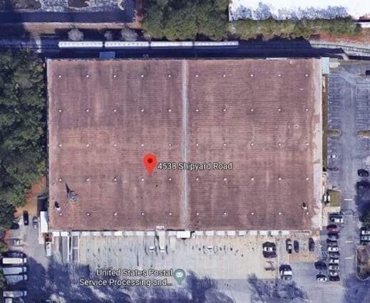
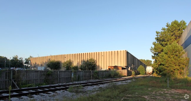
4538 Shipyard Rd, Mobile, AL 36675

Property Detail
4538 Shipyard Rd
Mobile, AL
LESSEE: TONSMEIRE CONSTRUCTION CORP LOT 1 CREEKLINE THIRD ADDN MBK 65 PG 25 #SEC 23 T5S R2W #MP33 06 23 1 000
33-06-23-1-000-001.01
MOBILE
Warehouse
Alabama
AE The base floodplain where base flood elevations are provided. AE Zones are now used on new format FIRMs instead of A1-A30 Zones.
1
2025
7.23 AC
2025
West Mobile
007000
Mobile
100,000 SF
NEARBY LISTINGS FOR SALE OR LEASE
DEMOGRAPHICS near 4538 Shipyard Rd
1 mile
3 mile
5 mile
2024 Total Population
1,471
21,216
87,302
2029 Population
1,470
21,039
86,448
Pop Growth 2024-2029
(0.07%)
(0.83%)
(0.98%)
Average Age
45
42
40
2024 Total Households
587
8,647
35,638
HH Growth 2024-2029
0.00%
(0.86%)
(1.08%)
Median Household Inc
$62,357
$58,831
$55,498
Avg Household Size
2.40
2.40
2.40
2024 Avg HH Vehicles
2.00
2.00
2.00
Median Home Value
$305,732
$209,723
$190,901
Median Year Built
1977
1977
1978
Nearby Places
Map Layers
Map Styles
 Street
 Aerial
Transit
 Traffic
 Biking
Places
Listings with unknown addresses are not visible on the map
- Restaurants
- Banks
- Shops
- Fitness
- Groceries
PUBLIC TRANSPORTATION
AIRPORT
Mobile International
Drive
Walk
Distance
Mobile International
15 min
7.9 mi
Mobile Regional
Drive
Walk
Distance
Mobile Regional
30 min
13.6 mi
Freight Ports
Port of Mobile
Drive
Walk
Distance
Port of Mobile
17 min
11.1 mi
SALE & LEASE HISTORY
LISTING DATE
SALE/LEASE

Oct 29, 2018
For Sale
Jul 25, 2019
For Sale
Nearby Properties
Address
Land Use
TOTAL SIZE
Lot Size
Zoning
Address
Land Use
TOTAL SIZE
Lot Size
Zoning
85,823 SF
13.26 AC
Address
Land Use
TOTAL SIZE
Lot Size
Zoning
117,000 SF
Address
Land Use
TOTAL SIZE
Lot Size
Zoning
24,255 SF
9.15 AC
Address
Land Use
TOTAL SIZE
Lot Size
Zoning
7,810 SF
15.35 AC
Address
Land Use
TOTAL SIZE
Lot Size
Zoning
37,604 SF
9.10 AC
Address
Land Use
TOTAL SIZE
Lot Size
Zoning
78,750 SF
27.51 AC
Address
Land Use
TOTAL SIZE
Lot Size
Zoning
26,933 SF
82.37 AC
Address
Land Use
TOTAL SIZE
Lot Size
Zoning
18,392 SF
15.69 AC
Address
Land Use
TOTAL SIZE
Lot Size
Zoning
204,868 SF
22.14 AC
Address
Land Use
TOTAL SIZE
Lot Size
Zoning
27,580 SF
4.69 AC
Address
Land Use
TOTAL SIZE
Lot Size
Zoning
51,610 SF
16.89 AC
Address
Land Use
TOTAL SIZE
Lot Size
Zoning
132,400 SF
23 AC
Address
Land Use
TOTAL SIZE
Lot Size
Zoning
15,476 SF
10.44 AC
Address
Land Use
TOTAL SIZE
Lot Size
Zoning
78,750 SF
24 AC
Address
Land Use
TOTAL SIZE
Lot Size
Zoning
20,000 SF
28.80 AC
Address
Land Use
TOTAL SIZE
Lot Size
Zoning
139,097 SF
11.64 AC
Address
Land Use
TOTAL SIZE
Lot Size
Zoning
66,382 SF
1.71 AC
Address
Land Use
TOTAL SIZE
Lot Size
Zoning
99,076 SF
25 AC
Address
Land Use
TOTAL SIZE
Lot Size
Zoning
110,982 SF
17.46 AC
Address
Land Use
TOTAL SIZE
Lot Size
Zoning
69,747 SF
20 AC
Address
Land Use
TOTAL SIZE
Lot Size
Zoning
92,271 SF
15.40 AC
Address
Land Use
TOTAL SIZE
Lot Size
Zoning
94,116 SF
7.11 AC
Address
Land Use
TOTAL SIZE
Lot Size
Zoning
396.69 AC
Address
Land Use
TOTAL SIZE
Lot Size
Zoning
16,452 SF
4.32 AC
Address
Land Use
TOTAL SIZE
Lot Size
Zoning
21,143 SF
7.03 AC
Address
Land Use
TOTAL SIZE
Lot Size
Zoning
74,000 SF
3.46 AC
Address
Land Use
TOTAL SIZE
Lot Size
Zoning
76,560 SF
27.88 AC
Address
Land Use
TOTAL SIZE
Lot Size
Zoning
60,630 SF
6.70 AC
Address
Land Use
TOTAL SIZE
Lot Size
Zoning
58,306 SF
3.11 AC
Address
Land Use
TOTAL SIZE
Lot Size
Zoning
204,776 SF
39.94 AC
The World's #1 Commercial Real Estate Marketplace
Connect with us
© 2026 CoStar Group
The information above has been obtained from sources believed reliable. While we do not doubt its accuracy we have not verified it and make no guarantee, warranty or representation about it. It is your responsibility to independently confirm its accuracy and completeness. Any projections, opinions, assumptions, or estimates used are for example only and do not represent the current or future performance of the property. The value of this transaction to you depends on tax and other factors which should be evaluated by your tax, financial, and legal advisors. You and your advisors should conduct a careful, independent investigation of the property to determine to your satisfaction the suitability of the property for your needs.