Property Record
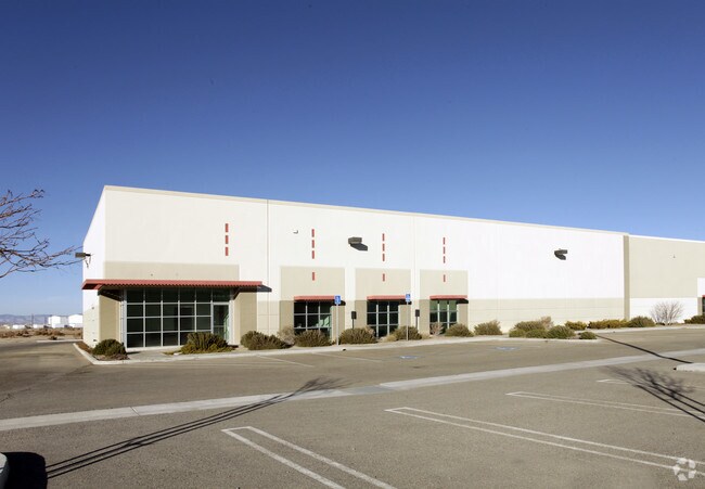
4543 Runway Dr, Lancaster, CA 93536


Property Detail
4543 Runway Dr
3105-001-050
P M 332-27-29 LOT 7
Warehouse
Los Angeles
LRSP*
California
B and X Area of moderate flood hazard, usually the area between the limits of the 100-year and 500-year floods.
7
2024
0.61 AC
2025
Antelope Valley
900901
Los Angeles
7,858 SF
Los Angeles-Long Beach-Glendale, CA
NEARBY LISTINGS FOR SALE OR LEASE
DEMOGRAPHICS near 4543 Runway Dr
1 mile
3 mile
5 mile
2025 Total Population
13
2,801
66,939
2030 Population
13
2,811
66,925
Pop Growth 2025-2030
0.00%
+ 0.36%
(0.02%)
Average Age
35
38
38
2025 Total Households
5
888
21,581
HH Growth 2025-2030
0.00%
+ 0.11%
(0.18%)
Median Household Inc
$44,999
$71,651
$85,140
Avg Household Size
2.50
3.00
3.00
2025 Avg HH Vehicles
1.00
2.00
2.00
Median Home Value
$750,000
$609,662
$474,902
Median Year Built
2007
2005
1988
Nearby Places
Map Layers
Map Styles
 Street
 Aerial
Layers
 Traffic
 Biking
Places
Listings with unknown addresses are not visible on the map
- Restaurants
- Banks
- Shops
- Fitness
- Groceries
PUBLIC TRANSPORTATION
COMMUTER RAIL
Lancaster (Antelope Valley Line - Southern California Regional Rail Authority (Metrolink))
Drive
Walk
Distance
Lancaster (Antelope Valley Line - Southern California Regional Rail Authority (Metrolink))
11 min
6.7 mi
Freight Ports
Port of Long Beach
Drive
Walk
Distance
Port of Long Beach
115 min
98.4 mi
Nearby Properties
Address
Land Use
TOTAL SIZE
Lot Size
Zoning
Address
Land Use
TOTAL SIZE
Lot Size
Zoning
2,922,905 SF
85.01 AC
LRLI
Address
Land Use
TOTAL SIZE
Lot Size
Zoning
465,697 SF
27.82 AC
LRSP*
Address
Land Use
TOTAL SIZE
Lot Size
Zoning
249,045 SF
19.74 AC
LRMPD*
Address
Land Use
TOTAL SIZE
Lot Size
Zoning
89,351 SF
17.97 AC
LRMDR
Address
Land Use
TOTAL SIZE
Lot Size
Zoning
81,668 SF
5.47 AC
LRSP80-01*
Address
Land Use
TOTAL SIZE
Lot Size
Zoning
198,494 SF
9.78 AC
LRSP*
Address
Land Use
TOTAL SIZE
Lot Size
Zoning
Address
Land Use
TOTAL SIZE
Lot Size
Zoning
99,247 SF
10.11 AC
LRA12*
Address
Land Use
TOTAL SIZE
Lot Size
Zoning
57,050 SF
4.28 AC
LRLI
Address
Land Use
TOTAL SIZE
Lot Size
Zoning
37.45 AC
LRSP
Address
Land Use
TOTAL SIZE
Lot Size
Zoning
Address
Land Use
TOTAL SIZE
Lot Size
Zoning
Address
Land Use
TOTAL SIZE
Lot Size
Zoning
259,447 SF
4.51 AC
LRD22*
Address
Land Use
TOTAL SIZE
Lot Size
Zoning
31,200 SF
2.28 AC
LRLI
Address
Land Use
TOTAL SIZE
Lot Size
Zoning
19,580 SF
2.02 AC
LRM120000*
Address
Land Use
TOTAL SIZE
Lot Size
Zoning
14,581 SF
0.95 AC
LRSP*
Address
Land Use
TOTAL SIZE
Lot Size
Zoning
26.32 AC
LCM1
Address
Land Use
TOTAL SIZE
Lot Size
Zoning
76.91 AC
LRA12*
Address
Land Use
TOTAL SIZE
Lot Size
Zoning
80 AC
LRA12*
Address
Land Use
TOTAL SIZE
Lot Size
Zoning
9.18 AC
LRC
Address
Land Use
TOTAL SIZE
Lot Size
Zoning
14,581 SF
1.06 AC
LRSP*
Address
Land Use
TOTAL SIZE
Lot Size
Zoning
21,808 SF
2.30 AC
LRM120000*
Address
Land Use
TOTAL SIZE
Lot Size
Zoning
1,500 SF
4.73 AC
LRD22*
Address
Land Use
TOTAL SIZE
Lot Size
Zoning
410,335 SF
9.76 AC
LRSP80-01*
Address
Land Use
TOTAL SIZE
Lot Size
Zoning
37.01 AC
LRA12*
Address
Land Use
TOTAL SIZE
Lot Size
Zoning
30.68 AC
LRHI
Address
Land Use
TOTAL SIZE
Lot Size
Zoning
6,457 SF
2.26 AC
LRLI*
Address
Land Use
TOTAL SIZE
Lot Size
Zoning
7,858 SF
0.60 AC
LRSP*
Address
Land Use
TOTAL SIZE
Lot Size
Zoning
9.47 AC
LRA12*
The World's #1 Commercial Real Estate Marketplace
Connect with us
© 2026 CoStar Group
The information above has been obtained from sources believed reliable. While we do not doubt its accuracy we have not verified it and make no guarantee, warranty or representation about it. It is your responsibility to independently confirm its accuracy and completeness. Any projections, opinions, assumptions, or estimates used are for example only and do not represent the current or future performance of the property. The value of this transaction to you depends on tax and other factors which should be evaluated by your tax, financial, and legal advisors. You and your advisors should conduct a careful, independent investigation of the property to determine to your satisfaction the suitability of the property for your needs.