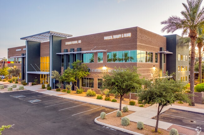
Property Record
4550 E Bell Rd, Phoenix, AZ 85032
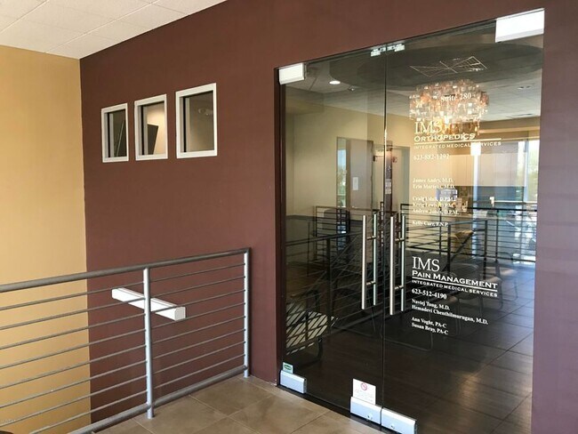

Current Lease Availabilities
Property Detail
4550 E Bell Rd
215-18-549A
FORTY FIFTH PLACE CONDOMINIUM MCR 896-49
Medicalbuilding
Maricopa
C-T
Arizona
C and X Area of minimal flood hazard, usually depicted on FIRMs as above the 500-year flood level.
284
2025
0.06 AC
2025
Paradise Valley
619800
Phoenix
28,827 SF
Phoenix-Mesa-Chandler, AZ
NEARBY LISTINGS FOR SALE OR LEASE
DEMOGRAPHICS near 4550 E Bell Rd
1 mile
3 mile
5 mile
2024 Total Population
16,231
122,345
260,457
2029 Population
16,832
126,836
271,312
Pop Growth 2024-2029
+ 3.70%
+ 3.67%
+ 4.17%
Average Age
40
40
41
2024 Total Households
6,472
49,960
110,365
HH Growth 2024-2029
+ 3.66%
+ 3.89%
+ 4.51%
Median Household Inc
$114,528
$97,402
$97,344
Avg Household Size
2.40
2.40
2.30
2024 Avg HH Vehicles
2.00
2.00
2.00
Median Home Value
$638,218
$576,228
$595,716
Median Year Built
1990
1988
1990
Nearby Places
Map Layers
Map Styles
 Street
 Aerial
Transit
 Traffic
 Biking
Places
Listings with unknown addresses are not visible on the map
- Restaurants
- Banks
- Shops
- Fitness
- Groceries
PUBLIC TRANSPORTATION
AIRPORT
Phoenix Sky Harbor International
Drive
Walk
Distance
Phoenix Sky Harbor International
28 min
18.8 mi
Phoenix-Mesa Gateway
Drive
Walk
Distance
Phoenix-Mesa Gateway
60 min
41.4 mi
Nearby Properties
Address
Land Use
TOTAL SIZE
Lot Size
Zoning
Address
Land Use
TOTAL SIZE
Lot Size
Zoning
1,504,047 SF
40.43 AC
I-P
Address
Land Use
TOTAL SIZE
Lot Size
Zoning
128,046 SF
9.97 AC
C2
Address
Land Use
TOTAL SIZE
Lot Size
Zoning
35.76 AC
R1-18
Address
Land Use
TOTAL SIZE
Lot Size
Zoning
14.58 AC
Address
Land Use
TOTAL SIZE
Lot Size
Zoning
1,162,283 SF
115.23 AC
C-C
Address
Land Use
TOTAL SIZE
Lot Size
Zoning
670,926 SF
20.92 AC
I-P
Address
Land Use
TOTAL SIZE
Lot Size
Zoning
1,200,514 SF
47.28 AC
S1
Address
Land Use
TOTAL SIZE
Lot Size
Zoning
487,786 SF
18.42 AC
S1
Address
Land Use
TOTAL SIZE
Lot Size
Zoning
342,574 SF
85.69 AC
R-18
Address
Land Use
TOTAL SIZE
Lot Size
Zoning
336,494 SF
55.06 AC
R-43AG
Address
Land Use
TOTAL SIZE
Lot Size
Zoning
539,135 SF
15.11 AC
R3A
Address
Land Use
TOTAL SIZE
Lot Size
Zoning
495,877 SF
21.08 AC
C-C
Address
Land Use
TOTAL SIZE
Lot Size
Zoning
525,073 SF
8.51 AC
R4
Address
Land Use
TOTAL SIZE
Lot Size
Zoning
359,170 SF
37.47 AC
R-14
Address
Land Use
TOTAL SIZE
Lot Size
Zoning
375,257 SF
12 AC
M-H
Address
Land Use
TOTAL SIZE
Lot Size
Zoning
512,499 SF
23.03 AC
R3A
Address
Land Use
TOTAL SIZE
Lot Size
Zoning
24,200 SF
2.15 AC
R-18
Address
Land Use
TOTAL SIZE
Lot Size
Zoning
240,187 SF
14.26 AC
S1
Address
Land Use
TOTAL SIZE
Lot Size
Zoning
482,581 SF
20.45 AC
C-C
Address
Land Use
TOTAL SIZE
Lot Size
Zoning
297,352 SF
7.17 AC
R-18
Address
Land Use
TOTAL SIZE
Lot Size
Zoning
3.27 AC
C-C
Address
Land Use
TOTAL SIZE
Lot Size
Zoning
318,389 SF
37.57 AC
R-14
Address
Land Use
TOTAL SIZE
Lot Size
Zoning
388,480 SF
18.69 AC
PAD
Address
Land Use
TOTAL SIZE
Lot Size
Zoning
327,729 SF
5.85 AC
R-18
Address
Land Use
TOTAL SIZE
Lot Size
Zoning
373,066 SF
13 AC
M-H
Address
Land Use
TOTAL SIZE
Lot Size
Zoning
163,122 SF
8.70 AC
C-C
Address
Land Use
TOTAL SIZE
Lot Size
Zoning
596,465 SF
66.04 AC
I-P
Address
Land Use
TOTAL SIZE
Lot Size
Zoning
167,532 SF
30 AC
R-14
Address
Land Use
TOTAL SIZE
Lot Size
Zoning
211,239 SF
12.33 AC
M-M
Address
Land Use
TOTAL SIZE
Lot Size
Zoning
96.57 AC
I-P
The World's #1 Commercial Real Estate Marketplace
Connect with us
© 2026 CoStar Group
The information above has been obtained from sources believed reliable. While we do not doubt its accuracy we have not verified it and make no guarantee, warranty or representation about it. It is your responsibility to independently confirm its accuracy and completeness. Any projections, opinions, assumptions, or estimates used are for example only and do not represent the current or future performance of the property. The value of this transaction to you depends on tax and other factors which should be evaluated by your tax, financial, and legal advisors. You and your advisors should conduct a careful, independent investigation of the property to determine to your satisfaction the suitability of the property for your needs.