Property Record
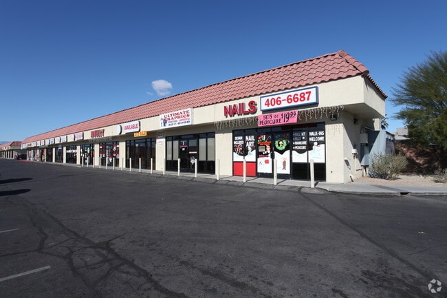
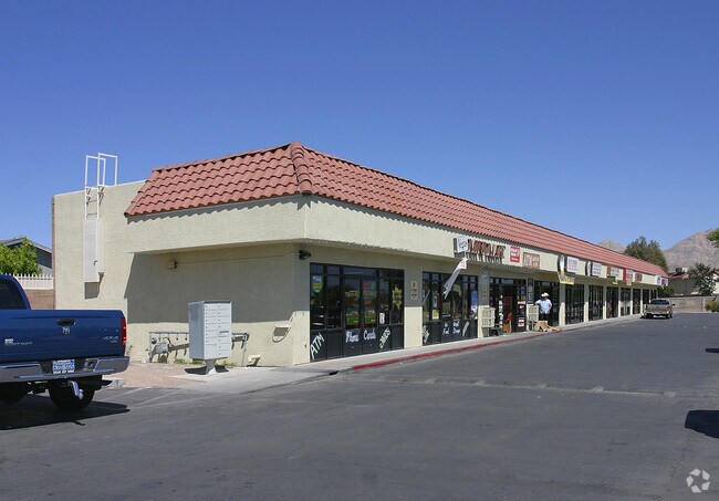
4552 E Bonanza Rd, Las Vegas, NV 89110


Property Detail
4552 E Bonanza Rd
140-29-411-217
BOULDER HGTS TRACT #1 PLAT BOOK 1 PAGE 81 LOT 25 BLOCK J & LOTS 26-48 & VAC RD
Storebuilding
CLARK
C1
Nevada
B and X Area of moderate flood hazard, usually the area between the limits of the 100-year and 500-year floods.
25
2026
1.09 AC
2026
Northeast Las Vegas
000515
Las Vegas
12,320 SF
Las Vegas-Henderson-North Las Vegas, NV
NEARBY LISTINGS FOR SALE OR LEASE
DEMOGRAPHICS near 4552 E Bonanza Rd
1 mile
3 mile
5 mile
2025 Total Population
32,004
244,051
472,635
2030 Population
33,371
254,458
493,481
Pop Growth 2025-2030
+ 4.27%
+ 4.26%
+ 4.41%
Average Age
35
36
37
2025 Total Households
9,822
77,258
160,621
HH Growth 2025-2030
+ 4.30%
+ 4.36%
+ 4.56%
Median Household Inc
$45,992
$50,791
$52,520
Avg Household Size
3.20
3.00
2.80
2025 Avg HH Vehicles
2.00
2.00
2.00
Median Home Value
$256,015
$299,336
$320,559
Median Year Built
1986
1985
1984
Nearby Places
Map Layers
Map Styles
 Street
 Aerial
Layers
 Traffic
 Biking
Places
Listings with unknown addresses are not visible on the map
- Restaurants
- Banks
- Shops
- Fitness
- Groceries
PUBLIC TRANSPORTATION
AIRPORT
Harry Reid International
Drive
Walk
Distance
Harry Reid International
18 min
11.2 mi
Boulder City Municipal
Drive
Walk
Distance
Boulder City Municipal
33 min
24.6 mi
Freight Ports
Port of Long Beach
Drive
Walk
Distance
Port of Long Beach
323 min
288.5 mi
SALE & LEASE HISTORY
LISTING DATE
SALE/LEASE

Dec 08, 2022
For Lease
Nearby Properties
Address
Land Use
TOTAL SIZE
Lot Size
Zoning
Address
Land Use
TOTAL SIZE
Lot Size
Zoning
345,133 SF
27.01 AC
H1
Address
Land Use
TOTAL SIZE
Lot Size
Zoning
324 SF
8.74 AC
R1
Address
Land Use
TOTAL SIZE
Lot Size
Zoning
6,396 SF
15.06 AC
Address
Land Use
TOTAL SIZE
Lot Size
Zoning
7.24 AC
PF
Address
Land Use
TOTAL SIZE
Lot Size
Zoning
67,649 SF
13.42 AC
CV
Address
Land Use
TOTAL SIZE
Lot Size
Zoning
29.35 AC
CV
Address
Land Use
TOTAL SIZE
Lot Size
Zoning
15.95 AC
PF
Address
Land Use
TOTAL SIZE
Lot Size
Zoning
20.91 AC
PF
Address
Land Use
TOTAL SIZE
Lot Size
Zoning
1,008 SF
31.47 AC
PF
Address
Land Use
TOTAL SIZE
Lot Size
Zoning
58,188 SF
20.04 AC
L:C-V
Address
Land Use
TOTAL SIZE
Lot Size
Zoning
339,280 SF
18.19 AC
Address
Land Use
TOTAL SIZE
Lot Size
Zoning
374,712 SF
18.88 AC
MD
Address
Land Use
TOTAL SIZE
Lot Size
Zoning
4.34 AC
RE
Address
Land Use
TOTAL SIZE
Lot Size
Zoning
19.30 AC
RE
Address
Land Use
TOTAL SIZE
Lot Size
Zoning
421,000 SF
19.59 AC
M1
Address
Land Use
TOTAL SIZE
Lot Size
Zoning
9,044 SF
8.62 AC
Address
Land Use
TOTAL SIZE
Lot Size
Zoning
223,422 SF
18.21 AC
R3
Address
Land Use
TOTAL SIZE
Lot Size
Zoning
7,908 SF
24.13 AC
R4
Address
Land Use
TOTAL SIZE
Lot Size
Zoning
2,926 SF
19.73 AC
R3
Address
Land Use
TOTAL SIZE
Lot Size
Zoning
307,997 SF
14.01 AC
Address
Land Use
TOTAL SIZE
Lot Size
Zoning
3,183 SF
18.35 AC
R3
Address
Land Use
TOTAL SIZE
Lot Size
Zoning
9.11 AC
PF
Address
Land Use
TOTAL SIZE
Lot Size
Zoning
3,424 SF
14.53 AC
R3
Address
Land Use
TOTAL SIZE
Lot Size
Zoning
11.69 AC
CV
Address
Land Use
TOTAL SIZE
Lot Size
Zoning
228,760 SF
12.72 AC
Address
Land Use
TOTAL SIZE
Lot Size
Zoning
326,165 SF
17.37 AC
Address
Land Use
TOTAL SIZE
Lot Size
Zoning
346,598 SF
17.95 AC
M1
Address
Land Use
TOTAL SIZE
Lot Size
Zoning
9,154 SF
8.94 AC
CV
Address
Land Use
TOTAL SIZE
Lot Size
Zoning
8.39 AC
CV
Address
Land Use
TOTAL SIZE
Lot Size
Zoning
8.87 AC
PF
The World's #1 Commercial Real Estate Marketplace
Connect with us
© 2026 CoStar Group
The information above has been obtained from sources believed reliable. While we do not doubt its accuracy we have not verified it and make no guarantee, warranty or representation about it. It is your responsibility to independently confirm its accuracy and completeness. Any projections, opinions, assumptions, or estimates used are for example only and do not represent the current or future performance of the property. The value of this transaction to you depends on tax and other factors which should be evaluated by your tax, financial, and legal advisors. You and your advisors should conduct a careful, independent investigation of the property to determine to your satisfaction the suitability of the property for your needs.