Property Record
45Th Street Ct, Rock Island, IL 61201
NEARBY LISTINGS FOR SALE OR LEASE
-
-
View all Rock Island listings for sale on LoopNet.com
Property Detail
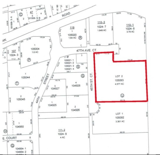
45Th Street Ct
Davenport/Moline/Rock Island
Park
Davenport-Moline-Rock Island, IA-IL
Rock Island
17-18-119-001
Illinois
Commercialacreage
4.58 AC
X
Greater Rock Island
19163C0500F
DEMOGRAPHICS near 45Th Street Ct
1 Mile
3 Mile
5 Mile
2024 Total Population
2,355
56,648
113,240
2029 Population
2,283
55,300
111,271
Pop Growth 2024-2029
(3.06%)
(2.38%)
(1.74%)
Average Age
46
41
40
2024 Total Households
1,054
23,896
48,696
HH Growth 2024-2029
(3.13%)
(2.45%)
(1.74%)
Median Household Inc
$81,801
$55,413
$53,135
Avg Household Size
2.20
2.20
2.20
2024 Avg HH Vehicles
2.00
2.00
2.00
Median Home Value
$157,767
$120,575
$133,870
Median Year Built
1961
1951
1953
Nearby Places
Map Layers
Map Styles
 Street
 Aerial
- Restaurants
- Banks
- Shops
- Fitness
- Groceries
PUBLIC TRANSPORTATION
AIRPORT
Quad Cities International
DRIVE
WALK
Distance
Quad Cities International
11 min
3.9 mi
Freight Ports
Port Milwaukee
DRIVE
WALK
Distance
Port Milwaukee
240 min
208.9 mi
SALE & LEASE HISTORY
LISTING DATE
SALE/LEASE

Jan 18, 2018
For Sale
Nearby Properties
Address
Land Use
TOTAL SIZE
Lot Size
Zoning
Address
Land Use
TOTAL SIZE
Lot Size
Zoning
2,595,576 SF
185.35 AC
MIL
Address
Land Use
TOTAL SIZE
Lot Size
Zoning
7.86 AC
Address
Land Use
TOTAL SIZE
Lot Size
Zoning
100,500 SF
0.94 AC
MOL
Address
Land Use
TOTAL SIZE
Lot Size
Zoning
1,287,769 SF
53.54 AC
MOL
Address
Land Use
TOTAL SIZE
Lot Size
Zoning
44,839 SF
10.86 AC
RI
Address
Land Use
TOTAL SIZE
Lot Size
Zoning
369,922 SF
3.14 AC
RI
Address
Land Use
TOTAL SIZE
Lot Size
Zoning
6.53 AC
MOL
Address
Land Use
TOTAL SIZE
Lot Size
Zoning
20.35 AC
MIL
Address
Land Use
TOTAL SIZE
Lot Size
Zoning
47,060 SF
3.23 AC
MOL
Address
Land Use
TOTAL SIZE
Lot Size
Zoning
935,332 SF
41.69 AC
MIL
Address
Land Use
TOTAL SIZE
Lot Size
Zoning
142,836 SF
14.60 AC
MOL
Address
Land Use
TOTAL SIZE
Lot Size
Zoning
66.76 AC
MOL
Address
Land Use
TOTAL SIZE
Lot Size
Zoning
73,065 SF
12.67 AC
I2
Address
Land Use
TOTAL SIZE
Lot Size
Zoning
9.42 AC
I2
Address
Land Use
TOTAL SIZE
Lot Size
Zoning
116,800 SF
9.30 AC
MOL
Address
Land Use
TOTAL SIZE
Lot Size
Zoning
14.01 AC
Address
Land Use
TOTAL SIZE
Lot Size
Zoning
79,785 SF
5.61 AC
MIL
Address
Land Use
TOTAL SIZE
Lot Size
Zoning
89,649 SF
0.70 AC
MOL
Address
Land Use
TOTAL SIZE
Lot Size
Zoning
96,352 SF
9.77 AC
MOL
Address
Land Use
TOTAL SIZE
Lot Size
Zoning
75,651 SF
7.29 AC
RI
Address
Land Use
TOTAL SIZE
Lot Size
Zoning
53,897 SF
3.13 AC
MOL
Address
Land Use
TOTAL SIZE
Lot Size
Zoning
33.09 AC
Address
Land Use
TOTAL SIZE
Lot Size
Zoning
3 AC
MOL
Address
Land Use
TOTAL SIZE
Lot Size
Zoning
81,500 SF
6.95 AC
MOL
Address
Land Use
TOTAL SIZE
Lot Size
Zoning
4.40 AC
Address
Land Use
TOTAL SIZE
Lot Size
Zoning
24,985 SF
3.36 AC
RI
Address
Land Use
TOTAL SIZE
Lot Size
Zoning
46.02 AC
MOL
Address
Land Use
TOTAL SIZE
Lot Size
Zoning
1.97 AC
MOL
Address
Land Use
TOTAL SIZE
Lot Size
Zoning
63,972 SF
2.66 AC
MOL
Address
Land Use
TOTAL SIZE
Lot Size
Zoning
112,833 SF
1.09 AC
MOL
The World's #1 Commercial Real Estate Marketplace
Connect with us
© 2025 CoStar Group
The information above has been obtained from sources believed reliable. While we do not doubt its accuracy we have not verified it and make no guarantee, warranty or representation about it. It is your responsibility to independently confirm its accuracy and completeness. Any projections, opinions, assumptions, or estimates used are for example only and do not represent the current or future performance of the property. The value of this transaction to you depends on tax and other factors which should be evaluated by your tax, financial, and legal advisors. You and your advisors should conduct a careful, independent investigation of the property to determine to your satisfaction the suitability of the property for your needs.