Property Record
46142 180Th Ave, Zumbrota, MN 55992
NEARBY LISTINGS FOR SALE OR LEASE
-
-
View all Zumbrota listings for sale on LoopNet.com
Property Detail
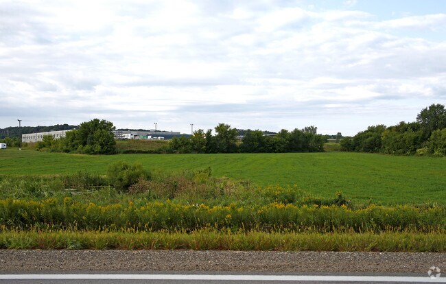
46142 180Th Ave
Other Market Areas
Unplatted Land
Red Wing, MN
UNPLATTED LAND 35.14 AC ID# 22-0560-09900 PT OF SE1/4 SEC 36 110 16 BEING THAT PT LYING SWLY OF NELY R/W HWY 52 EX 11.25AC EX
72.740.1130
Goodhue
Agriculturalland
Minnesota
2025
35.14 AC
2025
Minnesota South Area
080800
DEMOGRAPHICS near 46142 180Th Ave
1 Mile
3 Mile
5 Mile
2024 Total Population
1,962
4,770
5,750
2029 Population
1,995
4,879
5,870
Pop Growth 2024-2029
+ 1.68%
+ 2.29%
+ 2.09%
Average Age
41
41
41
2024 Total Households
783
1,904
2,274
HH Growth 2024-2029
+ 1.53%
+ 2.26%
+ 2.11%
Median Household Inc
$71,880
$73,777
$74,885
Avg Household Size
2.50
2.50
2.50
2024 Avg HH Vehicles
2.00
2.00
2.00
Median Home Value
$239,699
$238,437
$246,709
Median Year Built
1969
1970
1971
Nearby Places
Map Layers
Map Styles
 Street
 Aerial
- Restaurants
- Banks
- Shops
- Fitness
- Groceries
PUBLIC TRANSPORTATION
AIRPORT
Rochester International
DRIVE
WALK
Distance
Rochester International
38 min
30.9 mi
Freight Ports
Port Milwaukee
DRIVE
WALK
Distance
Port Milwaukee
331 min
300.3 mi
SALE & LEASE HISTORY
LISTING DATE
SALE/LEASE

Sep 24, 2016
For Sale
Nearby Properties
Address
Land Use
TOTAL SIZE
Lot Size
Zoning
Address
Land Use
TOTAL SIZE
Lot Size
Zoning
236,199 SF
17.67 AC
Address
Land Use
TOTAL SIZE
Lot Size
Zoning
54,694 SF
1.33 AC
Address
Land Use
TOTAL SIZE
Lot Size
Zoning
72,424 SF
0.23 AC
Address
Land Use
TOTAL SIZE
Lot Size
Zoning
81,661 SF
8.30 AC
Address
Land Use
TOTAL SIZE
Lot Size
Zoning
13,550 SF
3.62 AC
Address
Land Use
TOTAL SIZE
Lot Size
Zoning
22,272 SF
6.66 AC
Address
Land Use
TOTAL SIZE
Lot Size
Zoning
59,214 SF
7.56 AC
Address
Land Use
TOTAL SIZE
Lot Size
Zoning
7,365 SF
2.16 AC
Address
Land Use
TOTAL SIZE
Lot Size
Zoning
22,953 SF
4.19 AC
Address
Land Use
TOTAL SIZE
Lot Size
Zoning
44,010 SF
0.66 AC
Address
Land Use
TOTAL SIZE
Lot Size
Zoning
222 AC
Address
Land Use
TOTAL SIZE
Lot Size
Zoning
191.27 AC
Address
Land Use
TOTAL SIZE
Lot Size
Zoning
3,120 SF
11.73 AC
Address
Land Use
TOTAL SIZE
Lot Size
Zoning
208.14 AC
Address
Land Use
TOTAL SIZE
Lot Size
Zoning
143,232 SF
56.21 AC
Address
Land Use
TOTAL SIZE
Lot Size
Zoning
19,200 SF
2.82 AC
Address
Land Use
TOTAL SIZE
Lot Size
Zoning
79,848 SF
0.58 AC
Address
Land Use
TOTAL SIZE
Lot Size
Zoning
22.11 AC
Address
Land Use
TOTAL SIZE
Lot Size
Zoning
25,446 SF
20 AC
Address
Land Use
TOTAL SIZE
Lot Size
Zoning
152.85 AC
Address
Land Use
TOTAL SIZE
Lot Size
Zoning
19,352 SF
0.34 AC
Address
Land Use
TOTAL SIZE
Lot Size
Zoning
150.26 AC
Address
Land Use
TOTAL SIZE
Lot Size
Zoning
25,615 SF
2.19 AC
Address
Land Use
TOTAL SIZE
Lot Size
Zoning
10,726 SF
2.83 AC
Address
Land Use
TOTAL SIZE
Lot Size
Zoning
Address
Land Use
TOTAL SIZE
Lot Size
Zoning
9,513 SF
0.71 AC
The World's #1 Commercial Real Estate Marketplace
Connect with us
© 2025 CoStar Group
The information above has been obtained from sources believed reliable. While we do not doubt its accuracy we have not verified it and make no guarantee, warranty or representation about it. It is your responsibility to independently confirm its accuracy and completeness. Any projections, opinions, assumptions, or estimates used are for example only and do not represent the current or future performance of the property. The value of this transaction to you depends on tax and other factors which should be evaluated by your tax, financial, and legal advisors. You and your advisors should conduct a careful, independent investigation of the property to determine to your satisfaction the suitability of the property for your needs.