Property Record
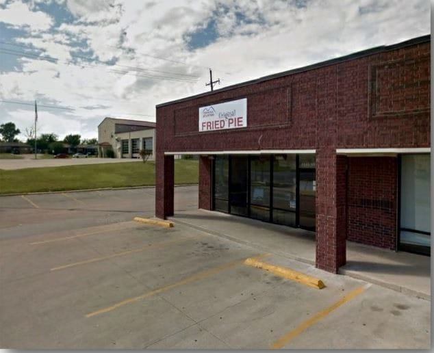
4645 W Gore Blvd, Lawton, OK 73505

NEARBY LISTINGS FOR SALE OR LEASE
Property Detail
4645 W Gore Blvd
Lawton, OK
2N-12W City Tracts
0026913
27-2N-12W C T BEG 302.74' (S89*55'E) & 50' (N0*05'E) OF SW/C SW/4 SEC 27- 2N-12W TH (N30*11'E) 507.16', (S59*49'E) A DIST OF
Apartment
Comanche
AE
Oklahoma
40031C0427E
5
2024
2.84 AC
2025
Oklahoma West Area
000504
Other Market Areas
12,160 SF
DEMOGRAPHICS near 4645 W Gore Blvd
1 Mile
3 Mile
5 Mile
2024 Total Population
9,039
58,356
80,296
2029 Population
9,309
60,411
83,127
Pop Growth 2024-2029
+ 2.99%
+ 3.52%
+ 3.53%
Average Age
36
37
36
2024 Total Households
3,784
24,097
31,038
HH Growth 2024-2029
+ 3.04%
+ 3.56%
+ 3.74%
Median Household Inc
$46,680
$45,644
$44,384
Avg Household Size
2.30
2.30
2.40
2024 Avg HH Vehicles
2.00
2.00
2.00
Median Home Value
$133,519
$137,924
$133,700
Median Year Built
1969
1973
1973
Nearby Places
Map Layers
Map Styles
 Street
 Aerial
- Restaurants
- Banks
- Shops
- Fitness
- Groceries
PUBLIC TRANSPORTATION
AIRPORT
Lawton-Fort Sill Regional
DRIVE
WALK
Distance
Lawton-Fort Sill Regional
13 min
5.3 mi
Freight Ports
Tulsa Port Of Catoosa
DRIVE
WALK
Distance
Tulsa Port Of Catoosa
230 min
213.1 mi
SALE & LEASE HISTORY
LISTING DATE
SALE/LEASE

Jul 23, 2020
For Lease
Dec 04, 2018
For Lease
Nearby Properties
Address
Land Use
TOTAL SIZE
Lot Size
Zoning
Address
Land Use
TOTAL SIZE
Lot Size
Zoning
9,000 SF
25.35 AC
Address
Land Use
TOTAL SIZE
Lot Size
Zoning
74,800 SF
1.41 AC
Address
Land Use
TOTAL SIZE
Lot Size
Zoning
30,000 SF
17.22 AC
Address
Land Use
TOTAL SIZE
Lot Size
Zoning
25,930 SF
5.47 AC
Address
Land Use
TOTAL SIZE
Lot Size
Zoning
32,000 SF
5.32 AC
Address
Land Use
TOTAL SIZE
Lot Size
Zoning
8,800 SF
30.05 AC
Address
Land Use
TOTAL SIZE
Lot Size
Zoning
9,240 SF
6.43 AC
Address
Land Use
TOTAL SIZE
Lot Size
Zoning
1,488 SF
19.43 AC
Address
Land Use
TOTAL SIZE
Lot Size
Zoning
13,326 SF
8.47 AC
Address
Land Use
TOTAL SIZE
Lot Size
Zoning
906 SF
5.51 AC
Address
Land Use
TOTAL SIZE
Lot Size
Zoning
800 SF
15.64 AC
Address
Land Use
TOTAL SIZE
Lot Size
Zoning
195,881 SF
15.39 AC
Address
Land Use
TOTAL SIZE
Lot Size
Zoning
39,546 SF
10.62 AC
Address
Land Use
TOTAL SIZE
Lot Size
Zoning
2,330 SF
19.42 AC
Address
Land Use
TOTAL SIZE
Lot Size
Zoning
12,068 SF
5.31 AC
Address
Land Use
TOTAL SIZE
Lot Size
Zoning
16,996 SF
12.16 AC
Address
Land Use
TOTAL SIZE
Lot Size
Zoning
131,736 SF
10.23 AC
Address
Land Use
TOTAL SIZE
Lot Size
Zoning
39,791 SF
20.50 AC
Address
Land Use
TOTAL SIZE
Lot Size
Zoning
25,800 SF
3.82 AC
Address
Land Use
TOTAL SIZE
Lot Size
Zoning
68,844 SF
10.42 AC
Address
Land Use
TOTAL SIZE
Lot Size
Zoning
2,376 SF
8.64 AC
Address
Land Use
TOTAL SIZE
Lot Size
Zoning
123,414 SF
17.50 AC
Address
Land Use
TOTAL SIZE
Lot Size
Zoning
3,470 SF
10.11 AC
Address
Land Use
TOTAL SIZE
Lot Size
Zoning
117,301 SF
13.83 AC
Address
Land Use
TOTAL SIZE
Lot Size
Zoning
36,063 SF
6.35 AC
Address
Land Use
TOTAL SIZE
Lot Size
Zoning
65,320 SF
4.80 AC
Address
Land Use
TOTAL SIZE
Lot Size
Zoning
63,224 SF
2.66 AC
Address
Land Use
TOTAL SIZE
Lot Size
Zoning
82,509 SF
6.29 AC
Address
Land Use
TOTAL SIZE
Lot Size
Zoning
50,002 SF
7.66 AC
Address
Land Use
TOTAL SIZE
Lot Size
Zoning
41,192 SF
6.60 AC
The World's #1 Commercial Real Estate Marketplace
Connect with us
© 2026 CoStar Group
The information above has been obtained from sources believed reliable. While we do not doubt its accuracy we have not verified it and make no guarantee, warranty or representation about it. It is your responsibility to independently confirm its accuracy and completeness. Any projections, opinions, assumptions, or estimates used are for example only and do not represent the current or future performance of the property. The value of this transaction to you depends on tax and other factors which should be evaluated by your tax, financial, and legal advisors. You and your advisors should conduct a careful, independent investigation of the property to determine to your satisfaction the suitability of the property for your needs.