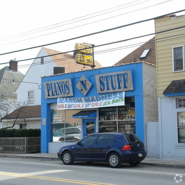
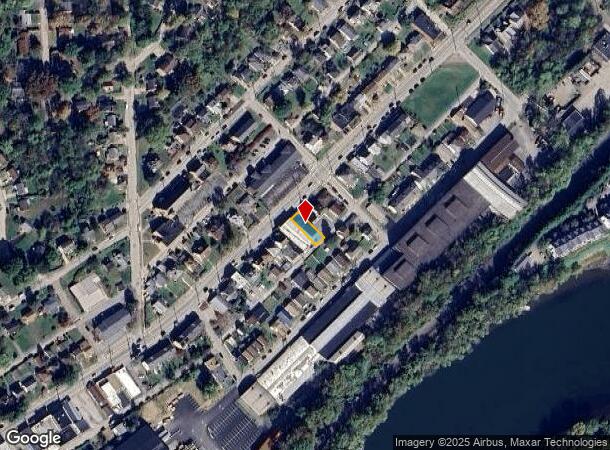
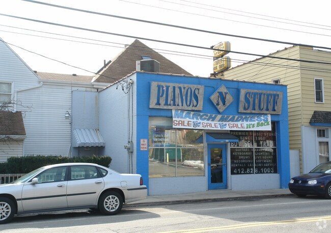
Property Record
468 Freeport Rd, Pittsburgh, PA 15238
NEARBY LISTINGS FOR SALE OR LEASE
Property Detail
468 Freeport Rd
Pittsburgh, PA
Village Of Montrose 3Rd
0292-L-00038-0000-00
VILLAGE OF MONTROSE 3RD WD PLAN 6 PT 5 BLK E L/ T 33X110 IN ALL FREEPORT RD 2 STY FRA-ALUM SDG HSE-BRK ADDN & INT GAR #468
Storebuilding
Allegheny
X
Pennsylvania
42003C0376H
38
2024
0.08 AC
2025
Northeast Pittsburgh
420000
Pittsburgh
DEMOGRAPHICS near 468 Freeport Rd
1 mile
3 mile
5 mile
2024 Total Population
3,928
53,837
184,680
2029 Population
3,831
52,885
181,776
Pop Growth 2024-2029
(2.47%)
(1.77%)
(1.57%)
Average Age
45
44
43
2024 Total Households
1,963
24,415
86,826
HH Growth 2024-2029
(2.50%)
(1.85%)
(1.65%)
Median Household Inc
$52,978
$61,523
$63,681
Avg Household Size
2.00
2.10
2.10
2024 Avg HH Vehicles
1.00
1.00
1.00
Median Home Value
$173,900
$160,360
$184,762
Median Year Built
1954
1956
1954
Nearby Places
Map Layers
Map Styles
 Street
 Aerial
Transit
 Traffic
 Biking
Places
Listings with unknown addresses are not visible on the map
- Restaurants
- Banks
- Shops
- Fitness
- Groceries
PUBLIC TRANSPORTATION
COMMUTER RAIL
Drive
Walk
Distance
18 min
9.7 mi
AIRPORT
Pittsburgh International
Drive
Walk
Distance
Pittsburgh International
44 min
26.7 mi
Arnold Palmer Regional
Drive
Walk
Distance
Arnold Palmer Regional
62 min
41.7 mi
Nearby Properties
Address
Land Use
TOTAL SIZE
Lot Size
Zoning
Address
Land Use
TOTAL SIZE
Lot Size
Zoning
48.57 AC
Address
Land Use
TOTAL SIZE
Lot Size
Zoning
17.75 AC
Address
Land Use
TOTAL SIZE
Lot Size
Zoning
41.36 AC
Address
Land Use
TOTAL SIZE
Lot Size
Zoning
58.96 AC
Address
Land Use
TOTAL SIZE
Lot Size
Zoning
160.63 AC
Address
Land Use
TOTAL SIZE
Lot Size
Zoning
4,242 SF
115.01 AC
Address
Land Use
TOTAL SIZE
Lot Size
Zoning
91.02 AC
Address
Land Use
TOTAL SIZE
Lot Size
Zoning
82.74 AC
Address
Land Use
TOTAL SIZE
Lot Size
Zoning
11.28 AC
Address
Land Use
TOTAL SIZE
Lot Size
Zoning
28.95 AC
Address
Land Use
TOTAL SIZE
Lot Size
Zoning
34.65 AC
Address
Land Use
TOTAL SIZE
Lot Size
Zoning
10.45 AC
Address
Land Use
TOTAL SIZE
Lot Size
Zoning
33.39 AC
Address
Land Use
TOTAL SIZE
Lot Size
Zoning
18.49 AC
Address
Land Use
TOTAL SIZE
Lot Size
Zoning
13.37 AC
Address
Land Use
TOTAL SIZE
Lot Size
Zoning
1,490 SF
129.81 AC
Address
Land Use
TOTAL SIZE
Lot Size
Zoning
528.43 AC
Address
Land Use
TOTAL SIZE
Lot Size
Zoning
6.35 AC
Address
Land Use
TOTAL SIZE
Lot Size
Zoning
4,836 SF
30.63 AC
Address
Land Use
TOTAL SIZE
Lot Size
Zoning
15.61 AC
Address
Land Use
TOTAL SIZE
Lot Size
Zoning
14.18 AC
Address
Land Use
TOTAL SIZE
Lot Size
Zoning
Address
Land Use
TOTAL SIZE
Lot Size
Zoning
20.86 AC
Address
Land Use
TOTAL SIZE
Lot Size
Zoning
1,440 SF
226.77 AC
Address
Land Use
TOTAL SIZE
Lot Size
Zoning
4.78 AC
Address
Land Use
TOTAL SIZE
Lot Size
Zoning
1,422 SF
162.05 AC
Address
Land Use
TOTAL SIZE
Lot Size
Zoning
25.97 AC
Address
Land Use
TOTAL SIZE
Lot Size
Zoning
Address
Land Use
TOTAL SIZE
Lot Size
Zoning
Address
Land Use
TOTAL SIZE
Lot Size
Zoning
11.22 AC
The World's #1 Commercial Real Estate Marketplace
Connect with us
© 2026 CoStar Group
The information above has been obtained from sources believed reliable. While we do not doubt its accuracy we have not verified it and make no guarantee, warranty or representation about it. It is your responsibility to independently confirm its accuracy and completeness. Any projections, opinions, assumptions, or estimates used are for example only and do not represent the current or future performance of the property. The value of this transaction to you depends on tax and other factors which should be evaluated by your tax, financial, and legal advisors. You and your advisors should conduct a careful, independent investigation of the property to determine to your satisfaction the suitability of the property for your needs.