Property Record
4690 Polo Gate Blvd, Charlotte, NC 28216


Current Lease Availabilities
NEARBY LISTINGS FOR SALE OR LEASE
Property Detail
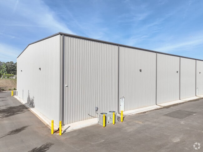
4690 Polo Gate Blvd
Charlotte-Concord-Gastonia, NC-SC
Recombination Surv Mtn Island
023-261-23
L4 M48-920
Industrialgeneral
Mecklenburg
X
North Carolina
3710451800L
4
2024
2.27 AC
2025
I-85/Beatties Ford Rd
006103
Charlotte
35,000 SF
DEMOGRAPHICS near 4690 Polo Gate Blvd
1 Mile
3 Mile
5 Mile
2024 Total Population
4,840
33,023
88,830
2029 Population
5,223
35,209
94,453
Pop Growth 2024-2029
+ 7.91%
+ 6.62%
+ 6.33%
Average Age
39
37
37
2024 Total Households
1,964
12,096
32,126
HH Growth 2024-2029
+ 8.04%
+ 6.75%
+ 6.46%
Median Household Inc
$77,949
$79,566
$71,186
Avg Household Size
2.50
2.70
2.70
2024 Avg HH Vehicles
2.00
2.00
2.00
Median Home Value
$463,347
$276,490
$249,542
Median Year Built
2001
1999
1997
Nearby Places
Map Layers
Map Styles
 Street
 Aerial
- Restaurants
- Banks
- Shops
- Fitness
- Groceries
PUBLIC TRANSPORTATION
AIRPORT
Charlotte/Douglas International
DRIVE
WALK
Distance
Charlotte/Douglas International
24 min
11.1 mi
Concord-Padgett Regional
DRIVE
WALK
Distance
Concord-Padgett Regional
24 min
16.5 mi
Freight Ports
North Charleston Terminal
DRIVE
WALK
Distance
North Charleston Terminal
235 min
207.0 mi
Nearby Properties
Address
Land Use
TOTAL SIZE
Lot Size
Zoning
Address
Land Use
TOTAL SIZE
Lot Size
Zoning
282,374 SF
11.58 AC
Address
Land Use
TOTAL SIZE
Lot Size
Zoning
197,874 SF
11.71 AC
Address
Land Use
TOTAL SIZE
Lot Size
Zoning
226,973 SF
16.97 AC
R17MFCD
Address
Land Use
TOTAL SIZE
Lot Size
Zoning
214,824 SF
18.78 AC
R12MFCD
Address
Land Use
TOTAL SIZE
Lot Size
Zoning
3,428 SF
13.21 AC
R-17MF
Address
Land Use
TOTAL SIZE
Lot Size
Zoning
437,434 SF
150.02 AC
MANU1
Address
Land Use
TOTAL SIZE
Lot Size
Zoning
89,113 SF
14.56 AC
R-3
Address
Land Use
TOTAL SIZE
Lot Size
Zoning
5,478 SF
44.91 AC
R1
Address
Land Use
TOTAL SIZE
Lot Size
Zoning
186,364 SF
18.43 AC
R-3
Address
Land Use
TOTAL SIZE
Lot Size
Zoning
960 SF
24.24 AC
CC
Address
Land Use
TOTAL SIZE
Lot Size
Zoning
80,799 SF
7.10 AC
NS
Address
Land Use
TOTAL SIZE
Lot Size
Zoning
Address
Land Use
TOTAL SIZE
Lot Size
Zoning
29,320 SF
340.71 AC
R1
Address
Land Use
TOTAL SIZE
Lot Size
Zoning
75,208 SF
15.55 AC
R-3
Address
Land Use
TOTAL SIZE
Lot Size
Zoning
102,934 SF
10.41 AC
B1CD
Address
Land Use
TOTAL SIZE
Lot Size
Zoning
58,553 SF
7.78 AC
B1CD
Address
Land Use
TOTAL SIZE
Lot Size
Zoning
63,651 SF
7.81 AC
B1CD
Address
Land Use
TOTAL SIZE
Lot Size
Zoning
40,822 SF
7.13 AC
B1
Address
Land Use
TOTAL SIZE
Lot Size
Zoning
41,414 SF
4.85 AC
CC
Address
Land Use
TOTAL SIZE
Lot Size
Zoning
78,660 SF
5.88 AC
O1CD
Address
Land Use
TOTAL SIZE
Lot Size
Zoning
33,307 SF
81.36 AC
R5
Address
Land Use
TOTAL SIZE
Lot Size
Zoning
101,187 SF
5.90 AC
B1CD
Address
Land Use
TOTAL SIZE
Lot Size
Zoning
20.02 AC
R-12MF(CD)
Address
Land Use
TOTAL SIZE
Lot Size
Zoning
11,490 SF
17.14 AC
R-4
Address
Land Use
TOTAL SIZE
Lot Size
Zoning
128,976 SF
5.84 AC
R12MFCD
Address
Land Use
TOTAL SIZE
Lot Size
Zoning
59,730 SF
2.36 AC
BP
Address
Land Use
TOTAL SIZE
Lot Size
Zoning
109,527 SF
30.45 AC
R3
Address
Land Use
TOTAL SIZE
Lot Size
Zoning
78,758 SF
26.71 AC
R3
Address
Land Use
TOTAL SIZE
Lot Size
Zoning
12,635 SF
1.95 AC
Address
Land Use
TOTAL SIZE
Lot Size
Zoning
48,889 SF
6.35 AC
B1SCD
The World's #1 Commercial Real Estate Marketplace
Connect with us
© 2025 CoStar Group
The information above has been obtained from sources believed reliable. While we do not doubt its accuracy we have not verified it and make no guarantee, warranty or representation about it. It is your responsibility to independently confirm its accuracy and completeness. Any projections, opinions, assumptions, or estimates used are for example only and do not represent the current or future performance of the property. The value of this transaction to you depends on tax and other factors which should be evaluated by your tax, financial, and legal advisors. You and your advisors should conduct a careful, independent investigation of the property to determine to your satisfaction the suitability of the property for your needs.