Property Record
60 Stw Vic Ave E, Lancaster, CA 93536

Property Detail
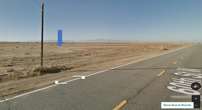
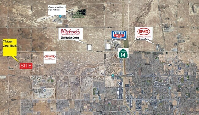
60 Stw Vic Ave E
Los Angeles-Long Beach-Glendale, CA
THAT PART EX OF ST N OF S 10 ACS OF N 1/2 OF SE 1/4 OF SEC 10 T 7N R 13W
3268-025-001
LOS ANGELES
Desertorbarrenland
California
LRRR-2.5
10
C and X Area of minimal flood hazard, usually depicted on FIRMs as above the 500-year flood level.
69.81 AC
2025
Antelope Valley
2025
Los Angeles
901214
NEARBY LISTINGS FOR SALE OR LEASE
DEMOGRAPHICS near 60 Stw Vic Ave E
1 mile
3 mile
5 mile
2025 Total Population
45
16,642
77,821
2030 Population
45
16,873
77,798
Pop Growth 2025-2030
0.00%
+ 1.39%
(0.03%)
Average Age
39
37
39
2025 Total Households
15
4,681
25,098
HH Growth 2025-2030
0.00%
+ 1.20%
(0.24%)
Median Household Inc
$55,000
$127,394
$99,798
Avg Household Size
2.70
3.40
3.00
2025 Avg HH Vehicles
2.00
3.00
2.00
Median Home Value
$425,000
$613,056
$519,920
Median Year Built
2000
2003
1989
Nearby Places
Map Layers
Map Styles
 Street
 Aerial
Layers
 Traffic
 Biking
Places
Listings with unknown addresses are not visible on the map
- Restaurants
- Banks
- Shops
- Fitness
- Groceries
PUBLIC TRANSPORTATION
COMMUTER RAIL
Lancaster (Antelope Valley Line - Southern California Regional Rail Authority (Metrolink))
Drive
Walk
Distance
Lancaster (Antelope Valley Line - Southern California Regional Rail Authority (Metrolink))
11 min
6.6 mi
Freight Ports
Port of Long Beach
Drive
Walk
Distance
Port of Long Beach
116 min
98.1 mi
SALE & LEASE HISTORY
LISTING DATE
SALE/LEASE

Aug 10, 2023
For Sale
Nearby Properties
Address
Land Use
TOTAL SIZE
Lot Size
Zoning
Address
Land Use
TOTAL SIZE
Lot Size
Zoning
465,697 SF
27.82 AC
LRSP*
Address
Land Use
TOTAL SIZE
Lot Size
Zoning
249,045 SF
19.74 AC
LRMPD*
Address
Land Use
TOTAL SIZE
Lot Size
Zoning
198,494 SF
9.78 AC
LRSP*
Address
Land Use
TOTAL SIZE
Lot Size
Zoning
0.34 AC
LCA22*
Address
Land Use
TOTAL SIZE
Lot Size
Zoning
32.02 AC
LRSP
Address
Land Use
TOTAL SIZE
Lot Size
Zoning
Address
Land Use
TOTAL SIZE
Lot Size
Zoning
99,247 SF
10.11 AC
LRA12*
Address
Land Use
TOTAL SIZE
Lot Size
Zoning
21,873 SF
3.38 AC
LCA22*
Address
Land Use
TOTAL SIZE
Lot Size
Zoning
14,581 SF
0.95 AC
LRSP*
Address
Land Use
TOTAL SIZE
Lot Size
Zoning
Address
Land Use
TOTAL SIZE
Lot Size
Zoning
76.91 AC
LRA12*
Address
Land Use
TOTAL SIZE
Lot Size
Zoning
80 AC
LRA12*
Address
Land Use
TOTAL SIZE
Lot Size
Zoning
1,192 SF
39.98 AC
LRR1-7000
Address
Land Use
TOTAL SIZE
Lot Size
Zoning
40.30 AC
LRR1-2.5
Address
Land Use
TOTAL SIZE
Lot Size
Zoning
14,581 SF
1.06 AC
LRSP*
Address
Land Use
TOTAL SIZE
Lot Size
Zoning
39.08 AC
LRR1-2.5
Address
Land Use
TOTAL SIZE
Lot Size
Zoning
75.90 AC
LRRR-2.5
Address
Land Use
TOTAL SIZE
Lot Size
Zoning
116.93 AC
LRRR
Address
Land Use
TOTAL SIZE
Lot Size
Zoning
Address
Land Use
TOTAL SIZE
Lot Size
Zoning
37.66 AC
LCA22*
Address
Land Use
TOTAL SIZE
Lot Size
Zoning
Address
Land Use
TOTAL SIZE
Lot Size
Zoning
19.09 AC
LRSP
Address
Land Use
TOTAL SIZE
Lot Size
Zoning
153.67 AC
LRRR25*
Address
Land Use
TOTAL SIZE
Lot Size
Zoning
7,858 SF
0.60 AC
LRSP*
Address
Land Use
TOTAL SIZE
Lot Size
Zoning
Address
Land Use
TOTAL SIZE
Lot Size
Zoning
9.47 AC
LRA12*
Address
Land Use
TOTAL SIZE
Lot Size
Zoning
Address
Land Use
TOTAL SIZE
Lot Size
Zoning
Address
Land Use
TOTAL SIZE
Lot Size
Zoning
16,614 SF
1.09 AC
LRSP*
Address
Land Use
TOTAL SIZE
Lot Size
Zoning
9.62 AC
LRA12*
The World's #1 Commercial Real Estate Marketplace
Connect with us
© 2026 CoStar Group
The information above has been obtained from sources believed reliable. While we do not doubt its accuracy we have not verified it and make no guarantee, warranty or representation about it. It is your responsibility to independently confirm its accuracy and completeness. Any projections, opinions, assumptions, or estimates used are for example only and do not represent the current or future performance of the property. The value of this transaction to you depends on tax and other factors which should be evaluated by your tax, financial, and legal advisors. You and your advisors should conduct a careful, independent investigation of the property to determine to your satisfaction the suitability of the property for your needs.