Property Record
4695 S Monaco St, Denver, CO 80237


Save to a Folder
{{folder.Name}}
{{folder.ListingIds.length}} Properties
{{folder.ListingIds.length}} Property
Create a New Folder
Property Detail
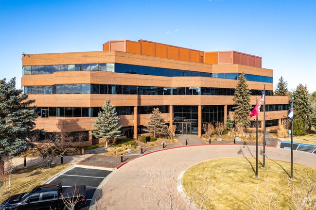
4695 S Monaco St
7084-00-055
T5 R67 S8 SE/4 BEG 14.37FT N OF NW COR L1 B2 THE 165 SUB TH N 276.33FT E 540.34FT SE CV/L 3.34FT S 215.34FT CV/R 145.71 FT W 183.87FT NW 119.08FT N 63.63FT W 270FT TO POB
Officebuilding
DENVER
B-4
Colorado
B and X Area of moderate flood hazard, usually the area between the limits of the 100-year and 500-year floods.
1
2025
4.10 AC
2025
Denver Tech Center
006701
Denver
94,382 SF
Denver-Aurora-Centennial, CO
NEARBY LISTINGS FOR SALE OR LEASE
DEMOGRAPHICS near 4695 S Monaco St
1 mile
3 mile
5 mile
2025 Total Population
12,771
99,848
332,383
2030 Population
13,168
101,140
338,723
Pop Growth 2025-2030
+ 3.11%
+ 1.29%
+ 1.91%
Average Age
40
41
40
2025 Total Households
7,227
43,962
147,095
HH Growth 2025-2030
+ 3.42%
+ 1.54%
+ 2.10%
Median Household Inc
$94,666
$104,462
$93,849
Avg Household Size
1.70
2.20
2.20
2025 Avg HH Vehicles
1.00
2.00
2.00
Median Home Value
$789,558
$768,924
$695,989
Median Year Built
2001
1979
1978
Nearby Places
Map Layers
Map Styles
 Street
 Aerial
Layers
 Traffic
 Biking
Places
Listings with unknown addresses are not visible on the map
- Restaurants
- Banks
- Shops
- Fitness
- Groceries
PUBLIC TRANSPORTATION
AIRPORT
Denver International
Drive
Walk
Distance
Denver International
34 min
26.2 mi
SALE & LEASE HISTORY
LISTING DATE
SALE/LEASE

Nov 25, 2019
For Lease
May 05, 2025
For Lease
Nearby Properties
Address
Land Use
TOTAL SIZE
Lot Size
Zoning
Address
Land Use
TOTAL SIZE
Lot Size
Zoning
579,353 SF
3.26 AC
T-MU
Address
Land Use
TOTAL SIZE
Lot Size
Zoning
508,135 SF
6.99 AC
C-RX
Address
Land Use
TOTAL SIZE
Lot Size
Zoning
277,917 SF
12.59 AC
B-4
Address
Land Use
TOTAL SIZE
Lot Size
Zoning
470,605 SF
13.68 AC
B-8
Address
Land Use
TOTAL SIZE
Lot Size
Zoning
344,259 SF
5.18 AC
Address
Land Use
TOTAL SIZE
Lot Size
Zoning
389,502 SF
2.32 AC
T-MU-30
Address
Land Use
TOTAL SIZE
Lot Size
Zoning
313,812 SF
5.24 AC
GMC
Address
Land Use
TOTAL SIZE
Lot Size
Zoning
1,666,986 SF
11.12 AC
Address
Land Use
TOTAL SIZE
Lot Size
Zoning
260,579 SF
4.22 AC
Address
Land Use
TOTAL SIZE
Lot Size
Zoning
898,130 SF
89.50 AC
Address
Land Use
TOTAL SIZE
Lot Size
Zoning
331,620 SF
2.03 AC
T-MU-30
Address
Land Use
TOTAL SIZE
Lot Size
Zoning
252,760 SF
3.63 AC
Address
Land Use
TOTAL SIZE
Lot Size
Zoning
959,756 SF
5.52 AC
PUD
Address
Land Use
TOTAL SIZE
Lot Size
Zoning
453,595 SF
26.08 AC
PUD
Address
Land Use
TOTAL SIZE
Lot Size
Zoning
394,111 SF
0.91 AC
T-MU
Address
Land Use
TOTAL SIZE
Lot Size
Zoning
355,464 SF
6.20 AC
B-8
Address
Land Use
TOTAL SIZE
Lot Size
Zoning
189,551 SF
16.22 AC
Address
Land Use
TOTAL SIZE
Lot Size
Zoning
320,589 SF
33.33 AC
S-SU-F
Address
Land Use
TOTAL SIZE
Lot Size
Zoning
14,878 SF
34.55 AC
OS-B
Address
Land Use
TOTAL SIZE
Lot Size
Zoning
313,836 SF
5.90 AC
B-8
Address
Land Use
TOTAL SIZE
Lot Size
Zoning
372,593 SF
5.61 AC
S-MX-12
Address
Land Use
TOTAL SIZE
Lot Size
Zoning
249,331 SF
4.93 AC
B-8
Address
Land Use
TOTAL SIZE
Lot Size
Zoning
191,152 SF
1.26 AC
S-MX-12
Address
Land Use
TOTAL SIZE
Lot Size
Zoning
231,867 SF
19.33 AC
S-MX-3A
Address
Land Use
TOTAL SIZE
Lot Size
Zoning
585,091 SF
5.42 AC
PUD
Address
Land Use
TOTAL SIZE
Lot Size
Zoning
40,268 SF
8.35 AC
S-SU-F
Address
Land Use
TOTAL SIZE
Lot Size
Zoning
396,041 SF
6.77 AC
B-8
Address
Land Use
TOTAL SIZE
Lot Size
Zoning
413,033 SF
4.33 AC
Address
Land Use
TOTAL SIZE
Lot Size
Zoning
332,114 SF
3.24 AC
GTC
Address
Land Use
TOTAL SIZE
Lot Size
Zoning
546,774 SF
8.81 AC
PUD
The World's #1 Commercial Real Estate Marketplace
Connect with us
© 2026 CoStar Group
The information above has been obtained from sources believed reliable. While we do not doubt its accuracy we have not verified it and make no guarantee, warranty or representation about it. It is your responsibility to independently confirm its accuracy and completeness. Any projections, opinions, assumptions, or estimates used are for example only and do not represent the current or future performance of the property. The value of this transaction to you depends on tax and other factors which should be evaluated by your tax, financial, and legal advisors. You and your advisors should conduct a careful, independent investigation of the property to determine to your satisfaction the suitability of the property for your needs.