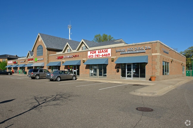
Property Record
4703 Highway 61 N, Saint Paul, MN 55110
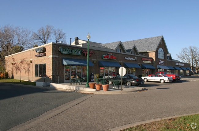
NEARBY LISTINGS FOR SALE OR LEASE
Property Detail
4703 Highway 61 N
Minneapolis-St. Paul-Bloomington, MN-WI
Mainstreet Crossing,Second Add
14-30-22-42-0132
MAINSTREET CROSSING,SECOND ADD LOTS 2 & 3 BLK 1 AND THAT PT OF LOT 5 BLK 1 IN TI 137-0
Regionalshoppingcenterormallwithanchorstore
Ramsey
X
Minnesota
27003C0450E
2,3,5
2024
2.60 AC
2025
Maplewood
040502
Minneapolis/St Paul
3,720 SF
DEMOGRAPHICS near 4703 Highway 61 N
1 Mile
3 Mile
5 Mile
2024 Total Population
6,468
41,777
93,099
2029 Population
6,272
41,233
93,188
Pop Growth 2024-2029
(3.03%)
(1.30%)
+ 0.10%
Average Age
45
44
43
2024 Total Households
2,703
17,105
36,903
HH Growth 2024-2029
(3.29%)
(1.54%)
(0.17%)
Median Household Inc
$81,204
$93,585
$96,763
Avg Household Size
2.30
2.40
2.50
2024 Avg HH Vehicles
2.00
2.00
2.00
Median Home Value
$295,882
$327,049
$345,838
Median Year Built
1968
1977
1981
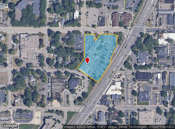
Nearby Places
Map Layers
Map Styles
 Street
 Aerial
- Restaurants
- Banks
- Shops
- Fitness
- Groceries
PUBLIC TRANSPORTATION
AIRPORT
Minneapolis-St Paul International/Wold-Chamberlain
DRIVE
WALK
Distance
Minneapolis-St Paul International/Wold-Chamberlain
33 min
21.6 mi
Freight Ports
Port Milwaukee
DRIVE
WALK
Distance
Port Milwaukee
371 min
335.1 mi
SALE & LEASE HISTORY
LISTING DATE
SALE/LEASE

Sep 25, 2016
For Lease
Nearby Properties
Address
Land Use
TOTAL SIZE
Lot Size
Zoning
Address
Land Use
TOTAL SIZE
Lot Size
Zoning
187,362 SF
70.96 AC
Address
Land Use
TOTAL SIZE
Lot Size
Zoning
5.59 AC
Address
Land Use
TOTAL SIZE
Lot Size
Zoning
77.53 AC
Address
Land Use
TOTAL SIZE
Lot Size
Zoning
250,050 SF
2.99 AC
Address
Land Use
TOTAL SIZE
Lot Size
Zoning
106,400 SF
18.29 AC
Address
Land Use
TOTAL SIZE
Lot Size
Zoning
78,163 SF
5.62 AC
Address
Land Use
TOTAL SIZE
Lot Size
Zoning
211,420 SF
5.22 AC
Address
Land Use
TOTAL SIZE
Lot Size
Zoning
271,355 SF
20.56 AC
Address
Land Use
TOTAL SIZE
Lot Size
Zoning
960 SF
17.11 AC
Address
Land Use
TOTAL SIZE
Lot Size
Zoning
138,655 SF
4.70 AC
Address
Land Use
TOTAL SIZE
Lot Size
Zoning
13,358 SF
311.47 AC
W8OPSP
Address
Land Use
TOTAL SIZE
Lot Size
Zoning
3,200 SF
14.31 AC
W7PUBLC
Address
Land Use
TOTAL SIZE
Lot Size
Zoning
138,960 SF
Address
Land Use
TOTAL SIZE
Lot Size
Zoning
163,709 SF
1.22 AC
Address
Land Use
TOTAL SIZE
Lot Size
Zoning
295,860 SF
11.84 AC
Address
Land Use
TOTAL SIZE
Lot Size
Zoning
204,399 SF
12.82 AC
Address
Land Use
TOTAL SIZE
Lot Size
Zoning
202,460 SF
26.72 AC
Address
Land Use
TOTAL SIZE
Lot Size
Zoning
156,090 SF
4.27 AC
Address
Land Use
TOTAL SIZE
Lot Size
Zoning
1,357 SF
8.22 AC
Address
Land Use
TOTAL SIZE
Lot Size
Zoning
134,280 SF
4 AC
Address
Land Use
TOTAL SIZE
Lot Size
Zoning
69,075 SF
3.85 AC
Address
Land Use
TOTAL SIZE
Lot Size
Zoning
234,156 SF
12.01 AC
Address
Land Use
TOTAL SIZE
Lot Size
Zoning
82,403 SF
41.35 AC
Address
Land Use
TOTAL SIZE
Lot Size
Zoning
128,462 SF
2.07 AC
Address
Land Use
TOTAL SIZE
Lot Size
Zoning
132,487 SF
2.19 AC
Address
Land Use
TOTAL SIZE
Lot Size
Zoning
103,400 SF
3.60 AC
Address
Land Use
TOTAL SIZE
Lot Size
Zoning
1,066 SF
8.04 AC
Address
Land Use
TOTAL SIZE
Lot Size
Zoning
110,528 SF
23.14 AC
Address
Land Use
TOTAL SIZE
Lot Size
Zoning
113,858 SF
27.82 AC
Address
Land Use
TOTAL SIZE
Lot Size
Zoning
98,905 SF
11.34 AC
The World's #1 Commercial Real Estate Marketplace
Connect with us
© 2026 CoStar Group
The information above has been obtained from sources believed reliable. While we do not doubt its accuracy we have not verified it and make no guarantee, warranty or representation about it. It is your responsibility to independently confirm its accuracy and completeness. Any projections, opinions, assumptions, or estimates used are for example only and do not represent the current or future performance of the property. The value of this transaction to you depends on tax and other factors which should be evaluated by your tax, financial, and legal advisors. You and your advisors should conduct a careful, independent investigation of the property to determine to your satisfaction the suitability of the property for your needs.