Property Record
4742 Whirlwind Dr, San Antonio, TX 78217


Property Detail
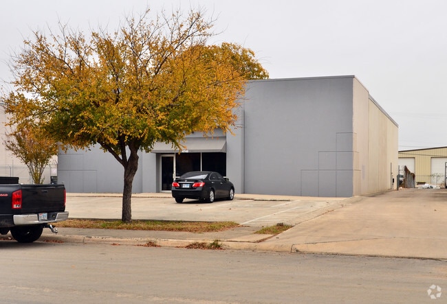
4742 Whirlwind Dr
San Antonio-New Braunfels, TX
NCB 14102 BLK 6 LOT 12
14102-006-0121
BEXAR
Warehouse
Texas
B and X Area of moderate flood hazard, usually the area between the limits of the 100-year and 500-year floods.
121
2025
0.58 AC
2025
Northeast
121203
San Antonio
6,600 SF
NEARBY LISTINGS FOR SALE OR LEASE
DEMOGRAPHICS near 4742 Whirlwind Dr
1 mile
3 mile
5 mile
2025 Total Population
8,045
106,611
297,788
2030 Population
8,373
111,419
311,905
Pop Growth 2025-2030
+ 4.08%
+ 4.51%
+ 4.74%
Average Age
38
39
39
2025 Total Households
3,336
42,403
114,337
HH Growth 2025-2030
+ 4.11%
+ 4.65%
+ 4.87%
Median Household Inc
$55,308
$62,525
$72,354
Avg Household Size
2.30
2.40
2.50
2025 Avg HH Vehicles
2.00
2.00
2.00
Median Home Value
$222,417
$237,615
$254,273
Median Year Built
1976
1979
1984
Nearby Places
Map Layers
Map Styles
 Street
 Aerial
Layers
 Traffic
 Biking
Places
Listings with unknown addresses are not visible on the map
- Restaurants
- Banks
- Shops
- Fitness
- Groceries
PUBLIC TRANSPORTATION
AIRPORT
San Antonio International
Drive
Walk
Distance
San Antonio International
10 min
6.4 mi
Freight Ports
Calhoun Port
Drive
Walk
Distance
Calhoun Port
182 min
149.1 mi
Nearby Properties
Address
Land Use
TOTAL SIZE
Lot Size
Zoning
Address
Land Use
TOTAL SIZE
Lot Size
Zoning
25,513 SF
18.14 AC
Address
Land Use
TOTAL SIZE
Lot Size
Zoning
359,349 SF
23.59 AC
Address
Land Use
TOTAL SIZE
Lot Size
Zoning
239,264 SF
9.02 AC
Address
Land Use
TOTAL SIZE
Lot Size
Zoning
266,702 SF
13.49 AC
Address
Land Use
TOTAL SIZE
Lot Size
Zoning
288,350 SF
13.01 AC
Address
Land Use
TOTAL SIZE
Lot Size
Zoning
110,605 SF
19.95 AC
Address
Land Use
TOTAL SIZE
Lot Size
Zoning
157,762 SF
9.26 AC
Address
Land Use
TOTAL SIZE
Lot Size
Zoning
328,605 SF
25.69 AC
Address
Land Use
TOTAL SIZE
Lot Size
Zoning
229,077 SF
10.06 AC
Address
Land Use
TOTAL SIZE
Lot Size
Zoning
457,302 SF
34.40 AC
Address
Land Use
TOTAL SIZE
Lot Size
Zoning
46,674 SF
53.43 AC
Address
Land Use
TOTAL SIZE
Lot Size
Zoning
279,012 SF
12.17 AC
Address
Land Use
TOTAL SIZE
Lot Size
Zoning
180,000 SF
40.73 AC
Address
Land Use
TOTAL SIZE
Lot Size
Zoning
92,859 SF
11.95 AC
Address
Land Use
TOTAL SIZE
Lot Size
Zoning
265,015 SF
12.81 AC
Address
Land Use
TOTAL SIZE
Lot Size
Zoning
337,468 SF
21.84 AC
Address
Land Use
TOTAL SIZE
Lot Size
Zoning
205,862 SF
10.79 AC
Address
Land Use
TOTAL SIZE
Lot Size
Zoning
275,327 SF
13.52 AC
Address
Land Use
TOTAL SIZE
Lot Size
Zoning
373,134 SF
16.29 AC
Address
Land Use
TOTAL SIZE
Lot Size
Zoning
222,865 SF
17.75 AC
Address
Land Use
TOTAL SIZE
Lot Size
Zoning
106,139 SF
5.84 AC
Address
Land Use
TOTAL SIZE
Lot Size
Zoning
257,263 SF
10.07 AC
Address
Land Use
TOTAL SIZE
Lot Size
Zoning
276,202 SF
17.32 AC
Address
Land Use
TOTAL SIZE
Lot Size
Zoning
15.42 AC
Address
Land Use
TOTAL SIZE
Lot Size
Zoning
257,734 SF
5.57 AC
Address
Land Use
TOTAL SIZE
Lot Size
Zoning
324,905 SF
22.32 AC
Address
Land Use
TOTAL SIZE
Lot Size
Zoning
212,078 SF
9.83 AC
Address
Land Use
TOTAL SIZE
Lot Size
Zoning
213,566 SF
10.17 AC
Address
Land Use
TOTAL SIZE
Lot Size
Zoning
241,922 SF
18.20 AC
Address
Land Use
TOTAL SIZE
Lot Size
Zoning
261,471 SF
11 AC
The World's #1 Commercial Real Estate Marketplace
Connect with us
© 2026 CoStar Group
The information above has been obtained from sources believed reliable. While we do not doubt its accuracy we have not verified it and make no guarantee, warranty or representation about it. It is your responsibility to independently confirm its accuracy and completeness. Any projections, opinions, assumptions, or estimates used are for example only and do not represent the current or future performance of the property. The value of this transaction to you depends on tax and other factors which should be evaluated by your tax, financial, and legal advisors. You and your advisors should conduct a careful, independent investigation of the property to determine to your satisfaction the suitability of the property for your needs.